Malecombe Circuit via the Chapelle de Sauveterre and Sainte-Anne

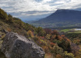
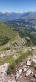
A lovely route below the Charance mountain, facing south-south-east, offering stunning panoramic views of all the surrounding mountains: Champsaur, Dévoluy, Céüse, etc.

Details

n°44439864
Creation:
Last update:
Last review:
  • Walking
    Activity: Walking
  • ↔
    Distance: 5.64 mi
  • ◔
    Average duration: 3h 30 
  • ▲
    Difficulty: Moderate

  • ⚐
    Back to start: Yes
  • ↗
    Ascent: + 1,037 ft
  • ↘
    Descent: - 1,066 ft

  • ▲
    Highest point: 4,019 ft
  • ▼
    Lowest point: 2,927 ft

Description of the walk

Head to Gap. At the Sénateur roundabout, take the Route de Malecombe, then turn right onto the Route de la Garde. Park in the car park opposite the “Les Olivades” restaurant, on the side with the recycling bins: make sure you do not take the spaces reserved for the restaurant.

(S/E) Continue along the Route de la Garde, leaving the access road to Les Méyères on your right, and cross the bridge over the Ruisseau de Malecombe.

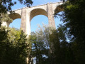
(1) Just after the bridge, take the path on the right which leads to the Canal du Drac. Walk to the aqueduct and join the canal on the left. Walk along the canal for about 400 m until you reach the sign for “Le Ponchet”.

(2) Turn right to climb up to the Replat, which takes you above and parallel to the Canal du Drac, passing by the Source de Touvet. There’s a lovely view of Gap and the surrounding mountains, with former meadows now overgrown with broom but which were once ideal for grazing: in the past, this spot was known as ‘the goat’s field’. Carry on straight ahead until you reach the tarmac road, then continue in the same direction to the Chapelle de Sauveterre.

(3) Turn left (due south) onto theGR® 93 towards the Saint-André district and La Freissinouse. Cross the canal and continue straight on downhill.

(4) Leave theGR® 93 and turn left (path marked with a cross indicating the end ofthe GR®) towards a small private family cemetery. Nothing remains of the Sainte-Anne Chapel, although it is still shown on the IGN map. Then continue south-east, skirting the fields on the right, until you reach a junction.

(5) Turn left and head northwards along the dog kennels. Continue to the ACCA hunting lodge at La Freissinouse, in the hamlet of La Bouyère.

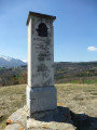
(6) Follow the path which crosses the Torrent de la Rousine and continues to the right towards the Château. Pass through the hamlet and carry on straight ahead until you reach the oratory.

(7) Take the small road opposite, then immediately veer slightly to the right onto the Chemin des Cytises, which runs parallel to the D994 for a good hundred metres. You’ll reach an area with several closely spaced junctions.

(8) Turn left onto the small road that climbs north-eastwards to the junction with the Chemin de la Gardette.

(9) Turn right downhill, towards Pornet. You’ll come out onto Route de la Garde.

(10) Turn left to return to the car park (S/E).

Waypoints

  1. S/E : mi 0 - alt. 2,982 ft - Car park
  2. 1 : mi 0.8 - alt. 3,458 ft - Path on the right
  3. 2 : mi 1.4 - alt. 3,740 ft - Sign for Le Ponchet - Canal de Gap
  4. 3 : mi 2.68 - alt. 3,832 ft - Chapelle de Sauveterre
  5. 4 : mi 3.41 - alt. 3,553 ft - GR route abandoned
  6. 5 : mi 3.91 - alt. 3,392 ft - Junction
  7. 6 : mi 4.22 - alt. 3,356 ft - La Bouyère, a hunting lodge
  8. 7 : mi 4.66 - alt. 3,248 ft - Oratory
  9. 8 : mi 4.9 - alt. 3,156 ft - Crossroads, after the - Rousine (rivière)
  10. 9 : mi 5.18 - alt. 3,189 ft - Chemin de la Gardette
  11. 10 : mi 5.55 - alt. 2,927 ft - Pornet neighbourhood – Route de la Garde
  12. S/E : mi 5.64 - alt. 2,982 ft - Car park

Worth a visit

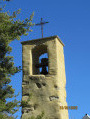
The lovely Malecombe torrent, the Canal du Drac (also known as the Canal de Gap), the flat area known as ‘le champ de la chèvre’, the Chapel of Sauveterre, the panoramic view over the Champsaur, the Dévoluy, Céüse, all the mountains around the Gapençais region, and the cemetery at the Chapel of Sainte-Anne.

Always be cautious and plan ahead when you're outdoors. Visorando and the author of this route cannot be held responsible for any accidents occurring on this route.

The GR® and PR® markings are the intellectual property of the Fédération Française de Randonnée Pédestre.

Reviews and comments

4 / 5
Based on 2 reviews

Reliability of the description
4 / 5
Ease of following the route
4 / 5
Route interest
4 / 5
User 27307274
• Edited:

The highlights are the pleasant view, the aqueduct and probably the stream, although it was dry at this time of year.
The weak points are that half of the route is on tarmac or a 4x4 track, and the proximity to the main road.

Machine-translated

Lulu05
Lulu05

Overall rating : 3.3 / 5

Date of your route : Dec 30, 2024
Reliability of the description : ★★★☆☆ Average
Ease of following the route : ★★★☆☆ Average
Route interest : ★★★★☆ Good
Very busy route : No

It’s worth noting that from the start of the path (next to the bins in the car park of the Les Olivades hotel), you follow the Route de la Garde for a good kilometre. A very pleasant path near Gap, with few other walkers

Machine-translated

Pomme 2 pin
Pomme 2 pin

Overall rating : 4.7 / 5

Date of your route : Aug 14, 2024
Reliability of the description : ★★★★★ Very good
Ease of following the route : ★★★★★ Very good
Route interest : ★★★★☆ Good
Very busy route : No

Thank you for this route description, which is simple and effective. There’s a good variety of scenery and a lovely view from Le Replat. The D944 is indeed quite close by points 5 and 8.
Practical information for walkers without a car: you can reach this route by taking bus 30 and getting off at the Chemin de la Gardette stop, which corresponds to point 10 on the walk.

Machine-translated

Other walks in the area

For more walks, use our search engine .

The GPS track and description are the property of this route's author. Please do not copy them without permission.