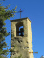
The Saint-Mens Hill as seen from Gap

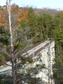
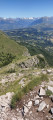
A walk on the wooded hill of Saint-Mens, directly accessible from the centre of Gap. On the ridge, a wayside shrine dedicated to St James of Compostela offers a beautiful view over the Gap basin and the Montagne de Charance. The route is relatively easy, consisting mainly of very gentle climbs.

Details

n°47838823
Creation:
Last update:
Last review:
  • Walking
    Activity: Walking
  • ↔
    Distance: 2.47 mi
  • ◔
    Average duration: 1h 45 
  • ▲
    Difficulty: Easy

  • ⚐
    Back to start: Yes
  • ↗
    Ascent: + 719 ft
  • ↘
    Descent: - 719 ft

  • ▲
    Highest point: 3,169 ft
  • ▼
    Lowest point: 2,444 ft

Photos

Description of the walk

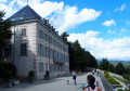
In Gap, head to Boulevard Bellevue and the car park at the Saint-Mens care home, above the ice rink.
The starting point is accessible by bus (lines 1, 2, 3, 4, 5, 6: La Blâche stop, or the Centro B shuttle: EHPAD Saint-Mens stop).

(S/E) From the car park, take the path that climbs to the left of the EHPAD and goes round the building to enter a small wood. On leaving the wood, cross the Blâche field to the hiking signpost opposite.

(1) Go up a small slope to join the Chemin de Saint-Jacques (GR® 653 D) to the left. Follow it straight up to the Molines picnic area and continue along the path leading uphill opposite until you reach the road.

(2) Cross the road and take the track opposite, passing the ONF barrier. The track makes a wide hairpin bend and passes by the start of a downhill mountain-bike route (wooden structure). Continue the climb along theGR® to the Col de Saint-Mens.

(3) At the Oratoire Saint-Jacques, follow the small tarmac road that runs along the ridge and enjoy the panoramic views over the Gap region and Treschâtel.

(4) When you reach the gate of a farm, take the small path that descends to the right into the woods. At the next small junction, continue down the path straight ahead, ignoring the path that branches off to the right along the hillside. Just before you reach the tarmac road, follow the path to the right, running alongside the treetop adventure park.

(5) Cross the road to take the path straight ahead, then take the narrow path that dips to the left until it joins the uphill route. Follow this for about a hundred metres to the left.

(1) This time, continue along the path opposite until you reach Allée Raoul Venderbecq. Head down it to the right to reach the car park where you started (S/E).

Waypoints

  1. S/E : mi 0 - alt. 2,451 ft - Bellevue car park. Near the - Luye (rivière)
  2. 1 : mi 0.29 - alt. 2,602 ft - Junction of the circular loop
  3. 2 : mi 0.49 - alt. 2,762 ft - Molines picnic area
  4. 3 : mi 1.13 - alt. 3,048 ft - Col de Saint-Mens - Oratoire Saint Jacques de Compostelle
  5. 4 : mi 1.44 - alt. 3,166 ft - Ferme du Chemin des Vignes
  6. 5 : mi 1.93 - alt. 2,749 ft - Crossing the road
  7. S/E : mi 2.47 - alt. 2,451 ft - Bellevue car park - Luye (rivière)

Notes

Shorter alternative route (marked 3 bis): at the junction of four paths after point (2), turn right onto the path that climbs more steeply (signposted “Col de Saint-Mens”). Then, on returning to point (1), follow the original route to get back to the car park more quickly (saving one kilometre).

Picnic areas in the Molines woodland (2) and a treetop adventure course.

This shaded route is pleasant on hot days.

Worth a visit

Oratory of Saint James of Compostela

Built on the Col de Saint-Mens overlooking the town of Gap, it marks the route of the Way of St James. Modern in design, it is constructed from exposed stone with terracotta elements incorporated into the structure, embodying the full symbolism of pilgrimages. The niche contains a glazed ceramic statue of the saint.

Always be cautious and plan ahead when you're outdoors. Visorando and the author of this route cannot be held responsible for any accidents occurring on this route.

The GR® and PR® markings are the intellectual property of the Fédération Française de Randonnée Pédestre.

Reviews and comments

4.7 / 5
Based on 1 review

Reliability of the description
5 / 5
Ease of following the route
5 / 5
Route interest
4 / 5
amclg
amclg

Overall rating : 4.7 / 5

Date of your route : Aug 10, 2026
Reliability of the description : ★★★★★ Very good
Ease of following the route : ★★★★★ Very good
Route interest : ★★★★☆ Good
Very busy route : Yes

A short walk at sunrise in Gap. Easy

Machine-translated

Other walks in the area

For more walks, use our search engine .

The GPS track and description are the property of this route's author. Please do not copy them without permission.