Country:
 City:


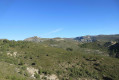
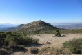
Park in the car park after the Allauch riding centre.
(S/E) Walk up the Chemin du Garlaban and take thefirst road on the left, towards Chante Colline.
The road turns into a track and the earth turns red (former bauxite deposits). Turn right at the Fork in the road, then keep left to reach an open area where there is a former deposit site closed off by a gate.
(1) Take the path leading off to the right. Pass under a high-voltage power line and turn onto thefirst path climbing up to the right. Then keep to the left. Pass under another high-voltage power line. At the junction of the tracks at the Col de Cante-Perdrix, turn right towards Grande Tête Rouge (inscription on a rock). You’ll reach a crossroads with a signpost.
(2) Keep to the left, heading towards Le Taoumé. At the next signpost, keep to the left and climb the path towards La Pounche des Escaouprés; you’ll reach a crossroads just before the summit.
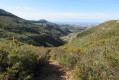
(3) Head down to the left along a small, rocky path which leads out onto the plain (yellow markings). Pass by a signpost and follow the path north-east. You’ll arrive near a DFCI track.
(4) Turn right, heading south. Continue in this direction, cross a few rocky outcrops and arrive at the junction below the Pic du Taoumé at the top of the Vallon des Escaouprés.
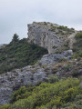
(5) Turn left and climb the rock face leading to the summit (marked with yellow markers).
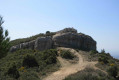
(6) Descend north-westwards to reach the vicinity of the Grotte du Grosibou. Then return via the same route to the junction in the Vallon des Escaouprés.
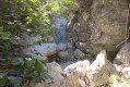
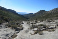
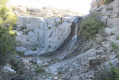
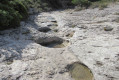
(5) Turn left and descend through the centre of the valley over large limestone slabs and water-filled potholes. Pass by the Source du Chien and the rock carvings.
After passing a wall, the rocky terrain gives way to a more conventional path. Keep to the right. Note: passing the wall may be daunting and vertiginous for some. In that case, it is possible to rejoin a parallel path further up.
You’ll reach a crossroads in a tricky section.
(7) Take care here; use your GPS so as not to miss the fork. From this point onwards, the difficulty increases considerably, but the route remains manageable through a narrow gully with large boulders to scramble down. The end of the valley becomes more gentle and leads to a path junction.
(8) Turn right onto the path, pass by the Source du Pichoun Ome and then reach a Fork in the road. Continue straight on towards the south.
(9) Turn right onto the path that climbs towards the cliffs. Be careful: use your GPS so as not to miss the fork. You’ll arrive directly below a small cave. Turn right and follow the track that runs alongside the cliffs. Pass another small cave before reaching the Baumes des Pestiférés. Continue southwards. Find a path and join it on the left. Cross two tracks in succession and continue north-west towards Peynaou. You’ll arrive near some houses.
(10) Turn right and walk alongside the wire fence. You’ll reach the tarmac road to Peynaou. Turn left onto the Garlaban path and head for the car park past the riding centre (S/E).

 Visorando Member
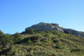

 Easy
 Association / Club / Walk leader