Country:

 City:
City:


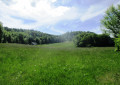
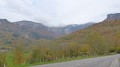
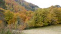
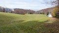
Start from the village of Bouvante-Le-Bas, using the car park next to the church and town hall. From here, follow the red and white markings ofthe GR®9to the Pélandré meadow.
(S) Head straight up the main D131 road towards the south. Shortly afterwards, when the road veers off to the right, follow an ascending road to the left, then, at a right-hand bend, follow the path opposite. You’ll come to a road; follow it to the left for about a hundred metres.
(1) Leave the road at a left-hand bend and take the steeply ascending path opposite towards the forest (marked with red and white signs). Follow this path as it climbs, curving first to the left, then to the right, and finally in a wide curve to the right. Ignore the paths to the right and left; cross a wider track near which a sign indicates that you are entering the Lente Forest. You’ll reach a level area with a wider path. You’ll see a road nearby on the right, but continue along the gently sloping path which joins a track coming from the road on the right.
(2) Follow the track to the left as it curves slightly. Shortly afterwards, let the track continue straight ahead and follow an ascending track to the left called “Route forestière de Pélandré”. Continue uphill, then follow the red and white-marked track downhill.
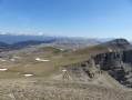
(3) At a junction, let theGR®9head off to the right and take a grassy path leading down opposite. If you keep a low profile in the meadow, you may spot some wildlife. Pass to the right of the Pélandré house.
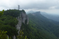
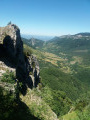
(4) Shortly after the house, cross the meadow to the left to get closer to the cliffs and admire the Val Sainte-Marie below. Take great care at the cliff edge! Retrace your steps.
(4) Turn left onto the original path, which descends and then curves to the right. Shortly afterwards, at elevation 1196, leave the path and follow a track branching off to the left. This track passes close to the far end of the meadow on the left and heads off to the right.
(5) As you enter the forest, the track splits into two: one levels out to the left, the other descends gently to the right. Follow the one on the right, which is an old forest track. This track curves leftwards downhill until it meets a path leading perpendicularly downhill to the right; then head quickly left through the box trees in a straight line. Note the ruins of the Grange Maillet on your left as you emerge onto the Col de la Rochette meadow. Follow the path marked by the box trees until you come to a path coming from the right, marked in yellow and green.
(6) Follow the steeply descending path to the left, marked in yellow and green. Continuing downhill through the forest, you’ll reach a flatter area and come to the houses in the hamlet of Les Vignes. Leave the yellow and green markings (which head off to the right).
(7) Between the houses, follow the road keeping to the far left. This road then curves back to the right and joins the main D131 road. Follow the D131 to the left until you reach the village and the starting point near the church.

 Visorando Member
 Moderate
 Tourism professional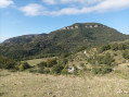
 Very difficult