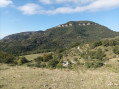
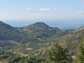
Grotte des Ussets and Rochers des Deux Soeurs

A visit to a cave and a few easy climbing moves make this an interesting hike for experienced walkers.

Details

64209021
Creation:
Last update:
Last review:
  • Walking
    Activity: Walking
  • ↔
    Distance: 7.89 mi
  • ◔
    Average duration: 6h 35 
  • ▲
    Difficulty: Very difficult

  • ⚐
    Back to start: Yes
  • ↗
    Ascent: + 3,406 ft
  • ↘
    Descent: - 3,402 ft

  • ▲
    Highest point: 4,180 ft
  • ▼
    Lowest point: 2,001 ft

Photos

Description of the walk

The start is below the hamlet of Les Pignes, which can be reached from Rochefort-Samson, following signs for Les Ducs then Les Pignes. Park in one of the two car parks before the ‘Voie sans Issue’ sign.

(S/E) From the ‘Voie sans Issue’ sign, head back down to the bend and turn right into the field; you need to join the path further down and follow it northwards, initially on level ground, and when it starts to climb, turn left onto a good path which joins one of the branches ofthe GR® de Pays des Monts du Matin.

(1) Continue straight on along theGR® to the Éperon des Ussets.

(2) Turn right, heading north, onto the Éperon towards the Pas du Loup, then left at the sign for the Montagne des Ussets; note a track leading uphill to the right.

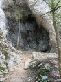
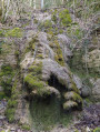
(3) At the Pas du Loup, take in the view, then head back to the path you spotted earlier, which climbs steeply to the left, and visit the cave.

(4) Head back down and turn left onto thePR® route towards the Col des Tourniers and then the Pas de la Pierre.

(5) At the pass, head up the slope opposite to reach La Porte and come to a fork in the path.

(6) Take a steep, slippery shortcut straight ahead to cut across the circular loop. At Font Pourcel, take the track that climbs and passes to the right of the viewpoint. Leave this track shortly afterwards and take the path to the left of the Pas de la Pierre. Before reaching the Pas, head for the cliff and turn left.

(7) From the Pas, head down towards “Sous le Pas de la Pierre” and turn right to rejoin theGRP® des Monts du Matin.

(8) Continue straight on along theGR® 9 andGRP®. The path is easy to follow and leads to Léoncel and the Pas de Bouvaret.

(9) At Bouvaret, leave the path to Léoncel on your left and keep to the right towards the Pas.

(10) Do not climb up to the Pass, but turn left and walk for 150 m.

(11) Continue along the track, which is sometimes hard to follow for about 200 m.

(12) At a fork, turn left and head slightly uphill if the track disappears. Pass a few scree slopes and reach a tree marked with a red dot, from where a path leads off to the right and straight up the slope to the Brèche du Cou de la Momie.

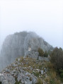
(13) Take the path on the left which runs alongside the cliff before veering away from it; follow a steep slope through the boxwood to reach a rock which you must either climb or bypass on the left, following the path that leads to the summit (panoramic view) after a second, easier climbing section which is no more exposed.

(14) Return to the previous junction.

(13) Take the path opposite, which leads to the Poitrine de la Momie, running alongside the cliff through the boxwood. There are a few easy, non-exposed rock sections to negotiate to reach the summit (beautiful pinnacles).

(15) Begin the descent by following the ridge northwards, then into the woods, but without straying too far from the edge.

(12) When you return to the junction you passed on the way up, turn left, heading in the opposite direction to your ascent, until you reach a shortcut at another junction which you also passed on the way up.

(11) Follow this path to the left and head for the Pas de Bouvaret.

(16) Then turn left down the slope towards Courbière.

(17) Leave the Sentier du Pas de Bouvaret on the right, heading towards Font Pourcel and the Pas de la Pierre, and continue on to Sous Verdu and a mountain bike track.

(18) At the hairpin bend on the left, take the lower path (mountain bike trail) which leads back along a ridge to the starting point. Leave this path once you can see the car park and head down a gently sloping meadow (S/E).

Waypoints

  1. S/E : mi 0 - alt. 2,106 ft - Car park
  2. 1 : mi 0.73 - alt. 2,198 ft - Path on the left
  3. 2 : mi 1.36 - alt. 2,123 ft - Ussets Spur
  4. 3 : mi 1.72 - alt. 2,608 ft - Pas du Loup (756m)
  5. 4 : mi 1.75 - alt. 2,635 ft - Grotte des Ussets
  6. 5 : mi 2.35 - alt. 2,425 ft - Col des Tourniers
  7. 6 : mi 2.57 - alt. 2,582 ft - The gate
  8. 7 : mi 3.15 - alt. 3,802 ft - Pas de la Pierre
  9. 8 : mi 3.58 - alt. 3,333 ft - Below the Pas de la Pierre
  10. 9 : mi 4.52 - alt. 3,501 ft - Bouvaret
  11. 10 : mi 4.77 - alt. 3,602 ft - Junction
  12. 11 : mi 4.86 - alt. 3,655 ft - Common junction for both the outward and return journeys
  13. 12 : mi 4.97 - alt. 3,773 ft - Common junction for both the outward and return journeys
  14. 13 : mi 5.57 - alt. 3,986 ft - Brèche
  15. 14 : mi 5.66 - alt. 4,091 ft - Summit
  16. 15 : mi 5.85 - alt. 4,180 ft - Poitrine de la Momie
  17. 16 : mi 6.41 - alt. 3,635 ft - Pas de Bouvaret
  18. 17 : mi 6.84 - alt. 2,904 ft - Courbière
  19. 18 : mi 7.42 - alt. 2,293 ft - Mountain bike trail
  20. S/E : mi 7.89 - alt. 2,110 ft - Car park

Notes

No water or specialist kit required, apart from poles, which you’ll stow away to reach the two summits.
As for the technical sections involving rock ledges to cross, there are plenty of ledge-like paths.

Below the Pas de la Pierre , do not head right into the gully – it’s a slippery and exposed route.
The rocks are easy to climb once you’ve found and correctly placed your first foothold; they are not exposed.
Below the summit of the Petite Sœur, do not take the horizontal ledge that heads off to the right.
From the summit of La Poitrine, continue a few metres along the ridge and rejoin the path through the woodland.
Below Verdu, the cows have trodden several paths; the correct one is at the exit of the hairpin bend and is marked with small mountain bike signs.
On the cliffs of the Combe d’Oyans, you’re sure to see some climbers.

Worth a visit

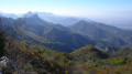
Enjoy the various views.

Always be cautious and plan ahead when you're outdoors. Visorando and the author of this route cannot be held responsible for any accidents occurring on this route.

The GR® and PR® markings are the intellectual property of the Fédération Française de Randonnée Pédestre.

Reviews and comments

4.1 / 5
Based on 3 reviews

Reliability of the description
4.7 / 5
Ease of following the route
3.3 / 5
Route interest
4.3 / 5
User 25624919

Overall rating : 4 / 5

Date of your route : Aug 23, 2025
Reliability of the description : ★★★★☆ Good
Ease of following the route : ★★★★☆ Good
Route interest : ★★★★☆ Good
Very busy route : No

A very interesting hike, but between points 14 and 15, reaching the mummy's chest was very complicated, with little information available. We turned back because it seemed quite dangerous, with no accessible path through the boxwood...
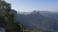
however, there were two magnificent viewpoints.

Machine-translated

Deelight
Deelight

Overall rating : 4 / 5

Date of your route : Jun 22, 2025
Reliability of the description : ★★★★★ Very good
Ease of following the route : ★★★☆☆ Average
Route interest : ★★★★☆ Good
Very busy route : No

This hike isn't particularly difficult technically, but it is quite "laborious" with plenty of opportunities to get lost, so a GPS is essential near the summit. We ended up adding an extra 1.5 km to our hike (we missed a fork before point 13 and explored two trails that weren't on the map around that point, but they did offer some beautiful views). The summit and the panoramic views arrived late, around 10-11 km (when we got a little lost), so we finally returned to point 12 via the same route as on the way there to ensure we finished the hike in a reasonable time. We probably missed the most spectacular part, but as we didn't set off early, we preferred to play it safe. We returned to the starting point after 7 hours and 35 minutes, including breaks. I found the difficulty/reward ratio a little less favourable than other hikes I've done in the Vercors, but it was a very good experience nonetheless.

Machine-translated

lolo26120
lolo26120
• Edited:

Overall rating : 4.3 / 5

Date of your route : Apr 22, 2025
Reliability of the description : ★★★★★ Very good
Ease of following the route : ★★★☆☆ Average
Route interest : ★★★★★ Very good
Very busy route : No

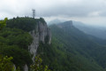
A magnificent hike along the most beautiful cliffs of the western foothills of the Vercors. From the flower-filled meadows of the Combeau valley to the vertiginous rocks of the peaks, passing through fragrant boxwood groves, it was a real feast for the eyes. And as a reward, a 360° view at the top. The path isn’t always easy to follow, but this gave us the chance to experience the life of wild boar cubs by occasionally following their trails on all fours through the boxwood to find our way back. If in doubt, keep an eye on your GPS to stay on the trail when it becomes faint. Once at the summit, near the Pierre Percée (visible in the photos), the path disappears, and you’ll need to wander a little to find it again further on, making your way through boxwood and varied rocky outcrops. On our watches, the hike showed 14 km. We’d been a bit worried about the final descent and its steep gradient, but it went very smoothly. Not a particularly difficult hike in my opinion, even though I’m afraid of heights. Apart from the difficulty in following the track – which actually adds a bit of adventure – I’d give it 5 out of 5.

Machine-translated

Other walks in the area

For more walks, use our search engine .

The GPS track and description are the property of this route's author. Please do not copy them without permission.