A walk along the bridle path near Divonne-les-Bains

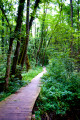
A circular loop through the Divonne forest along an excellent path beneath beech, oak and fir trees, returning via the forest track.
Shaded in summer and open in the off-season, it is accessible all year round.
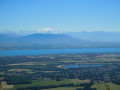
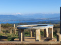
A few clearings offer views of the Lake Geneva basin and the Alps.
With signposts at various points, it is impossible to get lost.

Details

n°7633427
Creation:
Last update:
Last review:
  • Walking
    Activity: Walking
  • ↔
    Distance: 3.17 mi
  • ◔
    Average duration: 2h 00 
  • ▲
    Difficulty: Easy

  • ⚐
    Back to start: Yes
  • ↗
    Ascent: + 594 ft
  • ↘
    Descent: - 591 ft

  • ▲
    Highest point: 2,618 ft
  • ▼
    Lowest point: 2,024 ft

Description of the walk

On the Divonne-les-Bains forest road, after 500 m, park at the Fleutron reservoir car park, the starting point for walks.

(S/E) Take the track that climbs gently to the left and follow it, staying firmly on the main track.

(1) The track levels out slightly here; this is the only challenging part of the route. Continue to the Carrefour du Comte (signposted).

(2) At the crossroads, turn right onto the bridle path for an almost level stretch through the forest with a few views of Lake Geneva, the Alps and Mont Blanc in the background.

(3) The track crosses the path leading to the Jura peaks (a quick descent is possible). Continue along the track until you reach the forest road.

(4) Head down this road to return to the car park (S/E).

Waypoints

  1. S/E : mi 0 - alt. 2,024 ft - Car park at the Fleutron reservoir
  2. 1 : mi 0.33 - alt. 2,169 ft - Junction with the Chemin de la Baronne
  3. 2 : mi 0.69 - alt. 2,408 ft - Carrefour du Comte. Turn right
  4. 3 : mi 1.82 - alt. 2,592 ft - Path junction. Opposite
  5. 4 : mi 2.31 - alt. 2,470 ft - Arrival at the forest track. Turn right
  6. S/E : mi 3.17 - alt. 2,028 ft - Car park at the Fleutron reservoir

Notes

An easy walk requiring no special equipment (a few short sections that may be damp at times, animal tracks).

The route runs wholly or partly through the Haute Chaîne du Jura National Nature Reserve. Please observe the regulations: https://www.rnn-hautechainedujura.fr/reg...

This route passes through a protected area, which may be subject to special regulations:

Worth a visit

Take an interest in the place names:
‘Chemin du Comte’ may refer to the de la Forest Divonne family, who held the seigneury of Divonne.
‘Chemin de la Baronne’, like the farm of the same name situated below.

Reviews and comments

5 / 5
Based on 1 review

Reliability of the description
5 / 5
Ease of following the route
5 / 5
Route interest
5 / 5
adubout
adubout

Hello and thank you for your feedback. Whilst it is true that the circular loop has a steeper section shortly after the start, it does have the advantage of allowing you to coast downhill along the road, which requires less concentration…
It’s worth noting that the first hairpin bends on the anti-clockwise route are also quite steep and that you’re exposed to road traffic (light) for longer.

Machine-translated

Ranchera34
Ranchera34

Overall rating : 5 / 5

Date of your route : Aug 15, 2022
Reliability of the description : ★★★★★ Very good
Ease of following the route : ★★★★★ Very good
Route interest : ★★★★★ Very good
Very busy route : No

Contrary to what is stated in the description, I would advise turning right to start.
In other words, do the circular motion anti-clockwise.
If you turn left at the start, the climb is quite steep.

Machine-translated

Other walks in the area

For more walks, use our search engine .

The GPS track and description are the property of this route's author. Please do not copy them without permission.