The Marais des Bidonnes

A pleasant walk along boardwalks through a marshy area with themed information panels about the local flora and fauna.

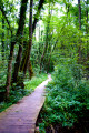
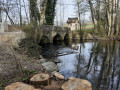
Starting from the hamlet known as ‘Les Îles’, an educational trail runs alongside the Crans Canal. This canal, also known as the Coppet Canal, has been used since 1265 to divert part of the waters of the Versoix towards Bogis and Commugny in Switzerland. The rich variety of flora and fauna (reeds, alders, oaks, lungwort, etc.) found here is highlighted by themed information boards. As you cross the Bidonnes marsh on wooden footbridges, you may spot beavers. Finally, an observation deck offers a superb view of this fragile ecosystem, where a herd of hardy cows helps to prevent natural reforestation.

Details

67112714
Creation:
Last update:
Last review:
  • Walking
    Activity: Walking
  • ↔
    Distance: 1.95 mi
  • ◔
    Average duration: 0h 55 
  • ▲
    Difficulty: Easy

  • ⚐
    Back to start: Yes
  • ↗
    Ascent: + 23 ft
  • ↘
    Descent: - 23 ft

  • ▲
    Highest point: 1,562 ft
  • ▼
    Lowest point: 1,532 ft

Photos

Description of the walk

Park in the car park near the Rond-Point des Iles.

(S/E) Head towards the roundabout. Leave the roundabout on your right, use the pedestrian crossing to cross Avenue du Rond-Point des Iles (D984c) and follow it to the left. Cross the River Versoix.

(1) Immediately afterwards, take a path on the right and walk alongside the river on your right. Further on, take a small bridge over the river and then walk alongside it on your left. Note the access to a viewing point on the right; you will soon reach a junction.

(2) Turn left and walk alongside two small ponds on your right. Continue along a wider, unpaved track. You’ll come out onto a small road; follow it to the left.

(3) As you come out of the right-hand bend and just before the D384c, keep parallel to the road and walk alongside a field on your left. You’ll reach a roundabout.

(4) Then turn left and walk along Avenue du Pont des Iles.

(1) Carry on straight ahead. After about fifty metres, cross the avenue at the pedestrian crossing and you’ll immediately reach the starting car park (S/E).

Waypoints

  1. S/E : mi 0 - alt. 1,539 ft - Car park – Rond-Point des Iles
  2. 1 : mi 0.07 - alt. 1,542 ft - Crossing the circular loop
  3. 2 : mi 0.76 - alt. 1,532 ft - Crossroads - Versoix ou Divonne (rivière)
  4. 3 : mi 1.16 - alt. 1,552 ft - Start of the trail
  5. 4 : mi 1.76 - alt. 1,542 ft - Roundabout
  6. S/E : mi 1.95 - alt. 1,539 ft - Car park – Rond-Point des Iles

Notes

Safety instructions
Part of this route passes through the Haute Chaîne du Jura National Nature Reserve; please respect its regulations

Among these rules: dogs are not permitted, even on a lead!

Before setting off
- Check the general and local weather forecast to ensure there is no rain.
- Find out about the approach walk, the altitude of the route, the walking time and possible escape routes (IGN map, GPS, guidebook, etc.).
- Assess any potential risks by consulting mountain professionals, mountain huts and lodges.
- Inform a friend or family member of your plans and contact them again if there are any changes: departure and return times, number of participants with each person’s telephone number, vehicle(s), car park.
- Avoid setting off alone; use equipment suitable for the activity, which is properly adjusted and in good condition, including a head torch, a fully stocked first-aid kit and a survival blanket, etc.
- In the event of a problem, call 112 (the European emergency number).

Worth a visit

You can round off your hike by walking around Lake Divonne (3 km).

Reviews and comments

4.7 / 5
Based on 2 reviews

Reliability of the description
5 / 5
Ease of following the route
5 / 5
Route interest
4 / 5
CPOIRAUD
CPOIRAUD

Overall rating : 5 / 5

Date of your route : Aug 06, 2026
Reliability of the description : ★★★★★ Very good
Ease of following the route : ★★★★★ Very good
Route interest : ★★★★★ Very good
Very busy route : Yes

A very shaded and pleasant walk, particularly in hot weather. A lovely, peaceful woodland setting that’s well maintained. The route is very well signposted.
The final section, which runs alongside the road and is more exposed, is less pleasant.
Taking the route in the opposite direction may prove more enjoyable, as it ends with the shadiest and quietest section.

Machine-translated

User 22962377

Overall rating : 4.3 / 5

Date of your route : Jan 07, 2026
Reliability of the description : ★★★★★ Very good
Ease of following the route : ★★★★★ Very good
Route interest : ★★★☆☆ Average
Very busy route : No

Travelled this route in spring 2025, unfortunately in grey weather, so it was rather dull.
I returned in December 2025 to get some fresh air, but winter is not the right season to walk here.
I will return in 2026, on a sunny day, to enjoy this interesting site as described in the discovery guide.

Machine-translated

Pays de Gex - Monts Jura
• Edited:


Following the storm on 23 October 2025, several trees fell on the trail, damaging some sections of the decking. As a result, we are forced to temporarily close the trail until the necessary repairs are made.

Signs and barrier tape will be installed to mark the closure of the trail.

The trail is once again accessible.

Machine-translated

Other walks in the area

For more walks, use our search engine .

The GPS track and description are the property of this route's author. Please do not copy them without permission.