


 Country:
 City:
City:


The start point is opposite the Divonne-les-Bains Lake Leisure Centre (car parks at the Esplanade du Lac de Divonne and the nearby swimming pool).
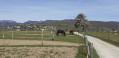
(S/E) Walk round the lake on the left-hand side. The Divonne river flows behind the equestrian centre and the racecourse, where it enters Switzerland and becomes the Versoix. Walk alongside the racecourse to discover the Sentier des Planètes. At the end of the lake, at the roundabout, turn left onto the D15 towards the border post. After crossing the Pont Béné bridge over the Versoix, pass through the Swiss border post.
(1) Just after the customs post, take the path branching off to the right which runs alongside a marshy area criss-crossed by the river. After about 3 km, at the end of the path, turn right towards the Pont de Grilly.
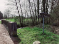
(2) You are back in France. 200 m further on, take the path on the left towards Sauverny and head for the Moulin de Grilly. Towards the end of this section, you can see the bed of the River Versoix on your left.
(3) Just past the enclosure next to the mill, take the path on your left, which later becomes a tarmac road at the entrance to Sauverny. At the end of this road, turn left to reach the Sauverny Bridge.
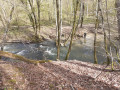
(4) Just after the bridge, go down the steps on the right which lead to the path along the Versoix. You are back in Switzerland. This part of the walk along the river is superb. In several places, the path rises slightly, forming a balcony-like section. Follow the Versoix as far as the Bossy Bridge.
(5) Cross the Bossy Bridge on your right and, immediately after it, turn right onto the path that climbs through the woods and offers a lovely viewpoint over the Versoix. It runs alongside the river on the opposite bank for 300 metres, then follows a ravine at the bottom of which flows the Fontaine de Pissevache, a small stream whose name doesn’t exactly make you want to take a sip. At the end of this path, leave the woods and take the road on your right alongside the Vieille Bâtie Golf Course. Pass the private track on the right leading to the golf course. 100 metres further on, you’ll find the bridle path on your right.
(6) Follow this bridle path as it winds through a private field. At the end of the path, head straight on into the Bois de Villars Dame and take the path that branches off slightly to the right (offering a lovely view of the Versoix). Walk down to the riverbank.
(7) At the border marker, walk a few metres alongside the river on your left, then take the path that climbs back up into the woods. This climb is short but steep. You are back in France. Continue along this main path, which gradually widens, leaves the woods, and passes through the hamlet of Villars Dame before reaching Pont-sur-l’Oudar.
(8) Just after the bridge, take the road on the right leading to Sauverny. A cycle lane is marked with paint on the left-hand side of the carriageway. At the entrance to the village, before the sports centre, turn left onto the Chemin de la Craz, which climbs into the village. At the top, at the Stop sign, turn right and pass in front of the town hall.
(9) A few metres further on, take the road that climbs to the left and, about 150 metres further on, turn onto the track suitable for vehicles that climbs to the right (Chemin sur les Vignes). Along the route, on your right, you’ll find the last patch of vineyards in the commune of Sauverny.
(10) At the junction with the Chemin du Moulin (view of Lake Geneva), turn left and carry on straight ahead. A sign for the footpath directs you to turn right, but the path that continues straight ahead is more pleasant, running through the horse paddocks at the Abreuvoir de Grilly. (In any case, both options lead to the same place in the end). When you reach the stud farm, take the small path opposite which leads to Grilly via the Passage du Munet.
(11) Follow the road that descends to your right. Once at the bottom (elevation 478), turn onto the wide, carriageable track that branches off to the left. Continue on to Arbère. The River Versoix, which you cannot see, winds its way behind the marshes and the Étang de Prodon, accessible via a path on your right.
(12) Cross the D15 with care and take Rue de la Source opposite, walking for about 400 m.
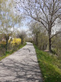
(13) Turn right onto the Voie Verte, which links Gex to Divonne-les-Bains. It then becomes a cycle path as far as the car park at Divonne-les-Bains station.
(14) At the roundabout, follow Rue Marcel Anthonioz, which starts opposite, then continue along Avenue Marcel Anthony for 400 m. Turn right onto Rue de Cheintres, which takes you back to the swimming pool car park (S/E).


 Tourist office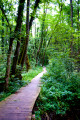
 Easy
Easy 
 Visorando Member
 Very difficult
 Moderate
