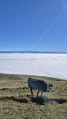
Chalet de la Vesancière

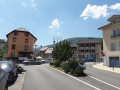
A lovely, easy walk taking you through the Jura forests and mountain pastures above Vesancy, a charming historic village in the Pays de Gex.
Please note! Hiking is not permitted between 15 December and 30 June

Details

n°69675
Creation:
Last update:
Last review:
  • Walking
    Activity: Walking
  • ↔
    Distance: 8.48 mi
  • ◔
    Average duration: 5h 25 
  • ▲
    Difficulty: Moderate

  • ⚐
    Back to start: Yes
  • ↗
    Ascent: + 1,742 ft
  • ↘
    Descent: - 1,739 ft

  • ▲
    Highest point: 4,692 ft
  • ▼
    Lowest point: 3,163 ft

Description of the walk

Moderator update on 5 July 2020. Please note !__ Hiking is prohibited between 15 December and 30 June under a prefectural order to protect the capercaillie
__
From Vesancy, take the road heading straight up towards the Riamont chapel. 50 metres further on, turn left at a Fork in the road and follow this road uphill for approximately 2.5 km, passing a road branching off to the right towards the TV relay station, and stop at the crossroads a little further on.

(S/E) Take the forest track straight ahead; after a large circular bend to the right, you’ll reach a junction with a footpath.

(1) Leave this track and take the path on the left. Head towards the Pralet hut and continue until you reach it.

(2) Return to the forest track branching off to the left. Follow it, ignoring all paths branching off to the left or right. Continue to the junction with the road leading to La Combe Blanche.

(3) Turn left onto this road, known as the Route Forestière de la Divonne. Pass a small car park and, immediately afterwards, reach the junction withthe GR® Balcon du Léman.

(4) Turn left onto this path. Continue along it until you reach the ruins of Puthod Castle. Carry on to the Croix de Puthod and the Maison Forestière.

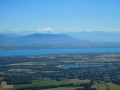
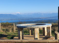
(5) Take the path branching off to the left – a track somewhat rutted by timber hauling and muddy in wet weather. Follow this path (which is not very well marked at the start of the season) as it crosses an old pasture and leads to the Vesancière chalet. A magnificent, vast clearing offering a beautiful view to the left over the Dôle and the Jura range, and straight ahead towards the Alps and Lake Geneva.

(6) Set off again along the path opposite the chalet to the Touppinet hut.

(7) Here, join the forest track. Follow it to the left and descend via a series of hairpin bends to reach the car park where you started (S/E).

Waypoints

  1. S/E : mi 0 - alt. 3,163 ft - Car park at a bend in the Route de Touppinet
  2. 1 : mi 0.79 - alt. 3,678 ft - T-junction with a bend
  3. 2 : mi 1.19 - alt. 3,944 ft - Pralet Hut
  4. 3 : mi 2.96 - alt. 4,488 ft - Divonne RF junction
  5. 4 : mi 3.56 - alt. 4,528 ft - GR junction at Balcon du Léman
  6. 5 : mi 4.66 - alt. 4,452 ft - Croix de Puthod
  7. 6 : mi 5.8 - alt. 4,665 ft - La Vesancière – View of the - Lac Léman
  8. 7 : mi 6.6 - alt. 4,222 ft - Touppinet
  9. S/E : mi 8.48 - alt. 3,166 ft - Car park at a bend in the Route de Touppinet

Notes

(2) Baraque de Pralet: picnic table available.
(5) In winter, this is the Vattay cross-country skiing area.
The ground is often muddy off the forest tracks in wet weather. Timber hauling takes place in early summer. The path leading to the Vesancière chalet is poorly marked in its final half from the Puthod hut; follow the trail.

This route runs wholly or partly through the Haute Chaîne du Jura National Nature Reserve. Please respect the regulations: https://www.rnn-hautechainedujura.fr/reg...
A section of this route is closed to the public from 15 December to 30 June (Wildlife Quiet Zone). Further information here: https://www.rnn-hautechainedujura.fr/

Worth a visit

There’s a lovely viewpoint at the Vesancière chalet, and you can have a picnic at the Pralet chalet.
An easy walk offering a chance to explore the Jura, following the Vattay cross-country ski trails in places.

Always be cautious and plan ahead when you're outdoors. Visorando and the author of this route cannot be held responsible for any accidents occurring on this route.

The GR® and PR® markings are the intellectual property of the Fédération Française de Randonnée Pédestre.

Reviews and comments

3.1 / 5
Based on 5 reviews

Reliability of the description
2.8 / 5
Ease of following the route
3.2 / 5
Route interest
3.2 / 5
masdelaraz38
masdelaraz38

Overall rating : 3.3 / 5

Date of your route : Oct 24, 2021
Reliability of the description : ★★★☆☆ Average
Ease of following the route : ★★★☆☆ Average
Route interest : ★★★★☆ Good
Very busy route : No

For us, who go hiking almost every weekend, we were a little disappointed. The advertised elevation gains didn’t put us off, nor did the fact that we couldn’t park in the small car park signposted on the Chemin du Touppinet. A barrier – albeit a removable one – added about 3 km to our walk. The main criticism is that, from the Chalet de la La Vesancière onwards, you have to pay very close attention to the route and/or the map, as it’s all too easy to go astray. The vegetation has reclaimed the area and the signposting is rather sparse. On the other hand, we came across a stag, caught sight of Mont Blanc on several occasions and were treated to some stunning views. All in all, even though we ended up walking over 20 km in total, we wouldn’t recommend this walk for families – unless you’re with keen teenagers!

Machine-translated

NJURA
NJURA

Overall rating : 1.7 / 5

Date of your route : Jun 27, 2020
Reliability of the description : ★☆☆☆☆ Very disappointing
Ease of following the route : ★★★☆☆ Average
Route interest : ★☆☆☆☆ Very disappointing
Very busy route : No

The route was closed in places to protect the wilderness; there were many detours as landmarks were not visible (either unidentifiable or no longer there – e.g. crosses – or could not be found – e.g. the castle ruins); there was no mobile signal along the entire route.
No views to speak of apart from the ascents and descents; the walk was largely
a 7-hour walk with absolutely nothing of interest
Perhaps for ‘locals’, this walk is easy to follow, but for us, coming from outside the department, it was very difficult.

Machine-translated

henri57
henri57 ★

Hello,

Thank you for your feedback.

The final section between 5 and 6 is really very poorly signposted; I followed a marked path but apparently it wasn’t the right one,

It’s true that with Visorando you often venture off the beaten track, so there are no markings.
Visorando does not recommend relying on signposting as this can be altered or removed… whereas landmarks on the ground provide consistent information.

Visorando provides a detailed route description and a 1:25,000-scale IGN map. And if signposting is essential for you, Visorando offers a virtual signposting tool: a GPS app.

This tool, offered free of charge by Visorando, allows you to verify waypoints and thus dispel any doubts regarding your direction.

See you soon

Machine-translated

senda01
senda01

Overall rating : 4 / 5

Date of your route : May 10, 2019
Reliability of the description : ★★★★☆ Good
Ease of following the route : ★★★★☆ Good
Route interest : ★★★★☆ Good

The path to the starting point was closed. I had to park further down and start the walk about 1 km before the starting point.
At point 5, be careful – the path is signposted as closed to everyone!
The final section between points 5 and 6 is extremely poorly signposted; I followed a marked path but apparently the wrong one, so I had to take a detour and ended up missing points 6 and 7.
A bit too much tarmac for my liking on the way back, but otherwise a lovely walk through the woods where I was lucky enough to spot quite a few animals
Thanks!

Machine-translated

bibi
bibi ★

Thank you for your feedback. What issues did you encounter with the description and the route on the map?
Kind regards

Machine-translated

hermieda
hermieda

Overall rating : 2.3 / 5

Date of your route : Jul 08, 2017
Reliability of the description : ★★☆☆☆ Disappointing
Ease of following the route : ★★☆☆☆ Disappointing
Route interest : ★★★☆☆ Average

A pleasant walk, but not much in the way of views. 5 hours. Classified as ‘easy’, but it still really works the thighs.

Machine-translated

Vincent01170
Vincent01170

I’ll give it a go tomorrow

Machine-translated

piaf61
piaf61
• Edited:

I only drove part of the route

Machine-translated

Other walks in the area

For more walks, use our search engine .

The GPS track and description are the property of this route's author. Please do not copy them without permission.