La Dôle, starting from Divonne-Les-Bains

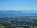
A beautiful Franco-Swiss hike to the Dôle, offering magnificent panoramic views of the Jura to the north, Lake Geneva to the south, the northern Alps and, consequently, Mont Blanc.

Details

42228
Creation:
Last update:
Last review:
  • Walking
    Activity: Walking
  • ↔
    Distance: 14.12 mi
  • ◔
    Average duration: 10h 25 
  • ▲
    Difficulty: Difficult

  • ⚐
    Back to start: Yes
  • ↗
    Ascent: + 4,514 ft
  • ↘
    Descent: - 4,511 ft

  • ▲
    Highest point: 5,469 ft
  • ▼
    Lowest point: 2,028 ft

Description of the walk

Start from the car park located north-west of Divonne-Les-Bains, heading towards and past the Fleutron campsite (more details in the practical information section).

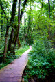
(S/E) At the start, take the ascending path towards La Dole. The forest stretches as far as the eye can see, but it’s a steep climb. The path crosses a forest track several times on the way to the Baraque de Divonne.

(1) Once you reach the Baraque de Divonne, take the tarmac road on the right for about 700 metres until you reach the start of a footpath.

(2) Take this path on the right towards the border.

(3) When you reach the border markers, head east for 100 metres, then turn left towards the Combe du Faoug.
From this point, there is a path leading to the Cabane du Faoug.

(4). Follow the signposts towards La Dôle. Look for a tarmac track to the north of the valley, climbing through the forest towards La Baudichonne, then follow the road to a junction.

(5) At the junction, turn right towards La Dôle. All you have to do is follow the signposts along the path towards La Dôle.

(6) Leave the return path on your right. Carry on straight ahead to reach the summit; take in the panoramic views, have a quick lunch break, a nap, and then set off again.

(7) From La Dôle, head north towards the Col de Porte.

(8) Then, head towards the small hut and take the path running below it towards the Chalet des Apprentis.

(9) Continue towards La Barillette.

(10) Just before La Barillette, you’ll come to a tarmacised three-way junction; from there, turn right onto the tarmacised road towards the Chalet de la Dôle.

(11) When you reach the Chalet de la Dôle, take the alternative path to the left. You’ll come to a junction you’ve already passed on the way there.

(6) Turn left and retrace your steps along the route you took on the way there, heading towards the border.

(5) Follow the Balcon du Léman path to the right, then, 150 metres further on, turn left towards the Grande Grand. Follow this path until you reach a tarmac road.

(12) Turn left, then left again towards the Petite Grand and the Baraque de Divonne.

(1) Follow the path to the right, heading in the opposite direction to the way out, and you’ll reach the car park (S/E).

Please note that the descent can be quite challenging in places in wet weather.

Waypoints

  1. S/E : mi 0 - alt. 2,028 ft - Car park after the Fleutron campsite
  2. 1 : mi 1.45 - alt. 3,957 ft - Divonne hut. Common junction (out and return)
  3. 2 : mi 1.83 - alt. 4,026 ft - Turn right towards the border
  4. 3 : mi 2.06 - alt. 4,026 ft - Border markers
  5. 4 : mi 2.43 - alt. 4,012 ft - Faoug Hut in Switzerland
  6. 5 : mi 4.02 - alt. 4,580 ft - Common junction (out and return). Border
  7. 6 : mi 5.02 - alt. 5,318 ft - Common junction (out and return)
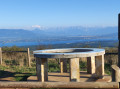
  8. 7 : mi 5.31 - alt. 5,453 ft - La Dôle – View of the - Lac Léman
  9. 8 : mi 5.86 - alt. 5,089 ft - Col de Porte
  10. 9 : mi 6.16 - alt. 4,869 ft - Chalet des Apprentis
  11. 10 : mi 6.89 - alt. 4,974 ft - Route
  12. 11 : mi 7.89 - alt. 4,728 ft - Chalet de la Dôle
  13. 12 : mi 10.86 - alt. 4,534 ft - Route: La Cabosse
  14. S/E : mi 14.12 - alt. 2,028 ft - Car park after the Fleutron campsite

Notes

When you reach the campsite entrance, take the road on the left towards Saint Gix; after about 500 metres, turn right towards the forest, then follow the road to the car park at the start of the footpaths.

On foot, starting from Divonne-Les-Bains, follow the same route but without a car. It’s about a 50-minute walk to the start of the hike.

As for the time it takes, I’ve already done this twice in summer, taking about 7 hours including a break for lunch, and twice in winter (on snowshoes); however, depending on snow conditions, it can take between 8 and 10 hours. For reference, the ascent to La Dôle via the standard path is estimated to take 4 hours.

The hardest part is the start – it’s quite a steep climb (around 500 m elevation gain over 3 km). The warm-up section is short, so take it easy at the start as you’ll need to keep going for the whole way.

There are no refreshment stops along the route unless the Chalet de la Dôle is open (check in advance).

No special kit is required apart from a good pair of trainers and a pair of walking poles – these are a great help, especially for the descent at the end.

A camera is a good idea too.

The route runs entirely or partly through the Haute Chaîne du Jura National Nature Reserve. Please respect the regulations: https://www.rnn-hautechainedujura.fr/reg...
Part of this route is within a Wildlife Quiet Zone from 15 December to 30 June (access prohibited from 15 December to 14 April; between 15 April and 30 June, you must not stray from the route between points 1, 12 and 5). Further information here: https://www.rnn-hautechainedujura.fr/car...

Worth a visit

There isn’t much to be found nearby apart from a number of fountains (water not suitable for drinking).

For anything else you might need, you’ll have to walk back down to Divonne-Les-Bains, which takes about 45 minutes on foot.

Reviews and comments

4.2 / 5
Based on 3 reviews

Reliability of the description
4.3 / 5
Ease of following the route
3.7 / 5
Route interest
4.7 / 5
Alblb
Alblb

Overall rating : 3.7 / 5

Date of your route : Jan 25, 2021
Reliability of the description : ★★★★☆ Good
Ease of following the route : ★★★☆☆ Average
Route interest : ★★★★☆ Good
Very busy route : No

A challenging hike on snowshoes.
The trail markings aren’t easy to follow, so you need to stay very alert!
The scenery is magnificent!

Machine-translated

Jccrou88
Jccrou88

Overall rating : 4.7 / 5

Date of your route : Aug 14, 2017
Reliability of the description : ★★★★★ Very good
Ease of following the route : ★★★★☆ Good
Route interest : ★★★★★ Very good

Hello,
we didn’t complete the whole walk due to a lack of time (my wife, my 16-year-old son and I).
We went as far as La Dôle and then turned back without completing the circular loop.
The path leading to the circular path in Switzerland isn’t very well signposted, and the track isn’t clearly marked as the vegetation has grown quite thick. At the Swiss border, we did indeed follow the path shown on the map, even though there were no visible markers on the ground. We climbed over a low wall where there was no barbed wire and crossed the ‘cow paddock’ to the farm shown on the map. Once on the road, there were no particular difficulties.
As stated in the document downloaded from the website, the first section is quite challenging up to the Divonne hut. The stretch along the road between the farm in Switzerland and the junction with the path leading up to La Dôle also involves a fair bit of elevation gain, but on tarmac it’s less noticeable.
In any case, it’s a superb hike and the view from La Dôle is well worth the effort it takes to get there.
Alternatively, on the Jura side, you can hike up from the cable car along the road between the Col de la Faucille and Les Rousses.
Enjoy your walks.

Machine-translated

gazok54
gazok54 ★

Hello everyone.
This walk has just been updated, notably with the addition of waypoints to help you find your way around this long ‘double circular’ route
Enjoy your future walks.

Machine-translated

acgerard
acgerard

Overall rating : 4.3 / 5

Date of your route : Aug 11, 2015
Reliability of the description : ★★★★☆ Good
Ease of following the route : ★★★★☆ Good
Route interest : ★★★★★ Very good

A lovely walk, but it wasn’t possible to cross into Switzerland at the point indicated.

Machine-translated

Other walks in the area

For more walks, use our search engine .

The GPS track and description are the property of this route's author. Please do not copy them without permission.