The penstock route from Pralognan-la-Vanoise

A superb combination near Pralognan: a route steeped in history and hydroelectricity.
Water flows beneath your feet through an underground tunnel… This tunnel, which starts at the dam downstream of the hamlet of Les Prioux, runs along the north-facing slope before passing beneath Mont Bochor and Mont Chevrier. The water ends its wild journey at Villard du Planay, where it powers the turbines of a hydroelectric power station. Along the way, discover the various viewing points in the underground gallery as well as the remains of the barracks used by the men who completed these tunnels just after the Second World War. Step into the history of hydroelectricity!

Details

58672829
Creation:
Last update:
Last review:
  • Walking
    Activity: Walking
  • ↔
    Distance: 3.92 mi
  • ◔
    Average duration: 2h 40 
  • ▲
    Difficulty: Moderate

  • ⚐
    Back to start: Yes
  • ↗
    Ascent: + 1,033 ft
  • ↘
    Descent: - 1,017 ft

  • ▲
    Highest point: 5,492 ft
  • ▼
    Lowest point: 4,642 ft

Description of the walk

(S/E) Set off from the foot of the Mont Bochor cable car, heading south-east to reach the Place du Barioz (meaning ‘barrier’ in local dialect) 150 metres further on.

(1) Follow the Chemin de l’Erlet to the hamlet of Les Bieux (‘birch’ in local dialect).

(2) Follow the path uphill towards Les Fontanettes (path no. 17). This path starts at the ‘bachal’ and leads to an orientation table.

(3) A little further up, take the fork in the path (trail no. 19c) towards the upper bridge at the Cascade de la Fraîche. Cross the bridge and head up the path (trail no. 19) to reach a broad, level area at Fenêtre no. 4 (the gallery’s only air vent).

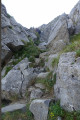
(4) From the flat area, follow a slightly exposed ledge to reach the foot of the Grand Marchet cliff face (trail no. 26).

(5) At the top of the slalom course, continue along the Nanette path (path no. 29).

(6) You’ll be walking through the heart of the forest, one of the most beautiful spruce forests in Savoie, which was devastated by a storm in 1970. Take the opportunity to admire the area’s diverse flora (monkshood, Alpine clematis, columbine, lady’s slipper, etc.).

(7) At the junction with the Sentier du Pas de l’Âne, continue along the path known as the Rocher Blanc trail (trail no. 35). This path crosses a wide avalanche corridor.

(8) At the junction, turn right onto the forest track towards the municipal campsite (trails nos. 36 and 34).

(9) Turn left to reach the Place du Barioz.

(1) Then, following the route back in the opposite direction to the outward journey, head to the foot of the Mont Bochor cable car (S/E).


Waypoints

  1. S/E : mi 0 - alt. 4,646 ft - Base of the Mont Bochor cable car
  2. 1 : mi 0.09 - alt. 4,672 ft - Place du Barioz
  3. 2 : mi 0.24 - alt. 4,816 ft - Towards Les Fontanettes
  4. 3 : mi 0.61 - alt. 5,131 ft - Head towards the upper bridge - Doron de Bozel (rivère)
  5. 4 : mi 0.85 - alt. 5,371 ft - Flat section
  6. 5 : mi 1.4 - alt. 5,236 ft - Summit of the slalom course
  7. 6 : mi 1.65 - alt. 5,417 ft - Forest
  8. 7 : mi 1.85 - alt. 5,492 ft - Trail junction
  9. 8 : mi 2.59 - alt. 5,085 ft - Forest track junction
  10. 9 : mi 3.52 - alt. 4,705 ft - Towards Les Barios
  11. S/E : mi 3.92 - alt. 4,649 ft - Base of the Mont Bochor Cable Car

Notes

Water points in the village

This route is on a north-facing slope. In wet weather or after a heavy downpour, it can be slippery.

Alternative descent routes: During your walk, there are two alternative descent routes to choose from: via the slalom stadium (trail no. 27) or via the path known as the ‘du pas de l’Âne’ (trail no. 30).

Worth a visit

La Fraiche Waterfall, Forest, Flora

Reviews and comments

3.4 / 5
Based on 4 reviews

Reliability of the description
4 / 5
Ease of following the route
3.3 / 5
Route interest
3 / 5
Kpi
Kpi

Overall rating : 3 / 5

Date of your route : Jul 29, 2026
Reliability of the description : ★★★★☆ Good
Ease of following the route : ★★☆☆☆ Disappointing
Route interest : ★★★☆☆ Average
Very busy route : No

Follow the route as indicated up to point 7, then head straight back to Pralognan as roadworks (summer 2026) prevent you from completing the circular loop.
Please note: there are several benches and tables along the route:
- at point 4, just below the wind tunnel (in the shade)
- just before point 5 (near the EDF window) (bench with a view of the valley)
- at point 7, in the shade (bench)
The hike is technically challenging (several tricky sections, particularly near the waterfall): I strongly recommend following the route in the direction indicated, especially not in wet weather, and only if you are already experienced in mountain walking (a good warm-up for seasoned hikers).
Its main attraction is that it is in the shade (with a direct descent to Pralognan at point 7) from start to finish.

Machine-translated

muse_88_
muse_88_
• Edited:

Overall rating : 3.7 / 5

Date of your route : Aug 31, 2025
Reliability of the description : ★★★★☆ Good
Ease of following the route : ★★★☆☆ Average
Route interest : ★★★★☆ Good
Very busy route : No

Hello, lovely walk along the Fraîche waterfall. The circuit offers beautiful views of the surrounding mountains. The problem is that at point 5 we cannot take the Nanette trail due to fallen trees and rocks (see photo added to the hike description). It is difficult to get to the car park at the start of the walk because all the paths below the village are blocked due to roadworks when you come back down to point 5. The best thing to do is to turn back at point 4 rather than completing the loop.

Machine-translated

User 3718946

Overall rating : 2.3 / 5

Date of your route : Aug 21, 2025
Reliability of the description : ★★★☆☆ Average
Ease of following the route : ★★★☆☆ Average
Route interest : ★☆☆☆☆ Very disappointing
Very busy route : No

I love hiking, but this is the first time I've ever given a hike a rating of 0.
The trail is full of rocks and roots, and you spend the entire time watching where you're stepping.
There's nothing to see, you're in the forest most of the time, and it's not interesting.

Machine-translated

sbas
sbas

On 26 June 2025, we climbed up to the wind tunnel. Unfortunately, the path was blocked by a banner. The path was closed due to falling rocks and trees. It was impossible to continue along the Nanette trail.

Machine-translated

dede53
dede53

Overall rating : 4.7 / 5

Date of your route : Aug 13, 2024
Reliability of the description : ★★★★★ Very good
Ease of following the route : ★★★★★ Very good
Route interest : ★★★★☆ Good
Very busy route : No

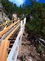
A lovely view of Pralognan. After the ski lift, the path is very uneven – with rocks and tree roots – and the wooden footbridge near the EDF manhole is in quite a poor state; a few slats are missing. If you take care, it’s fine.

Machine-translated

Other walks in the area

For more walks, use our search engine .

The GPS track and description are the property of this route's author. Please do not copy them without permission.