Country:
 City:


Start from the Poteau de Saint-Priest car park. Access from the village of Chamant via Avenue Foch.
No signposting
(S/E) Head north-east and follow the Route Royale towards the Gallo-Roman temple. Walk for approximately 1.5 km and, at the successive junctions, go straight on. Then turn left onto the main path and you will immediately come to a fork.
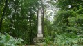
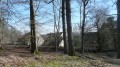
(1) Turn right onto a path leading towards the Gallo-Roman temple. Carry on straight ahead, ignoring a few faint parallel paths, and you’ll soon reach the temple ruins.
(2) Carry on in the same direction. At the junction that appears shortly afterwards, carry on straight ahead along a faintly marked path. At the next junction, go straight ahead and climb slightly. Pass a pond on your right and walk alongside a fence on the same side.
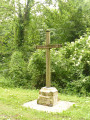
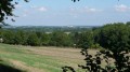
(3) At the junction at the corner of the fence, carry on straight ahead, pass a metal cross and you’ll soon reach a viewpoint overlooking the countryside. Retrace your steps.
(3) Head north-west: turn right when returning from the viewpoint, or left if you have not made this short round trip. At the T-junction, turn left and head slightly downhill.
Red and white markings
(4) At the junction, carry on straight ahead, following the winding GR® route. At a T-junction, turn right until you reach a crossroads with a small road.
(5) Cross the road and, on the other side, take the path on the right, the Route des Blancs Sablons. Climb gently and steadily, then alternate between short descents and ascents through fern-filled woodland.
(6) At the junction, turn left. Ignore a path branching off to the left and continue to the foot of the Chêne à l’Image when the main path turns right (information sign; small statue of the Virgin Mary high up on the tree trunk).
Unmarked
(7) Continue straight on and downhill: two paths go round the oak; take the one on the left (the one on the right is too rutted). At the junction of the two paths, carry on to a crossroads.
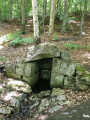
(8) Then turn left. After about fifty metres, veer right and head into the woodland along a track (follow the blue paint marks). Pass a red arrow indicating a right turn and, shortly afterwards, turn right to reach the Fontaine Bertrand (a stone-built spring and pond).
(9) Leave the spring and the pond on your right and follow a better-marked path. You’ll come out onto a wider path; follow it to the right and you’ll soon reach a crossroads.
(10) Take the second path on the left (south). At the junction, turn right and follow a wide path for about 200 metres.
(11) At the junction, turn left onto a narrower path. Further on, cross a wide path and continue straight ahead along a faintly marked track. At the next junction, carry on straight ahead for about a hundred metres. Then turn right and you’ll soon reach a clearly visible signpost.
(12) Take the first path on the left, at an acute angle, the Route du Dindon. Follow this wide path straight on until you reach the Poteau de Saint-Priest (S/E).
 Visorando Member
 Moderate

 Difficult