The Taennchel, starting from the Grande Verrerie

A walk starting from the hamlet of La Grande Verrerie, allowing you to explore almost the entire Taennchel massif. Allow a full day for the best experience. There is a wealth of literature on the Taennchel, and the information boards along the route help you gain a better understanding of the area.

Details

101149901
Creation:
Last update:
Last review:
  • Walking
    Activity: Walking
  • ↔
    Distance: 11.23 mi
  • ◔
    Average duration: 7h 05 
  • ▲
    Difficulty: Moderate

  • ⚐
    Back to start: Yes
  • ↗
    Ascent: + 2,205 ft
  • ↘
    Descent: - 2,201 ft

  • ▲
    Highest point: 3,225 ft
  • ▼
    Lowest point: 1,581 ft

Description of the walk

Park at the entrance to the hamlet of La Grande Verrerie. From Ribeauvillé, head towards Aubure. At a place called La Pépinière, take the small forest road on the right: the car park is signposted with a ‘P’ sign on the right.

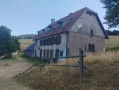
(S/E) From the car park, continue up the road, passing through the hamlet to reach the old Taennchel inn: there is a sign on the wall, though it is almost faded.

(1) Take the path on the left, following the Blue Disc markings, and head to the clay car park at Saxermatt.

(2) Opposite, follow the Yellow Ring markings to reach the hamlet of La Petite Verrerie.

(3) Turn left to go round the back of the church, staying on the Yellow Ring route. Walk for about 800 metres until you reach the junction with a main track.

(4) Take the track to the right (north), following the Yellow Ring signposting, and walk for over a kilometre.

(5) Take the Blue Triangle path on the left towards the Croix de Ribeauvillé and head towards it.

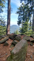
(6) Follow the path on the right marked with the Yellow Rectangle; stay on this path to reach a viewpoint.

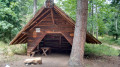
(7) Carry on to the right, staying on the Yellow Rectangle trail whilst ignoring the offshoots on either side. This will take you to the large picnic tables, then the small ones, and finally to the Kutzigbuech Shelter.

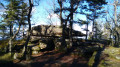
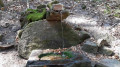
(8) Carry on straight ahead following the Yellow Rectangle. Don’t miss the Rocher des Reptiles, then the Rocher de la Petite Fée, before reaching the Rocher des Géants.

(9) Change route to follow the Red Ring to the right towards the Rock of Peace of Udine.

(10) Temporarily leave the trail markings to turn right and reach the Rock of the Titans. Pass the Pointed Rock, rejoin the Red Ring trail markings and continue along the route to the right to reach the Rock of Peace of Udine, which marks the southern end of the massif.

(11) Begin the descent by following the Red Ring to the right and walking for about 700 m.

(12) Look out for the ‘Hasenclever’ sign on the left and follow the dual Yellow Triangle and Red Ring markings to reach the Hasenclever junction and the Taennchel shelter.

(13) Turn right, following the Blue Triangle / Blue Disc markings; keep left at the three-way junction to follow the Blue Disc path until you reach a forest track.

(14) Cross this and rejoin the Blue Disc path opposite. You’ll reach another track.

(15) Continue along it to the right and return to the crossroads by the old inn at La Grande Verrerie.

(1) Head back down the road to the left to return to the car park (S/E).

Waypoints

  1. S/E : mi 0 - alt. 1,581 ft - Grande Verrerie car park
  2. 1 : mi 0.34 - alt. 1,729 ft - La Grande Verrerie – junction of the circular loop
  3. 2 : mi 0.92 - alt. 2,113 ft - Saxermatt
  4. 3 : mi 1.76 - alt. 2,067 ft - Petite Verrerie
  5. 4 : mi 2.24 - alt. 2,329 ft - Finishes on a main path
  6. 5 : mi 3.02 - alt. 2,631 ft - Change in signposting -> Blue Triangle
  7. 6 : mi 3.72 - alt. 2,421 ft - Abri+Maurice+Burrus
  8. 7 : mi 5.07 - alt. 3,054 ft - Viewpoint
  9. 8 : mi 5.91 - alt. 3,094 ft - Abri Kutzig Buech
  10. 9 : mi 6.47 - alt. 3,064 ft - Rocher des Géants
  11. 10 : mi 7.24 - alt. 3,031 ft - Rocher des Titans junction
  12. 11 : mi 8.12 - alt. 2,966 ft - Udine Peace Rock
  13. 12 : mi 8.56 - alt. 2,743 ft - Hasenclever signpost
  14. 13 : mi 9.35 - alt. 2,326 ft - Taennchel shelter
  15. 14 : mi 9.9 - alt. 2,185 ft - Junction with a forest track
  16. 15 : mi 10.43 - alt. 1,913 ft - Junction with forest track
  17. S/E : mi 11.23 - alt. 1,585 ft - Grande Verrerie car park

Notes

There are no water points along the route.

Shelters at the Croix de Ribeauvillé (6), at Kutzigbuech (8) and at the Hasenclever crossroads (13).

There are numerous picnic spots across the mountain range.

Worth a visit

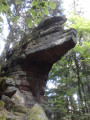
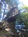
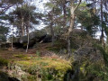
The main attraction is the Taennchel rocks and the legends surrounding them. Several information boards summarise the geological formation and the local beliefs associated with this site.

Reviews and comments

virgule
virgule

Hello,

it’s a lovely walk, one I’ve done many times before, with various variations. It’s nicer during the week as the Taennchel gets very busy.

Once you reach Saxermatt (2), if you’re feeling a bit thirsty, you can make a detour to the Club Vosgien refuge at Schelmenkopf. You’re always made to feel welcome there; it’s a lovely spot. It’s open every day in summer and at weekends in the shoulder season. It’s best suited to those doing the route in the opposite direction, as it’ll be towards the end of their walk.

Machine-translated

Other walks in the area

For more walks, use our search engine .

The GPS track and description are the property of this route's author. Please do not copy them without permission.