Country:

 City:
City:


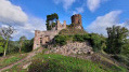
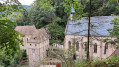
The starting point is on Rue du 3 Décembre in Ribeauvillé. Generally, park near number 92, where there are a few parking spaces available. If necessary, you can park a little before this point or further on, on Route de Sainte-Marie-aux-Mines, on the left.
(S/E) Head north along Rue du 3 Décembre.
(1) Turn right onto Route de Sainte-Marie-aux-Mines. You’ll arrive at Place de la République, then turn left onto Passage Jeanelle.
(2) Turn left onto the GR®5, marked with a Red Rectangle.
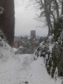
(3) At the junction, follow the red/white/red Red Rectangle markings to the right. About 100 metres further on, turn left to begin the very steep climb up to Girsberg Castle.
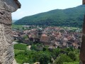
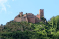
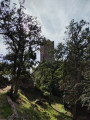
(4) Visit the castle, which offers a superb view, then continue on to Saint-Ulrich Castle. Explore this castle (you can climb the tower).
(5) Cross the forest track, then take the very steep climb towards Haut-Ribeaupierre, following the Red Rectangle markings.
(6) At Haut-Ribeaupierre, after your visit, continue along the path marked with a Red Rectangle.
(7) At the crossroads, carry on straight ahead, following the Red Rectangle/White Rectangle/Red Rectangle markings.
(8) At the junction, turn left to reach Spinplatz.
(9) At the Carrefour du Cerisier Noir, follow the path on the right marked with a Red Saltire.
(10) At the Brigadier Denny Crossroads, take the unmarked path opposite, which climbs very steeply.
(11) Take a detour to the left as far as the Rocher de la Paix d’Udine.
(12) Retrace your steps.
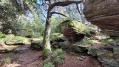
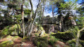
(11) Continue straight on along the Red Ring marked path. The path runs alongside the Mur Païen and passes through some remarkable rock formations.
(13) Ignore a path on the left which you will take on the way back. Carry on straight ahead and, after about 200 m, admire the view from the Rocher de Bellevue, with a panorama of Haut-Koenigsbourg. Carry on.
(14) Ignore a path on the left – you’ll take this later – and carry on straight ahead to reach the Rocher des Géants.
(15) Magnificent view. Follow the Red Disc markings to reach the Rocher des Reptiles.
(16) This rock, which is often less crowded, offers a peaceful setting with a lovely view. Continue to the junction at the Club Vosgien’s Kutzigbuech shelter.
(17) At the Kutzigbuech shelter, carry on straight ahead for a round trip, following the Yellow Rectangle markings to admire the Rocher des Trois Petites Tables and then the Rocher de l’Anneau.
(18) Retrace your steps back to the Kutzigbuech shelter.
(17) Follow the Red Ring markings to the right. Be careful, as the path can be difficult to spot, and it’s easy to end up on the Red Disc markings, which head off slightly further to the right. You’ll reach a junction you passed on the way out.
(14) Turn right and follow the path in the opposite direction to your outward journey until you reach the next fork, which you also passed on the way out.
(13) Turn right to begin the descent along a very pleasant path, following the Yellow Triangle markings, and head for the Abri du Taennchel.
(19) Then turn left, following the Red Ring markings, and return to the Carrefour du Cerisier Noir, which you passed on the way out.
(9) Carry on straight ahead and follow the path in the opposite direction to the outward journey until you reach the next junction, which you also passed on the way out.
(8) Take the path on the far right which heads deep into the forest, due south.
(20) Turn right, following the Red Triangle markings. Cross the forest track. You’ll reach the forest road.
(21) Turn left and walk past the Notre-Dame de Dusenbach Monastery.
(22) Follow the Maria Raydt Trail on the left. You’ll reach the Route de Sainte-Marie-aux-Mine (D416).
(23) Turn left onto it and continue to the roundabout.
(1) Turn right and head for the car park on Rue du 3 Décembre (S/E).


 Visorando Member
 Moderate
 Easy
Easy