Country:
 City:
City:


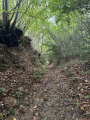
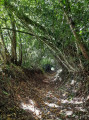
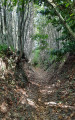
Park on Rue Abbé Giraudet, in the car park opposite the church of Saint-Hilaire-du-Bois.
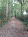
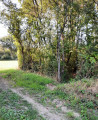
(S/E) Leave the car park by heading downhill to the left along Rue Abbé Giraudet. Turn left onto the path just after the last house, on your left. Continue, turn left onto the next path, then immediately right onto the small path that winds its way between the trees, at the edge of the woods. Continue along this path under the trees.
(1) At the T-junction, turn left to come out onto the road (D10), which you must cross to continue straight ahead, between the houses, along the path marked in yellow. You are now at a place called La Pardière. When you reach the crossroads, turn right; then, as you emerge from the woods, go up the very narrow road and continue until you reach the junction with the D10 again. Turn left and continue for about 600 metres, walking carefully along the verge. Pass the Saint John Paul II Chapel on your left.
(2) Take the stony path on the left for about 150 m; when you reach an X-shaped junction, take the left-hand path.
(3) At the three-way junction where there are numerous signposts for walking routes, take the path furthest to the left, which slopes slightly downwards and is set back from the road. Continue to the road and turn right onto it. Walk downhill and turn onto the first road on the right, towards La Grippé, La Guinelière and La Daudière. Walk up the road.
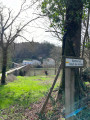
(4) At the crossroads at the top of the hill, turn left – that is, follow the yellow-marked route indicated on the EDF post, just before the bend. At the next junction, continue left along the stony path and head towards the T-junction with a tarmac road.
(5) Turn slightly left, cross over and continue along the path running between the hedge of trees and the field. Carry on to the next junction with a stony track, which you take to the left.
(6) At the top of the hill, turn right between the trees onto the grassy path. Continue to the next junction and go up to the right, then right again at the next T-junction. Follow the signposted path, ignoring the paths branching off to the left, until you reach a Y-junction at a place called Le Pont Chevrette.
(7) Keep to the right, staying on the main path, until you reach another junction.
(8) Turn left. Carry on straight ahead along the main path – the one in the middle – until you reach the road. Turn right.
(9) As you round the bend, leave the road and turn left onto the small dirt track signposted ‘Route Saint-Hilaire’. At the next junction (Croisée de la Cayenne), stay on the track and continue to the next junction, barely 100 metres further on. Turn right.
(10) Turn left onto a very narrow path at the edge of the woods.
(11) At the T-junction, turn left to leave the woods. Continue to the road (D10), which you take to the right.
(12) After about 200 metres, turn left onto a small path just next to a barbed-wire fence. Carry on along the narrow path that winds its way through the trees just before the edge of the field. Continue until you reach a small road, where you turn right. When you reach another junction with a road, cross it and carry on straight ahead to the next crossroads, which you passed on the way out.
(1) Turn left and follow the outward route in the opposite direction until you reach the car park (S/E).

 .
. Visorando Member
 Moderate
 Association / Club / Walk leader