Country:
 City:
City:





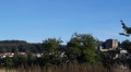
The route starts from the square in front of Puybelliard Town Hall, taking in the ‘Circuit des Venelles’ and some pretty houses, including an ancient 11th-century tower.
(S/E) From the car park, head right along Rue de l’Arguignon and continue straight on. Leave the village, cross a stream – the Arguignon – and ignore a path on the right. You’ll reach a junction with a second path on the right. You are now on theGRP® de Mélusine (marked in red and yellow).
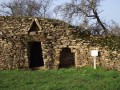
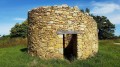
(1) Turn right onto it and follow the Arguignon stream, where vineyard huts await the winegrowers amidst the fields, though the vines have disappeared. You’ll reach a four-way junction.
(2) Continue left along the GRP®. Cross the Ruisseau de Chassais via the Pont Sénéchal to reach the crossroads in the hamlet of La Grange.
(3) Turn right, still on theGRP®, and cross the road from Saint-Mars de Prés to La Salle de l’Aubépin, then arrive at La Croisée de la Bobinière.
(4) Cross the D39 and continue straight ahead.
(5) Leave theGRP® which branches off to the right (see alternative route in Practical Information) and carry on straight ahead. Ignore the streets on the left leading to the village of Requerre, then take the road on the right.
(6) At the fork in the road, by a cross, ignore the road on the right towards La Jordronnière and carry on straight ahead on the D117.
(7) Carry on straight ahead over Lake Rochereau and continue under the railway bridge. Reach the other side of the lake and follow the lakeshore, turning right. You will reach a branch of the River Maine.
(8) Cross the footbridge and continue to the right along the lakeshore until you reach the Rochereau leisure area (beach, playground), then head towards the dam.
(9) Cross the dam and turn left at the car park (back onto theGRP®) to join the D39 and follow it to the left. After about fifty metres, you’ll reach the bridge over the Grand Lay.
(10) Turn right and continue along the road to the village of La Fambretière. At the crossroads, do not head towards La Frambretière but turn right (leaving theGRP®) onto Chemin Saint-André and head for the La Muette crossroads.
(11) Carry on to the right along Chemin Saint-André (you can visit the Muette farm brewery – enquire about tours – by taking a short detour to the left and back). This path becomes a trail and descends towards the River Grand Lay.
(12) Cross the river via the small Pignardière footbridge (caution! it is very narrow). Continue straight on across a field, or go round it to the right, to reach the end of the road leading to a house. Follow this road to cross the railway line, then turn left towards Saint-Mars des Prés. Continue along the road until you reach the wash house.
(13) Continue for another forty metres or so along the road and take the path on the right; an old windmill is visible amongst the fields to the right of the path. You’ll reach a road at a wayside cross at the entrance to the hamlet of Pissot (Puysault).
(14) Turn left onto it, then turn right into the village, walk through it and continue along the path that runs alongside the street. At the T-junction, take the path on the left.
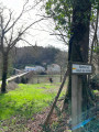
Wade across the Arquignon stream, then a little further on, pass the Croix des Martyres and join the Puybelliard road. Turn right.
(15) About fifty metres further on, turn right and, as you pass, admire the Manoir de Ponsay on your right.
Further on, the road bends to the right. Ignore the footpaths and continue along the road to Puybelliard. Once you reach Rue de l’Arquignon, turn left to return to the car park where you started (S/E).





 Visorando Member

 Easy
Easy 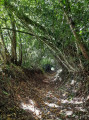
 Tourist office