Country:

 City:
City:


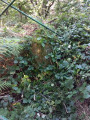
The starting point for this walk is in the car park in front of the Ola cider house in Irun.
To get to this starting point by car, see the ‘Practical Information’ section below.
(S/E) From the car park, head back towards the entrance and cross the bridge on the left. Continue walking, preferably on the left-hand side of the road, taking care until you reach the first path (a concrete path) on the left, which you should take. You’ll come to a Fork in the road.
(1) Take the middle dirt track. Follow the stream, then you’ll come to a wider track.
(2) Leave the previous track and take the one on the right. It’s a lovely track through the woods that runs alongside the river. Pass the ruins and join a wide track.
(3) Take this path, turning right, until you reach the tarmac road.
(4) Follow this road, keeping to the right. Pass a fountain (water not suitable for drinking) and continue until you reach a Fork in the road.
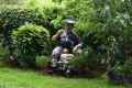
(5) When you reach the crossroads, start by heading towards the garden on the left, where there are two very large trees, to admire the large statue of a man sitting and smoking his pipe. Then head right towards the house and the sign indicating one of the entrances to the Aiako Harria Nature Park. You’ll come to a junction.
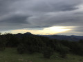
(6) Change direction completely and take the path on the right (almost behind you). A steep climb leads to a clearing with a lovely view of the summit of the Three Crowns. Continue to the right.
(7) Take the path on the right, which then curves gently to the left until you reach a junction.
(8) Leave this path by turning left to join another path. You’ll reach the summit of Atseginarri at an altitude of 392 m, which lies at the foot of a pidgeon hunting hut, right in the centre. It’s marked by an upright stone which, depending on the season, may be hidden by brambles and ferns.
(9) Begin the tricky descent on the other side, as the path is quite steep. After a while, you’ll join the main track at a yellow gas pipe marker post. A gas pipeline runs straight along this path. It is, of course, possible to continue the (rather steep) descent straight ahead, following this pipeline and the yellow posts.
(10) Alternatively, opt for the small paths through the forest. Head towards the two upright posts on the left and take the small ‘hidden’ path behind them. The descent is a bit steep (take care) but the route runs through the heart of the forest. Further down, join the wide path with the gas posts.
(11) Pass the first post with the ‘no cycling’ sign. When you reach the second post with the ‘no cycling’ sign, take the small path hidden behind it. This time it’s a very pleasant path that descends gently. At one point, it passes behind some ruins. It emerges near a road at a bend.
(12) Immediately take the wide path on the right. This is the “Camino de los tuberculosos”. You’ll pass a fountain (water not fit for drinking) and come out onto the path you took on the way there, at the house with the man sitting there smoking his pipe.
(5) Then take the same path back, heading left. Carry on to the Fork in the road.
(4) Head down to the left and carry on to the next fork.
(3) To avoid the detour along the stream, carry on straight ahead along the path. Continue to the next Fork in the road, where you’ll cross the path you took on the way out.
(2) Then follow the path you took on the way out to return to the car park (S/E).

 Association / Club / Walk leader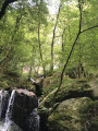

 Visorando Member
 Easy
Easy