Chemin des Croix d’Availles

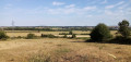
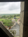
Start with some superb views over the Vienne Valley, continue past a few wayside crosses and 15th- and 18th-century castles, making sure to take a detour to see Chitré Castle, and finish the route by passing the famous “Lépine” oil mill and its press.
A picnic area awaits you in the hamlet of Prinçay.

Details

3149247
Creation:
Last update:
Last review:
  • Walking
    Activity: Walking
  • ↔
    Distance: 7.50 mi
  • ◔
    Average duration: 3h 50 
  • ▲
    Difficulty: Moderate

  • ⚐
    Back to start: Yes
  • ↗
    Ascent: + 400 ft
  • ↘
    Descent: - 400 ft

  • ▲
    Highest point: 440 ft
  • ▼
    Lowest point: 197 ft

Description of the walk

Park at Place du 19 Mars next to the football ground.

(S/E) Head towards La Poste and make your way to the roundabout on the right. Take Rue Treuille towards Châtellerault, then turn left at the next junction into the Grands Pas housing estate. Turn left again into Rue des Pinsons, then into Rue des Alouettes until you reach the Stop sign. Turn right towards a beautiful house and continue to the Maconnay roundabout.

(1) Before continuing along the route, head slightly to the right to admire the view over the Vienne valley and discover the ‘Le Pigeonnier du Perron’ quiet spot. Retrace your steps and turn left onto Rue du Rabaté until you reach the cross. Turn right (be careful, it’s a hairpin bend) onto Impasse du Chapitre, first on the road and then on a track, passing a small wood and fields until you reach a crossroads just before the departmental road.

(2) Turn left, pass a pond and a beautiful house, then turn right onto Rue des Marchais until you reach the main road.

(3) Cross the D749 (take care – there is frequent traffic) and turn left after a few metres. Follow it for 500 m and turn left at the next junction to cross the departmental road again, taking care as always.

(4) Carry on straight ahead and walk alongside the Château de la Cataudière for 500 m, pass the hamlet of La Bergeronnerie and continue straight on to the caves.

(5) At the junction, turn right onto the tree-lined path until you reach the road, then turn left into Rue de la Palarderie and carry on straight ahead. Pass the quarry and turn left at the sign for Chagon. Take the path between a house and its garden and carry on straight ahead until you reach a junction (with a view of Château de Chitré on the right).

(6) Turn left, pass through the hamlet of Les Bruyères and carry on straight on to the village of Prinçay.

(7) Turn right past the former vicarage, go downhill and turn right, passing the cemetery. Continue straight on to the end of the path.

(8) Turn right, then left onto a stony track until you reach the Croix Fleurioux.

(9) Turn left and continue along this path until you reach the road. Turn right and walk alongside the road.

(10) At the three-way junction, take the path that runs alongside the stone wall of the Château de la Doubtière and, at the second junction, turn left until you reach the road.

(11) Turn left onto the road, leave the boundary wall behind you, walk past the detached houses and turn right onto Allée du Bas Chabonne. At the bend, take the grassy path until you reach the next junction.

(12) Turn right at the crossroads, follow the path to the road and turn left into Rue de l’Huilerie, then right into Rue du Pressoir, then right again into Rue du Poitou.

(13) Turn right into Rue d’Aunis, then at the cross, turn left into Rue du Limousin. You’ll find yourself back at the church square. Turn right at the post office to return to the stadium car park (S/E).

Waypoints

  1. S/E : mi 0 - alt. 243 ft - Place du 19 Mars, next to the football ground
  2. 1 : mi 0.67 - alt. 289 ft - Perron Dovecote
  3. 2 : mi 1.44 - alt. 223 ft - Les Plantis
  4. 3 : mi 1.99 - alt. 200 ft - D749 road
  5. 4 : mi 2.42 - alt. 207 ft - Crossing the D749
  6. 5 : mi 2.86 - alt. 315 ft - Caves
  7. 6 : mi 3.6 - alt. 413 ft - Crossroads – View of the - Château de Chitré
  8. 7 : mi 4.07 - alt. 328 ft - Prinçay
  9. 8 : mi 4.32 - alt. 371 ft - Path
  10. 9 : mi 4.65 - alt. 436 ft - Croix Fleuriot
  11. 10 : mi 5.14 - alt. 328 ft - Three-way junction
  12. 11 : mi 5.91 - alt. 351 ft - Chabonne
  13. 12 : mi 6.29 - alt. 318 ft - Crossroads
  14. 13 : mi 7.05 - alt. 262 ft - Rue d’Aunis
  15. S/E : mi 7.5 - alt. 243 ft - Place du 19 Mars, next to the football ground

Notes

-Bakery
-Accommodation

Worth a visit

A beautiful mansion with a small bell tower.
View over the Vienne valley.
View of the Moulière Forest.
La Cataudière Castle.
Chitré Mill.
Saint-Madeleine Chapel.
The village of Prinçay.
The village of Le Plessis.

Reviews and comments

4.2 / 5
Based on 4 reviews

Reliability of the description
4.3 / 5
Ease of following the route
4.3 / 5
Route interest
4 / 5
User 16521404

Overall rating : 5 / 5

Date of your route : Jan 28, 2026
Reliability of the description : ★★★★★ Very good
Ease of following the route : ★★★★★ Very good
Route interest : ★★★★★ Very good
Very busy route : Yes

Very pretty route, slightly difficult in wet weather (steep slope in the woods, a bit slippery)
A lovely way to discover the village's heritage
However, crossing the RD749 twice adds nothing special and is impractical when leading a group of more than 20 people. When I tested it, there were only three of us and we had difficulty crossing because of the traffic.
With the group, we prefer to take the road that leads to the Château de la Cataudière and then head back towards La Bergeronnerie to rejoin the route. This doesn't change the final mileage much.

Machine-translated

Martine TRANCHANT
Martine TRANCHANT

Overall rating : 4.7 / 5

Date of your route : Feb 03, 2026
Reliability of the description : ★★★★★ Very good
Ease of following the route : ★★★★★ Very good
Route interest : ★★★★☆ Good
Very busy route : Yes

Very well marked route.
A small section (less than 1 km) can be omitted when you have to cross the main road and then cross it again after
walking along a field, as it is of no interest.

Machine-translated

Grand Châtellerault
Grand Châtellerault

Thank you for your comment, which certainly highlights this point.
Every year, the 62 walking routes in the Grand Châtellerault urban area are reviewed annually by our teams, both in terms of path maintenance and the yellow signposting.
We will contact the teams to ensure that maintenance (mowing) of the route is carried out as soon as possible.
As for the markings, please do not hesitate to let us know the specific locations where you encountered problems so that we can take action. A map showing the identified points will enable us to respond more quickly.

Machine-translated

Alain MOREAU
Alain MOREAU

Overall rating : 2 / 5

Date of your route : Apr 27, 2023
Reliability of the description : ★★☆☆☆ Disappointing
Ease of following the route : ★★☆☆☆ Disappointing
Route interest : ★★☆☆☆ Disappointing
Very busy route : No

poorly signposted route, poorly maintained paths (tall grass)
You end up passing right by some lovely spots without getting anywhere near them. Don’t hesitate to take a detour.
So it’s not particularly interesting, but the woods are pleasant.

Machine-translated

Grand Châtellerault
Grand Châtellerault

Thank you for your comment. The Grand Châtellerault urban area is particularly keen to promote its walking trails. We look forward to welcoming you back.

Machine-translated

AURUS
AURUS

Overall rating : 5 / 5

Date of your route : Feb 06, 2023
Reliability of the description : ★★★★★ Very good
Ease of following the route : ★★★★★ Very good
Route interest : ★★★★★ Very good
Very busy route : No

A wonderful walk with lovely paths and superb views....

Machine-translated

Other walks in the area

For more walks, use our search engine .

The GPS track and description are the property of this route's author. Please do not copy them without permission.