Country:

 City:


Start opposite the former Margnès town hall, in Lagrange.
(S/E) Follow the road that passes above the former town hall. At the second bridge over the Ruisseau du Falcou, follow the gravel and cobbled track that climbs to the right up to La Bartassade.
(1) Continue to the left, pass underneath the farm buildings, take the stony track to the right (as if heading towards the large building) and climb to the left along the forest track. You’ll reach an S-bend. After this bend, the path leads into the woods. At the first junction, turn right.
(2) Ignore a path on the left and carry on through the Margnès communal woodland. A lovely view. You’ll reach a four-way crossroads.
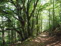
(3) Turn left. In the middle of the woods, you can see the work of generations past: low walls marking the boundaries of plots that were once cultivated, and the ruins of a barn. Cross the bridge and turn right into the hamlet of Lassouts, then head out again to the right.
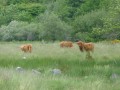
(4) After leaving the hamlet, take a path on the left lined with walls and holly hedges. The path opens out onto flower-filled meadows that undulate in the spring breeze.A beautiful view. The path leads back into the woods. Stay on the main track until you reach the road (Croix de Caillé).
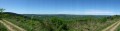
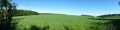
(5) Take the track opposite (slightly to the left) which climbs through open countryside. A magnificent panorama unfolds, with meadows in the foreground covered in broom, gorse and various flowers, and the sanha (peat bog); in the background, the surrounding mountains and, in the distance, the Montagne Noire with the Pic de Nore. Continue to the end of the meadows.
(6) Take the track that climbs to the left at the edge of the woodland. Continue to the right, entering the pine forest. At the summit of the Puech du Singladou (the highest point in the commune), there is another viewpoint. On a clear day, you can see Albi Cathedral. You’ll come to a crossroads.
(7) Take the track on the right, then turn right three more times, followed by a left, and continue to the road.
(8) Continue left towards the hamlet of Cros. Walk through the village and past the magnificent ruin that once served as a barn and stable. Cross the stream and follow the track to the Sigarède farm.
(9) Walk down the road to the Fork in the road.
(10) Turn right towards Cauquil.
(11) Just past the ruins of Cauquil, take the forest track on the left, cross a stream and pass beneath the ruins of Cap de Cabre. At the junction, turn right to re-enter the forest and continue to the road.
(12) Continue to the left, then veer right and head towards La Jasse. Take the small path on the left before the house at the bottom. Pass underneath it and join a track lined with low walls that descends to Lagrange. Cross the bridge and enter the hamlet (S/E).

 Visorando Member


 Tourist office