Le Puech dels Carboniès

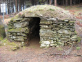
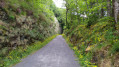
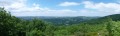
In the Berlou region, the local woodland once provided charcoal for the villages, hamlets and farms of a land of livestock and crops. Today, on the Puech dels Carboniès, the shepherds’ huts bear witness to this history, set amongst conifer plantations…

Details

72943226
Creation:
Last update:
Last review:
  • Walking
    Activity: Walking
  • ↔
    Distance: 7.35 mi
  • ◔
    Average duration: 4h 35 
  • ▲
    Difficulty: Moderate

  • ⚐
    Back to start: Yes
  • ↗
    Ascent: + 1,375 ft
  • ↘
    Descent: - 1,365 ft

  • ▲
    Highest point: 2,674 ft
  • ▼
    Lowest point: 1,886 ft

Photos

Description of the walk

(S/E) Opposite the war memorial in Berlats, turn right onto the D154 towards La Béguinié.

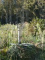
(1) In front of La Béguinié, turn left. When you reach the castle, turn right, then carry on straight ahead. At the three-way junction, turn left (junction with the GR® de Pays des Monts et Lacs in Haut-Languedoc – between Gijou and Raviège). Carry on until you reach the cross.

(2) Carry on straight ahead. On the road, turn left, then left again and continue to a small road.

(3) Turn right; further on, cross a second, wider road, and carry on straight ahead. At the junction, turn left and carry on straight ahead to reach the entrance to Les Saussonnières.

(4) Turn left twice onto the road (GR® de Pays marked in red and yellow). Facing the Étang, turn right, then take the second path on the left. Continue along the sunken lane. Pass through Nel until you reach the road.

(5) On the road, turn right. At the corner of a shed, turn left. Take the path immediately on the right and follow it down to La Vitarelle.

(6) Leave the GR® de Pays on your left. Turn right towards the mill. First turn left then right, and carry on straight on towards the D154. Turn left. Cross the bridge. Immediately afterwards, turn right. At the top of the hill, carry on straight ahead. At the Barde three-way junction, carry on straight ahead. At the T-junction, go straight on towards Calmels.

(7) At the entrance to Calmels, go round the first buildings on the right. Take the first street on the right, then turn right. Then carry on straight ahead. On leaving the village, take the road on the left towards Julié.

(8) At the top of the hill before Julié, turn left twice. Take the first left-hand bend, then the second right-hand bend. After that, carry on straight ahead to the top of the hill towards the junction in front of La Soulière.

(9) Turn left. Enter the Berlats communal forest via the track on the left. Continue straight on (returning to the GR® de Pays des Monts et Lacs en Haut-Languedoc – between Gijou and Raviège). On the right: an alternative route via the other side of the Puech Carboniès.
At the three-way junction, head down to the left until you reach a bend as you leave the forest.

(10) Carry on straight ahead. At the junction, go straight ahead again. Head down to Berlats (S/E).

Waypoints

  1. S/E : mi 0 - alt. 1,942 ft - War memorial
  2. 1 : mi 0.18 - alt. 1,962 ft - La Béguinié
  3. 2 : mi 0.65 - alt. 2,195 ft - Cross
  4. 3 : mi 1.52 - alt. 2,169 ft - Short route
  5. 4 : mi 2.02 - alt. 2,011 ft - Saussonnières
  6. 5 : mi 2.42 - alt. 2,178 ft - Nel and road
  7. 6 : mi 2.86 - alt. 1,916 ft - La Vitarelle
  8. 7 : mi 4.37 - alt. 2,123 ft - Calmels
  9. 8 : mi 4.8 - alt. 2,277 ft - Julié
  10. 9 : mi 5.25 - alt. 2,526 ft - Junction towards La Soulière
  11. 10 : mi 6.02 - alt. 2,621 ft - Bend on leaving the forest
  12. S/E : mi 7.35 - alt. 1,942 ft - War memorial

Notes

Start: at the war memorial, Berlats

Finish: same place as the start

Towns: Berlats, Fontrieu

Road access and parking: Berlats , 35 km north-east of Castres and 12 km from Brassac via the D 622 and D 154.

Parking: War MemorialSquare , near the town hall

Worth a visit

It is known as a ‘mazet’ in the wine-growing Languedoc, a ‘drystone shelter’ in the Mediterranean Languedoc… In the mountains of Haut-Languedoc, it is called a ‘jasse’: a drystone shelter, still being built in pastoral areas at the start of the 20th century. Shepherds built it using the corbelled vault or load-bearing roof principle.“This is the ‘false vault’ technique, whereby the stones are not set against one another in a radial pattern but laid in courses, with the upper course projecting over the lower one.”(J.-L. Massot). A complex construction technique: the cantilevered structure allows the stones to join together to form a self-supporting vault, with the upper slabs serving solely to ensure watertightness. A task that must be executed flawlessly.

-Villages and hamlets

Always be cautious and plan ahead when you're outdoors. Visorando and the author of this route cannot be held responsible for any accidents occurring on this route.

The GR® and PR® markings are the intellectual property of the Fédération Française de Randonnée Pédestre.

Reviews and comments

4.5 / 5
Based on 2 reviews

Reliability of the description
4.5 / 5
Ease of following the route
4.5 / 5
Route interest
4.5 / 5
Aigle noir
Aigle noir

Overall rating : 4 / 5

Date of your route : Nov 10, 2025
Reliability of the description : ★★★★☆ Good
Ease of following the route : ★★★★☆ Good
Route interest : ★★★★☆ Good
Very busy route : No

Well-marked trail, pleasant walk through small hamlets, beautiful views of the rolling countryside, no difficulty following the trail.

Machine-translated

isa81360
isa81360

Overall rating : 5 / 5

Date of your route : Nov 09, 2025
Reliability of the description : ★★★★★ Very good
Ease of following the route : ★★★★★ Very good
Route interest : ★★★★★ Very good
Very busy route : No

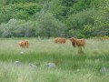
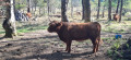
A lovely, easy hike, a stroll from hamlet to hamlet, through green meadows, past cows and along wooded paths. At the end of the trail, on the slopes of Puech Carboniés, you can admire three well-preserved sheepfolds by the side of the path, one of which was restored in 1984. These are the last remaining traces of pastoral life in the last century.
Highly recommended +++

Machine-translated

Other walks in the area

For more walks, use our search engine .

The GPS track and description are the property of this route's author. Please do not copy them without permission.