The Masnau trail

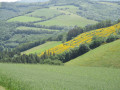
At the headwaters of the Dadou, the rugged terrain of the plateau vies with the forested gorges of the river and its tributaries; as the locals say, ‘Lo rec manjo la plano’ (the stream eats away at the plateau).

Details

72948341
Creation:
Last update:
Last review:
  • Walking
    Activity: Walking
  • ↔
    Distance: 10.98 mi
  • ◔
    Average duration: 6h 20 
  • ▲
    Difficulty: Difficult

  • ⚐
    Back to start: Yes
  • ↗
    Ascent: + 1,496 ft
  • ↘
    Descent: - 1,493 ft

  • ▲
    Highest point: 2,690 ft
  • ▼
    Lowest point: 1,713 ft

Photos

Description of the walk

(S/E) From the village hall car park (D82, towards Montfranc), head for the path opposite the road access. At the three-way junction, turn right to reach a crossroads. 

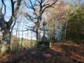
(1) Turn left. At the three-way junction by the wayside cross, go straight on. You’ll reach another three-way junction.

(2) Head left. At the bottom of the descent, keep left and pass the reservoir. After crossing the stream, leave the track and take a path on the left. At the road (caution: junction of routes), also turn left towards Font Leval.

(3) Carry on straight ahead, then turn left onto the road. At the Gaillardac three-way junction, keep left to reach the bridge over the Dadou.

(4) Carry on straight ahead. At the three-way junction below Muratel, turn right towards Montfranc (caution: junction of routes). At the sign saying ‘bend in 3,000 m’, take the steep path up to the left. rejoin the road on the left. Pass through Massuguiès until you reach the start of a left-hand bend.

(5) Take the hairpin bend to the left. At the junction, take the road opposite. Pass through Lartigue. On leaving the village, head down the path on the left. Further on, turn left onto the track. Continue straight down to the junction of two tracks.

(6) Head down the hairpin bend to the left. Pass through Le Soulié. At the road, turn right and follow the tarmac road to the three-way junction below Saint-Michel-de-Léon.

(7) Leave the road and take the path on the left towards ‘Saut de la Truite’ (waterfall). Climb the steep slope. At the tarmac road, turn left. At the three-way junction, take the grassy path on the left. Cross the stream. At the first three-way junction on the track, take the hairpin bend to the left. At the second junction, head up to the right. At the third three-way junction, in a bend, turn right. On the ridge, carry on straight ahead until you reach a sports ground.

(8) Walk along the right-hand side of the stadium. At the bend facing the edge of the woods, turn right along the edge of the woods and continue to the D82.

(9) Turn right, cross the ditch to take the grassy path in front of the transformer. At the track, continue straight ahead. At the junction, head down to the right onto the path running alongside the holly bushes. Continue straight ahead. Cross the road and follow it back up towards Masnau (S/E).


Waypoints

  1. S/E : mi 0 - alt. 2,530 ft - Village hall car park
  2. 1 : mi 0.5 - alt. 2,687 ft - Crossroads
  3. 2 : mi 1.14 - alt. 2,451 ft - Three-way junction
  4. 3 : mi 2.5 - alt. 1,962 ft - Font Leval - Dadou (rivière)
  5. 4 : mi 3.37 - alt. 1,913 ft - Bridge over the - Dadou (rivière)
  6. 5 : mi 4.68 - alt. 2,310 ft - At the start of a left-hand bend
  7. 6 : mi 6.6 - alt. 1,860 ft - Crossroads and hairpin bend to the left
  8. 7 : mi 7.82 - alt. 1,722 ft - Fork in the road below Saint-Michel-de-Léon - Dadou (rivière)
  9. 8 : mi 9.66 - alt. 2,362 ft - Stadium
  10. 9 : mi 10.12 - alt. 2,431 ft - D 82
  11. S/E : mi 10.98 - alt. 2,530 ft - Village hall car park

Notes

Start: Villagehall

Finish: same place as the start

Towns: Le Masnau-Massuguiès, Saint-Salvi-de-Carcavès, Lacaze

Road access and parking: Le Masnau-Massuguiès, 23 km north-west of Lacaune via the D 622, D 607 and D 89.

Parking: Villagehall (at the exit from Le Masnau, towards Montfranc)

Worth a visit

A doctor practising in the mountains during the 19th century, Dr Rascol describes the agricultural practices of his early days, when the land was ploughed with a wooden-shod plough:‘This plough(...) turns over a thin layer of soil and cannot lift the turf, which is dealt with by burning. This labourious and costly work has the advantage of ridding the soil of weed seeds and providing ash that is favourable to plant growth. On land that has been ploughed several times or simply burnt, manure or ash is spread, followed by rye. The following year, it is the turn of oats, after which the fields are left fallow for seven to eight years. Soon, the potato takes precedence over oats in the crop rotation, which becomes a three-year cycle ’. Different times, different difficulties...

Accommodation (Le Soulié)

Reviews and comments

4.3 / 5
Based on 2 reviews

Reliability of the description
4.5 / 5
Ease of following the route
4.5 / 5
Route interest
4 / 5
OT Sidobre & vallées
• Edited:

Thank you for your feedback! After point 4, stay on the small road that passes under the hamlet of Muratel before rejoining the road that climbs up to cross the small stream. You can then cut left to avoid taking too much of the road. We will check the GPX track to make sure it matches the route.
We are at your disposal for other ideas for walks in Sidobre & Vallées.

Machine-translated

ha-thai81
ha-thai81
• Edited:

Overall rating : 4.3 / 5

Date of your route : Jul 14, 2025
Reliability of the description : ★★★★☆ Good
Ease of following the route : ★★★★☆ Good
Route interest : ★★★★★ Very good
Very busy route : No

We encountered a problem after point 4: the exit on the left into the field crossing the water does not exist. The exit is a little further on after the logging area. So do not follow the GPS and continue on the road until you see the signpost that directs you to turn left.
Otherwise, it was a very nice hike. We are two 71-year-old hikers with a dog and did not find this hike difficult. There was a bit of road walking, but no cars.
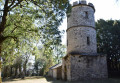
we were able to have a picnic at Massuguiez Castle, which was open to the public.
Thanks to the tourist office.

Machine-translated

marc24
marc24

Overall rating : 4.3 / 5

Date of your route : Jun 28, 2025
Reliability of the description : ★★★★★ Very good
Ease of following the route : ★★★★★ Very good
Route interest : ★★★☆☆ Average
Very busy route : No

Hello everyone, I’ve just done it and, well… a quarter of the route is on tarmac, which isn’t great for me… the signposting is spot on and the woodland sections are lovely… but I wouldn’t recommend it…

Machine-translated

Other walks in the area

For more walks, use our search engine .

The GPS track and description are the property of this route's author. Please do not copy them without permission.