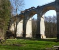
The Esley Old Ponds Trail

A pleasant, easy short route through the woods, taking you past two old ponds, an ancient Gallo-Roman quarry and an old ‘Borne de France’ marker. Much of the route runs through woodland along winding little paths, with the final two kilometres following a stone path and a tarmac road. The trail is well signposted: follow the small signs featuring a Yellow Circle. Halfway along the route, you’ll find a picnic area with tables and a small hut where you can take a break by the Étang des Limaçons.

Details

n°37560177
Creation:
Last update:
Last review:
  • Walking
    Activity: Walking
  • ↔
    Distance: 4.18 mi
  • ◔
    Average duration: 2h 00 
  • ▲
    Difficulty: Easy

  • ⚐
    Back to start: Yes
  • ↗
    Ascent: + 89 ft
  • ↘
    Descent: - 89 ft

  • ▲
    Highest point: 1,227 ft
  • ▼
    Lowest point: 1,138 ft
  • ⚐ Country: France
  • ⚐ City: Esley (88260)
  • ⚑
    Start/End: N 48.162583° / E 6.053812°
  • ❏
    IGN map(s): Ref. 3318SB
  • Hour-by-hour weather

Photos

Description of the walk

Head to the Esley stadium car park.

(S/E) Take the road towards Esley. After 80 metres, turn left towards Thuilières. Follow the roadside for 300 metres and enter the woods on your left.

(1) Walk for about 1 km until you reach the first pond.

(2) Continue along the path for about 1.5 km until you reach the stony track.

(3) Walk for 300 metres, turn onto the woodland path, keep to the right and then turn left towards a small wooden jetty.

.(4) You will then reach the second pond, the Étang des Limaçons; walk along its left-hand side, following the path and the signposts. Carry on until you reach the old Queveney quarry.

(5) Then continue along the path (be careful, it’s a bit marshy), which will take you to the other side of the pond and on to the picnic area.

(6) Then head back towards the forest track and turn right towards La Borne de France.

(7) Then turn back towards the forest track and carry on to the right, retracing the 300 m of the path you took on the way there.

(3) Turn right onto the stony path heading due north. Pass to the right of the first pond, then the sports ground, and arrive at the stadium car park (S/E).

Waypoints

  1. S/E : mi 0 - alt. 1,227 ft - Stadium car park in Esley
  2. 1 : mi 0.26 - alt. 1,214 ft - Entrance to the woods
  3. 2 : mi 0.72 - alt. 1,194 ft - First pond
  4. 3 : mi 1.63 - alt. 1,161 ft - Crossroads at the end of the circular loop
  5. 4 : mi 1.76 - alt. 1,142 ft - Wooden jetty leading to the Étang des Limaçons
  6. 5 : mi 2.19 - alt. 1,165 ft - l'ancienne carrière de Queveney
  7. 6 : mi 2.61 - alt. 1,155 ft - Étang des Limaçons picnic area
  8. 7 : mi 2.72 - alt. 1,138 ft - Borne de France
  9. S/E : mi 4.18 - alt. 1,227 ft - Stadium car park in Esley

Notes

You can take shelter and have a break at the Étang des Limaçons (a rest area with a shelter and picnic tables).

Worth a visit

Along the route, you’ll see old stone boundary markers, an ancient Gallo-Roman quarry and an old ‘Borne de France’ marker, all of which trace the region’s history.

Reviews and comments

4.7 / 5
Based on 1 review

Reliability of the description
5 / 5
Ease of following the route
5 / 5
Route interest
4 / 5
Ulysse68
Ulysse68

Overall rating : 4.7 / 5

Date of your route : Sep 14, 2026
Reliability of the description : ★★★★★ Very good
Ease of following the route : ★★★★★ Very good
Route interest : ★★★★☆ Good
Very busy route : Yes

An easy, pleasant, well-shaded walk

Machine-translated

Other walks in the area

For more walks, use our search engine .

The GPS track and description are the property of this route's author. Please do not copy them without permission.