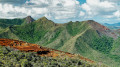
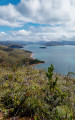
Ridges of Cap N’Dua, on the Sentier de l’Aiguillon

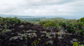
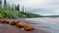
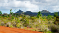
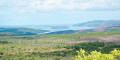
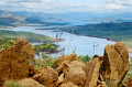
A beautiful path situated just before the entrance to the Cap N’Dua Nature Reserve. It offers a 360° view as you climb, taking in the sea, the islets and Cap N’Dua to the south, Île d’Ouen to the west, and Prony Bay to the north.

Details

103945226
Creation:
Last update:
Last review:
  • Walking
    Activity: Walking
  • ↔
    Distance: 3.48 mi
  • ◔
    Average duration: 2h 00 
  • ▲
    Difficulty: Moderate

  • ⚐
    Back to start: Yes
  • ↗
    Ascent: + 509 ft
  • ↘
    Descent: - 509 ft

  • ▲
    Highest point: 669 ft
  • ▼
    Lowest point: 289 ft

Photos

Description of the walk

Park at the GPS coordinate; this is the first viewpoint marked by a sign that you’ll come across on the main road to Le Cap.

(S/E) Return along the track you came up by car; after about a hundred metres, you’ll reach a white gate on your left.

(1) Do not take the clearly visible path that goes through the barrier; the trail is less obvious and is on the left, before the barrier. This is the Sentier crête de l’Aiguillon; follow this old track, which is no longer maintained but is quite wide. Continue to the end of this track.

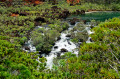
(2) Be careful here: navigation is more difficult; using a GPS track is strongly recommended as the path disappears into the scrub. You can walk more or less anywhere amongst the plants, but at times it is quite difficult to follow the path precisely. So, if in doubt, follow the GPS closely. Cross a stretch of black rocks, which contrasts with the red earth you usually walk on in this area. Reach the first panoramic viewpoint.

(3) You will now come to a clearly visible path marked with white paint on the ground. Reach the foot of the ridge, then climb as the terrain dictates – there are no further white markings on the ascent – to reach another viewpoint.

(4) Follow this route back in the opposite direction to the car park (S/E).

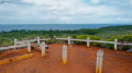
(S/E) Continue straight ahead, north-east, and take a round trip to reach another viewpoint, complete with an orientation table.

(5) Return to the car park (S/E).

Waypoints

  1. S/E : mi 0 - alt. 325 ft - Car park, viewpoint sign
  2. 1 : mi 0.07 - alt. 322 ft - Barrier
  3. 2 : mi 0.66 - alt. 463 ft - End of the trail
  4. 3 : mi 1 - alt. 600 ft - First panoramic view
  5. 4 : mi 1.63 - alt. 640 ft - Second panoramic view
  6. 5 : mi 3.37 - alt. 371 ft - Panoramic view with orientation table
  7. S/E : mi 3.48 - alt. 325 ft - Car park, viewpoint sign

Notes

Please note: the southern route is in very poor condition and involves crossing several small fords; a 4x4 is advisable. It can be done in a city car, but should be avoided in wet weather.
There is no water or shade along the route, so make sure you come well prepared.
Between (2) and (3): the trail isn’t too physically demanding, but finding your way can be tricky on this section; a GPS is recommended.
(4) Final view: it is theoretically possible to continue along the Sentier de l’Aiguillon to climb even further up the ridges, but from this point onwards the path disappears completely into the scrub due to a lack of maintenance and is frankly not pleasant to follow; this is why we decided to cut the walk short at this point.

Worth a visit

Cap N’dua, its vegetation, its lighthouse, its scrubland, Île d’Ouen and Prony Bay, and of course the sea stretching along the entire southern coastline.

Other walks in the area

For more walks, use our search engine .

The GPS track and description are the property of this route's author. Please do not copy them without permission.