Country:
 City:
City:





Take the southern road from Nouméa, then, after the Col de Prony, turn right onto the track leading to the Mont Mau wind turbines. Park at the side of the road at the GPS coordinate, just before a steep climb where the track becomes impassable without a 4x4.
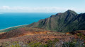
(S/E) Walk up the slope heading south, then take the first track on the right: at this point there is already a magnificent first viewpoint over the Woodin Channel and Ouen Island. Just past this viewpoint, you will see a slope on your right; the next track lies above this slope, which you will need to climb, though it is not particularly difficult.
(1) At this point, a section of the road has collapsed, forming a small canyon approximately 2 metres high and 6 to 7 metres wide. You must cross this canyon by carefully descending from the right; natural steps can be found at the shallowest part. Then follow the bottom of the canyon to climb back up the opposite side via natural steps formed by a pile of rocks. Take great care not to slip on the descent; this is the only difficult part of the route. Then follow the only possible track to a junction: it is easy to spot.
(2) Take the track on the left to go round a small rise.
(3) At this point, the track fades away slightly and there are metal posts on the left. To find the track again, do not head towards these posts, but go just a little further to the left. The track becomes wide and clearly marked again before heading into a short stretch of scrubland where it winds its way through a few dense trees and bushes. You’ll come to another junction.
(4) Take the track that climbs to the left in a hairpin bend. Then follow the natural curve of Mont Mau through the mining scrub: there is no clearly defined path, but the terrain is easily passable. Reach the summit and its magnificent 360° panorama.
(5) Turn back.
(3) This time, take the track that heads off along the ridges to the left. This section is straightforward: the track is wide, there are no navigation difficulties and no side paths – simply enjoy the magnificent 360° view, right up to the panorama of Pic la.
(6) Turn back.
(3) Continue straight ahead to shorten the route.
(1) Cross back through the small canyon, taking the same precautions, and follow the outward route to return to the car park (S/E).
 Visorando Member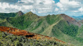




 Easy
Easy