The Francesca Circular Route

A lovely circular walk starting from Vezzani, one of Corsica’s most beautiful villages.
After an initial downhill section on the D343 to warm up, the walk really gets going past the stadium, becoming very demanding and difficult.
A shaded, unmarked route to the Col de Foce, followed by very easy-to-walk forest tracks.
This second section remains very easy and pleasant through the forest.
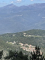
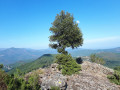
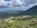
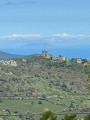
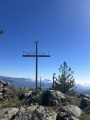
The views are to die for!

Details

n°1324274
Creation:
Last update:
Last review:
  • Walking
    Activity: Walking
  • ↔
    Distance: 8.61 mi
  • ◔
    Average duration: 5h 30 
  • ▲
    Difficulty: Difficult

  • ⚐
    Back to start: Yes
  • ↗
    Ascent: + 1,765 ft
  • ↘
    Descent: - 1,732 ft

  • ▲
    Highest point: 4,088 ft
  • ▼
    Lowest point: 2,336 ft
  • ⚐ Country: France
  • ⚐ City: Vezzani (20242)
  • ⚑
    Start/End: N 42.172938° / E 9.246492°
  • ❏
    IGN map(s): Ref. 4351OT, 4352OT
  • Hour-by-hour weather

Photos

Description of the walk

Park near Vezzani Church.

(S/E) Walk through the village to the children’s playground, then head towards the D343.
Turn left onto the D343, heading downhill.
Further on, join the track leading to the Joseph Chiarelli stadium.

(1) Turn right onto this track, pass the stadium and take the path on the right which begins to climb.
Follow it until you come to a dry riverbed.

(2) Be careful, this section is tricky. Follow the path closely, going round the overgrown vegetation (brambles) on the left. The path, which is rather difficult to follow, lies just behind and then opens up ahead of you. There’s a steep climb now. Pass alongside a small stream.

(3) First turn left then right and continue climbing along the path strewn with branches and pine cones, until you emerge onto a much more passable track. Take this to the right to reach the Col de Foce very quickly – the highest point of your journey.

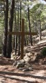
(4) At the large junction on the Col de Foce, take the lovely forest track immediately on the right. Follow this track for a long way until you reach the ONF hut, which also serves as a mountain refuge.

(5) Carry on straight ahead past the refuge to reach the Col de Foce d’Eria. Stay on the track opposite and you’ll reach a junction at a hairpin bend.

(6) Turn sharply left and head downhill to the sports ground; cross it lengthways and take the small path on the right leading to the Padula fountain.

(7) Join the D343 on the right and make your way back to Vezzani at a leisurely pace along the road with little traffic, returning to the church car park (S/E).

Waypoints

  1. S/E : mi 0 - alt. 2,503 ft - Vezzani Church
  2. 1 : mi 0.71 - alt. 2,336 ft - Crossroads by the Joseph Chiarell Stadium
  3. 2 : mi 1.42 - alt. 2,589 ft - Dried-up river
  4. 3 : mi 2.51 - alt. 3,845 ft - Small stream
  5. 4 : mi 2.75 - alt. 4,065 ft - Foce Pass
  6. 5 : mi 4.35 - alt. 3,812 ft - Mountain hut (ONF hut)
  7. 6 : mi 4.93 - alt. 3,615 ft - Trail junction at the hairpin bend
  8. 7 : mi 6.49 - alt. 2,986 ft - Padula Fountain
  9. S/E : mi 8.61 - alt. 2,510 ft - Vezzani Church

Notes

Parking is very easy.
Small grocery shop in the village, biscuit factory, post office, restaurant and bar.
The “Three Graces” fountain.

Worth a visit

In the evening, don’t miss the small Corsican concerts in the church square.
Wood Festival on 14 and 15 July.
15 August festivities.

Reviews and comments

3.7 / 5
Based on 2 reviews

Reliability of the description
3.5 / 5
Ease of following the route
4 / 5
Route interest
3.5 / 5
Terrige
Terrige

Information regarding this walk: the path leading up to the Col de Foce has now been cleared and signposted (orange); it forms part of a stage of the Mare e Monte Livantinu Ghisoni–Vezzani route.
On the return journey, I can confirm that there is indeed a path linking Padula to Vezzani; at the fountain, follow the markings (also orange, as it is on the ‘Mare e Monte Livantinu Vezzani–Vivario’ route) and the signposts leading back to the village of Vezzani.
This much more pleasant return route offers some truly beautiful panoramic views.

As an added bonus, there is now a themed trail in the Padula forest; at the fountain, you’ll find an information board suggesting a route of around 1.8 km through this remarkable site.

Although the first part is challenging (don’t rush to avoid getting out of breath), this walk is outstanding and will ensure you have a brilliant day out.

Machine-translated

h.szeflinski
h.szeflinski

Overall rating : 4 / 5

Date of your route : Jul 21, 2022
Reliability of the description : ★★★★☆ Good
Ease of following the route : ★★★★☆ Good
Route interest : ★★★★☆ Good
Very busy route : No

At the start (the first 300 metres after leaving the stadium), do not follow the paths marked out along the pipes that supply the cistern to their intake point
It is best to follow the route very closely using a GPS and the Geoportail base map, for example
This is also useful when you’re halfway up the slope in the pine forest, as the forest and the path have been so badly churned up by wild boars.
A very little-used path up to the pass.
It’s a bit disappointing at the pass as there’s no view, but there are some on the way down
It seems there is now a path that allows you to avoid the return journey via the D343 road between the last fountain (Padula) and the village of Vezzani (not shown on the IGN base map but signposted as you enter Vezzani)

The whole route is shaded!

Machine-translated

Nicole Monf.
Nicole Monf.

Overall rating : 3.3 / 5

Date of your route : Jul 25, 2020
Reliability of the description : ★★★☆☆ Average
Ease of following the route : ★★★★☆ Good
Route interest : ★★★☆☆ Average
Very busy route : Yes

There’s little point in walking so much along the road, whether at the start up to point 2 or on the way back from point 7.
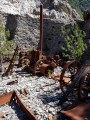
The climb between points 2 and 4 is very, very unpleasant; it seems to go on forever through a scree of stones and wood debris, with no signposting.

It would be more enjoyable to do a return trip from 7 to 4 along this lovely forest track, with a nice picnic on the way back.

Thank you for making all these routes available.

Machine-translated

Other walks in the area

For more walks, use our search engine .

The GPS track and description are the property of this route's author. Please do not copy them without permission.