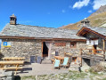
The Lanslebourg to Lanslevillard balcony trail

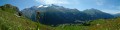
This walk takes you through the forest as well as along a scenic ridge. You’ll cross vast expanses of meadows where a variety of flowers – gentians, asters, Alpine carnations and Alpine pansies – line the path. In the distance, you can admire the Ronces Glacier.

Details

n°1308254
Creation:
Last update:
Last review:
  • Walking
    Activity: Walking
  • ↔
    Distance: 13.01 mi
  • ◔
    Average duration: 9h 00 
  • ▲
    Difficulty: Difficult

  • ⚐
    Back to start: Yes
  • ↗
    Ascent: + 3,422 ft
  • ↘
    Descent: - 3,442 ft

  • ▲
    Highest point: 7,825 ft
  • ▼
    Lowest point: 4,560 ft

Description of the walk

Park in the car park behind Place de Lanslebourg.

(S/E) Take Rue des Jardins behind the ‘Vieille Poste’ restaurant, heading towards the cinema; when you reach the school, turn right towards the chapel.

(1) Walk up a path alongside the chapel to reach a crossroads marked by an old stone cross. Take the track on the left and, after a right-hand bend, take the path on the right at the next crossroads.

(2) Take this path, continue westwards and you’ll reach the junction with the Route de Pierres Longues.

(3) Cross it and continue along the path, ignoring all turn-offs to the left or right. You’ll reach the Pré Vaillant crossroads, where you’ll join theGR®5, which is shared with theGRP® de Haute Maurienne.

(4) Follow it to the right and continue towards the Refuge du Cuchet. Follow a virtually level path to reach the Cuchet chalets.

(5) Continue along theGR® to reach the Refuge du Cuchet.

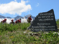
(6) Stay on theGR® towards the Refuge de Vallonbrun. This is a balcony trail offering a magnificent panorama stretching out before you. Reach the Combes stream, where a sign indicates ‘Refuge de Vallonbrun: 1h15’.

(7) Still on theGR®, cross Plan de la Cha and continue along the ridge path to reach the Vallonbrun Refuge.

(8) Leave theGR®5here and start the descent to Les Grattais on the right. Pass through the chalets in the hamlets of La Fesse du Milieu and then those of La Fesse d’en Bas. Reach the crossroads.

(9) Keep to the right, cross the Ruisseau de Burel, and join the road leading up to Les Grattais. Follow this road, negotiating a series of hairpin bends, and after the last bend, you’ll reach another crossroads of paths.

(10) Leave the road by turning left onto the footpath. Cross the Ruisseau du Pichet and arrive at the hamlet known as Les Côtes de la Farine. At the junction, keep to the right and reach the village of L’Adroit on the left bank of the Ruisseau du Driet.

(11) Follow this bank without crossing the footbridge, then turn right onto the Grande Rue.

(12) Cross the D902 and then the River Arc, turn right and walk past the church. Continue left along the Chemin des Chenevers to reach the Chapel of Saint John the Baptist.

(13) Join theGR® again, turn right onto Rue du Vieux Moulin and follow it to the left until you reach a roundabout.

(14) After this roundabout, head towards the Ruisseau des Essarts, cross it and continue south-west.

(15) Cross the Ruisseau du Pré Nouvel and continue in the same direction. Pass close to a leisure park and follow the path running parallel to the Arc until you reach the start of several chairlifts.
.
(16) Turn right and cross the Arc again to reach the departure car park opposite (S/E).

Waypoints

  1. S/E : mi 0 - alt. 4,583 ft - Car park behind Place de Lanslebourg
  2. 1 : mi 0.28 - alt. 4,583 ft - Chapel
  3. 2 : mi 0.67 - alt. 4,816 ft - Path on the right
  4. 3 : mi 1.19 - alt. 5,374 ft - Pierres Longues
  5. 4 : mi 2 - alt. 6,289 ft - Pré Vaillant
  6. 5 : mi 3.46 - alt. 6,736 ft - Chalets du Cuchet
  7. 6 : mi 4 - alt. 7,096 ft - Refuge du Cuchet
  8. 7 : mi 5.21 - alt. 7,618 ft - Ruisseau des Combes
  9. 8 : mi 7.49 - alt. 7,431 ft - Refuge de Vallonbrun
  10. 9 : mi 8.26 - alt. 6,883 ft - Junction towards the Ruisseau de Burel
  11. 10 : mi 9.88 - alt. 6,053 ft - Les Grattais crossroads
  12. 11 : mi 10.82 - alt. 4,892 ft - L’Adroit
  13. 12 : mi 11.07 - alt. 4,793 ft - Cross the D902 and then the River Arc
  14. 13 : mi 11.44 - alt. 4,803 ft - St John the Baptist Chapel
  15. 14 : mi 11.72 - alt. 4,728 ft - Roundabout
  16. 15 : mi 12.04 - alt. 4,721 ft - Ruisseau du Pré Nouvel
  17. 16 : mi 12.91 - alt. 4,593 ft - Bridge over the - Arc (rivière) - Affluent de l'Isère
  18. S/E : mi 13.01 - alt. 4,583 ft - Car park behind Place de Lanslebourg

Always be cautious and plan ahead when you're outdoors. Visorando and the author of this route cannot be held responsible for any accidents occurring on this route.

The GR® and PR® markings are the intellectual property of the Fédération Française de Randonnée Pédestre.

Reviews and comments

4.7 / 5
Based on 1 review

Reliability of the description
4 / 5
Ease of following the route
5 / 5
Route interest
5 / 5
anniemeignie
anniemeignie

Thank you for your feedback.
I’d like to point out that at the Cuchet refuge, you simply need to take the GR path behind the refuge, where there’s a viewpoint; the path then follows the mountain along a balcony trail as far as the Vallonbrun refuge. This is the most beautiful part of the route, where the view of the surrounding mountain ranges is splendid
In summer, I didn’t notice any barriers preventing hikers from moving freely; there are just a few fences to stop the cows from escaping.
I strongly recommend you do this route again – it’s well worth the trip.

Machine-translated

Zer0_Fame
Zer0_Fame

Overall rating : 4.7 / 5

Date of your route : Aug 15, 2020
Reliability of the description : ★★★★☆ Good
Ease of following the route : ★★★★★ Very good
Route interest : ★★★★★ Very good
Very busy route : No

Clear explanations, and far more precise than those provided by the tourist office maps.
In theory, the route seems easy to follow, but in practice there are too many misleading signs along the way, with paths cutting across private farmland that leave you confused, and signposts pointing to the same destination but heading off in three different directions. As a result, we got a bit lost just past the Cuchet refuge, but we would have carried on if the weather had been on our side.
We’ll give it another go, setting off earlier and avoiding a day when there’s a storm – that might help…

Machine-translated

Other walks in the area

For more walks, use our search engine .

The GPS track and description are the property of this route's author. Please do not copy them without permission.