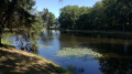
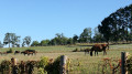
The Ruisseau des Belles Dames

Perhaps during this walk you will come across belladonna, whose active ingredient, atropine, dilates the pupils and is said to have made the ladies ‘bella dona’.

Details

n°1079387
Creation:
Last update:
Last review:
  • Walking
    Activity: Walking
  • ↔
    Distance: 6.63 mi
  • ◔
    Average duration: 3h 25 
  • ▲
    Difficulty: Moderate

  • ⚐
    Back to start: Yes
  • ↗
    Ascent: + 440 ft
  • ↘
    Descent: - 423 ft

  • ▲
    Highest point: 1,276 ft
  • ▼
    Lowest point: 971 ft
  • ⚐ Country: France
  • ⚐ City: Beyssenac (19230)
  • ⚑
    Start/End: N 45.403576° / E 1.285753°
  • ❏
    IGN map(s): Ref. 2033E
  • Hour-by-hour weather

Photos

Description of the walk

(S/E) From the Place de l’Église, turn right and walk down Rue des Acacias. Walk past the cemetery and you will reach the Croix l’Aneau crossroads.

(1) Head straight on down the road opposite, pass by a pond and continue towards La Graulière.

(2) Turn right before the village of La Graulière and continue towards La Malférie for about 1 km.

(3) In the hamlet, take the path on the right and, at the end of the straight stretch, turn right. Follow the Chemin des Vigirouillas and then veer left, near the pond, until you reach the road.

(4) Turn left, cross the Orne bridge over the Belles Dames stream and turn right towards Sarrette.

(5) Walk through the village of Sarrette and turn right towards Les Pradelles. Before reaching the house, head down the path on the left and then turn right until you reach the Belles Dames stream.

(6) Cross the small wooden bridge and head back up into the woods along the footpath, then follow the track towards Bourbon. At the road, carry on straight on towards Pissac until you reach the D7.

(7) Cross the road and continue towards Petit-Pissac Bas (not shown on the IGN map), then take the track on the left.

(8) At the junction, turn right until you reach the road at a place called Le Petit Pissac and continue straight on towards the D7.

(9) Cross the road and take the path opposite to reach the Place de l’Église in Beyssenac (S/E).

Waypoints

  1. S/E : mi 0 - alt. 1,155 ft - Place de l’Église
  2. 1 : mi 0.56 - alt. 1,148 ft - Croix l’Aneau crossroads
  3. 2 : mi 1.22 - alt. 1,230 ft - Before the village of La Graulière, on the right
  4. 3 : mi 1.58 - alt. 1,273 ft - La Malférie
  5. 4 : mi 2.75 - alt. 1,086 ft - Arrival on the D6E
  6. 5 : mi 3.43 - alt. 1,181 ft - Sarette
  7. 6 : mi 4.17 - alt. 974 ft - Ruisseau des Belles Dames
  8. 7 : mi 5.22 - alt. 1,135 ft - Crossing the D7
  9. 8 : mi 5.47 - alt. 1,145 ft - On the path, on the right
  10. 9 : mi 6.07 - alt. 1,175 ft - Crossing the D7
  11. S/E : mi 6.63 - alt. 1,155 ft - Place de l’Église

Notes

Green trail, route no. 14.

Worth a visit

The12th-centuryRomanesque church, dedicated to Saint Médard, was restored in the14th,18th,19th and early21st centuries with the support of the Fondation du Patrimoine, and features contemporary stained-glass windows made of glass and cement. These windows are the work of Benedictine monks from Fleury Abbey in Saint-Benoît-sur-Loire.
It is a Romanesque-era building, with the west entrance and the nave likely dating from the14th century. Médard was Bishop of Noyon in the 6th century, and is credited with all manner of miracles. It was he who consecrated Queen Radegonde to God when, as Queen of the Franks, she decided to take the veil.

In the past, Beyssenac was home to a commandery of the Order of Malta, which had a chapel of devotion containing an enamelled copper reliquary. The Order of Malta was the first religious and military order to emerge from the Crusades. Founded in the mid-11th century, it welcomed sick and needy pilgrims into its hospices.

The Saint-Fiacre fountain (near the church) is said to have healing properties for convulsions and digestive disorders.

The Moulin du Pont Lasveyras: Situated on the banks of the Auvézère, it is one of those places where history has left its mark: on 16 February 1944, 34 young Resistance fighters from the Violette Battalion were executed by a German firing squad, 12 were deported (7 of whom escaped), and 3 survived the attack.
The mill is now a memorial site where an exhibition recounting these events is open to the public every summer (on Saturday and Sunday afternoons from July to September).

Reviews and comments

4 / 5
Based on 2 reviews

Reliability of the description
4.5 / 5
Ease of following the route
5 / 5
Route interest
2.5 / 5
User 3763399

Very well signposted and pleasant

Machine-translated

Pierre chaumeil
Pierre chaumeil

Overall rating : 3.7 / 5

Date of your route : Jan 19, 2025
Reliability of the description : ★★★★☆ Good
Ease of following the route : ★★★★★ Very good
Route interest : ★★☆☆☆ Disappointing
Very busy route : No

The commune has several well-signposted and marked walking routes. Whilst a few sections are pleasant – mainly in the valley floors – there are far, far too many stretches on tarmac. Furthermore, as in other parts of the department, one cannot help but notice the deterioration of the rural landscape in Corrèze. Small plots of land have disappeared, as have hedgerows, copses and wetlands. Vast meadows, mostly artificial, are criss-crossed by oversized machinery… There is truly no longer any appeal in walking through this environment. A real shame!

Machine-translated

Celineetfrederic
Celineetfrederic

Overall rating : 4.3 / 5

Date of your route : Feb 25, 2023
Reliability of the description : ★★★★★ Very good
Ease of following the route : ★★★★★ Very good
Route interest : ★★★☆☆ Average
Very busy route : No

An easy walk, well described and well signposted, but not particularly interesting. You walk mainly along roads. Add to that the fact that we stumbled straight into a far-right demonstration by a small group bearing the same name as the militiamen who shot and betrayed the Resistance fighters in the region during the Second World War (Action Française), and you can imagine that the afternoon was not exactly pleasant.
Worth doing to stretch your legs if you’re in the area

Machine-translated

Other walks in the area

For more walks, use our search engine .

The GPS track and description are the property of this route's author. Please do not copy them without permission.