The oval barns around Beyssenac

This walk offers the chance to discover a unique architectural feature: the oval barns.

Details

n°1083358
Creation:
Last update:
Last review:
  • Walking
    Activity: Walking
  • ↔
    Distance: 5.10 mi
  • ◔
    Average duration: 2h 40 
  • ▲
    Difficulty: Easy

  • ⚐
    Back to start: Yes
  • ↗
    Ascent: + 328 ft
  • ↘
    Descent: - 299 ft

  • ▲
    Highest point: 1,250 ft
  • ▼
    Lowest point: 981 ft
  • ⚐ Country: France
  • ⚐ City: Beyssenac (19230)
  • ⚑
    Start/End: N 45.403568° / E 1.285738°
  • ❏
    IGN map(s): Ref. 2033E
  • Hour-by-hour weather

Description of the walk

Start from the square in front of Beyssenac church.

(S/E) With your back to the church, turn left and, after the post office, turn right onto the D107 towards Pompadour.

(1) Take thefirst track on the left. At the end, turn left onto the D7.

(2) Take thefirst road on the right, towards Germignac. At the next two junctions, ignore the roads on the left and carry on towards the hamlet of Le Clédier.

(3) About fifty metres before the farm, turn into the meadow on the right. Cross the meadow towards the small copse, then cross the second meadow towards the woods. Follow the path through the woods (not shown on the map) as far as Deux Rieux.

(4) Continue up the road. At the junction, leave the road on your left and head towards La Flotte.

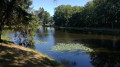
(5) At the three-way junction, near a pond, turn left towards Les Palissas. Walk through the hamlet.

(6) Ignore the road on the right and carry straight on. After a right-hand bend at a right angle, leave the road and follow the parallel path on the left until you reach the D7.

(7) Cross the road and first turn left then right to continue straight on towards Le Méchenin.

(8) In the village, at a T-junction, turn right. At the next junction, turn left. At the following junction, turn right towards La Varonie.

(9) At the fork in the road, take the left-hand track. At the next junction, go straight on. At the crossroads, turn left. After the oval barn, turn left again.

(1) Continue straight on along the road to Beyssenac (S/E).

Waypoints

  1. S/E : mi 0 - alt. 1,155 ft - Beyssenac Church Square
  2. 1 : mi 0.28 - alt. 1,171 ft - Crossroads at the end of the circular loop
  3. 2 : mi 0.93 - alt. 1,184 ft - Road to Germignac
  4. 3 : mi 1.96 - alt. 1,037 ft - Le Clédier
  5. 4 : mi 2.25 - alt. 1,037 ft - Deux Rieux
  6. 5 : mi 2.93 - alt. 1,165 ft - Étang – Three-way junction
  7. 6 : mi 3.54 - alt. 1,247 ft - Junction
  8. 7 : mi 3.7 - alt. 1,230 ft - D7 road
  9. 8 : mi 3.91 - alt. 1,214 ft - Turn left off the path
  10. 9 : mi 4.43 - alt. 1,188 ft - La Varonie
  11. S/E : mi 5.1 - alt. 1,155 ft - Beyssenac Church Square

Notes

Follow the pink signposts, route no. 15, entitled “Germignac”.

Worth a visit

The oval barns: today, these oval barns have swapped their thatched roofs for sheet metal ones. Their construction was characteristic of this area; they were built from the mid-18th to the mid-19th century. Their distinctive feature lies in the fact that the roof rests on a framework, separate from the non-load-bearing walls.

The 12th-century Romanesque church, dedicated to Saint Médard, was restored in the 14th, 18th, 19th and early 21st centuries with the support of the Fondation du Patrimoine. It features contemporary stained-glass windows made of glass and cement. These windows are the work of Benedictine monks from Fleury Abbey in Saint-Benoît-sur-Loire.
It is a Romanesque-era building, with the west entrance and the nave likely dating from the 14th century. Médard was Bishop of Noyon in the 6th century, and all manner of miracles are attributed to him. It was he who consecrated Queen Radegonde to God when, as Queen of the Franks, she decided to take the veil.

In the past, Beyssenac was home to a commandery of the Order of Malta, with a chapel of devotion that housed an enamelled copper reliquary. The Order of Malta was the first religious and military order to emerge from the Crusades. Founded in the mid-11th century, it welcomed sick and needy pilgrims into its hospices.

The Saint-Fiacre fountain (near the church) is said to have healing properties for convulsions and digestive disorders.

The Moulin du Pont Lasveyras: Situated on the banks of the Auvézère, it is one of those places where history has left its mark: on 16 February 1944, 34 young Resistance fighters from the Violette Battalion were executed by a German firing squad, 12 were deported (7 of whom escaped), and 3 survived the attack.
The mill is now a memorial site where an exhibition recounting these events is open to the public every summer (on Saturday and Sunday afternoons from July to September).

Reviews and comments

3.3 / 5
Based on 4 reviews

Reliability of the description
3.8 / 5
Ease of following the route
3.3 / 5
Route interest
3 / 5
Barry
Barry

Overall rating : 3 / 5

Date of your route : Nov 17, 2025
Reliability of the description : ★★★★☆ Good
Ease of following the route : ★★☆☆☆ Disappointing
Route interest : ★★★☆☆ Average
Very busy route : No

Very few markings, and between 3 and 4 nothing at all. We knocked on the door of a house in Le Clédier where a kind lady allowed us to cross her cattle field to reach the road.

Machine-translated

Celineetfrederic
Celineetfrederic

Overall rating : 3.7 / 5

Date of your route : Jan 13, 2024
Reliability of the description : ★★★★☆ Good
Ease of following the route : ★★★★☆ Good
Route interest : ★★★☆☆ Average
Very busy route : No

A pleasant walk on a sunny winter’s day. At point 3, the route has changed since the GPS track was recorded. Ignore the track shown and cross the meadow widthways. You’ll then come to a footpath. There’s a pink signpost, but it’s not facing the right way – you need to head downhill.
In several places, the signposts are incorrectly positioned.
At point 6, there is another change to the route; simply cross the D7 after the bend (more incorrectly positioned signs).
In the village (point 8), the route has also been slightly altered; follow the signs to avoid entering private property.
Thank you for sharing this

Machine-translated

Madonna
Madonna

Overall rating : 1.7 / 5

Date of your route : Jan 06, 2023
Reliability of the description : ★★☆☆☆ Disappointing
Ease of following the route : ★★☆☆☆ Disappointing
Route interest : ★☆☆☆☆ Very disappointing
Very busy route : No

98 per cent road-based tour

Machine-translated

mamyrisette
mamyrisette
• Edited:

Overall rating : 5 / 5

Date of your route : Sep 09, 2019
Reliability of the description : ★★★★★ Very good
Ease of following the route : ★★★★★ Very good
Route interest : ★★★★★ Very good

My friends and I really enjoyed this walk because of its varied scenery and its historic buildings...

We’d love to do it again… just one minor drawback: the 500 metres we had to walk along the D7 (a bit risky?)

Machine-translated

Other walks in the area

For more walks, use our search engine .

The GPS track and description are the property of this route's author. Please do not copy them without permission.