Country:
 City:


There are two main routes to Camps-la-Source:
- From Brignoles, at the eastern exit of the town, head towards Camps-la-Source at the Intermarché roundabout. After 3 km, the road passes through the village and turns sharply south in the centre. You can park there in a large, attractive car park on the right-hand side of the road. The car park we chose is located at the stadium, 500 m further south.
- From Forcalqueiret, turn right onto the D12 towards Camps-la-Source: after 2.5 km, you’ll reach the stadium car park.
(S/E) Head north towards the village. Continuing along the Route de Brignoles, turn left onto the Grande Rue.
(1) When you reach a square with the church on your left and the town hall on your right, carry straight on, going round the town hall on the right, and follow Rue du Château. At the end of this street, take a short stretch of Chemin Neuf, then make a quick first turn right then left to quickly join Chemin Saint-Sébastien heading north.
(2) Leave the Chemin de la Calade on your right – you’ll take this on the way back – and carry on straight ahead until you reach a water tower, from where you turn left towards the Saint-Sébastien Chapel.
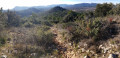
(3) To the west of the chapel, facing its entrance, there are two options: to the left, a path through the rocks; to the right, a gentler path through the woodland. Take the path on the right and head west, with the cliffs directly above on your left. After 200 metres, the path climbs up to the ridge on the left. Continue due west along the ridge, where the path is always clearly marked by a red streak amidst the white limestone rocks.
(4) After about 1,500 metres along a ridge path that is never dull, offering constant beautiful views of the Val de Camps to the south, and often of Brignoles to the north, after skirting a long dry-stone wall and passing through a stretch of woodland, you’ll reach the foot of the Gueit rock massif.
To the right, a path descends steeply due north towards the Font de Bardel hollow (which will be the subject of another walk). Turn left round the rock mass to go round it and soon climb up to the Gueit promontory. There, you’ll find a lovely orientation board made up of several panels, and plenty of spots perfect for a picnic or even a nap! Head back down from the promontory.
(4) Return along the ridge path in the opposite direction, straight on to the chapel and then the water tower.
(2) Turn left onto the Chemin de la Calade and follow it all the way down. Once in the village, take the street on the right, then the paved slanting street on the left to reach the Grande Rue and then the town hall/church square on the right.
(1) Walk down past the church along Rue de l’Église.
(5) At the junction, turn right onto Rue Henri Aubert, which soon passes the historic spring that gives the village its name. Unfortunately, it had run dry when we were there. Carry on a little further to see a water distribution system, then retrace your steps.
(5) Then turn right onto the street leading straight south out of the village towards the plain. Cross a stream, the Grand Vallat or Val de Camps, and further on you’ll come out onto a road running perpendicular to it.
(6) Turn left (eastwards) onto this road, which runs through the middle of wheat fields on a very flat plain that is usually damp.
(7) At the crossroads (with the wayside shrine), turn left onto the main road leading to the village and you will very quickly reach the stadium car park (S/E).


 Visorando Member

 Moderate


 Association / Club / Walk leader

 Difficult