Country:

 City:


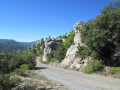
On arriving in Garéoult, look for the Domaine de la Garbelle, walk past it and park in a very spacious clearing about 600 metres further on.
(S/E) Take the yellow-marked track; this is a PR® heading north-north-east.
(1) At the junction, leave the track and continue along the path, which is still marked in yellow, heading west. Walk through the Vallon de Cavaillon to reach a junction where several paths meet.
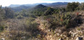
(2) Leave the yellow markings and continue straight ahead along the ridge until you reach another junction.
(3) Carry on straight ahead to reach the summit of the Amarron.
(4) Return to the path and descend the Amarron to the first junction further down.
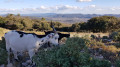
(5) Continue straight ahead down the slope to reach the plateau, which serves as a small cow pasture.
(6) Begin a new ascent along the path straight ahead. Join the service road leading to the summit of La Loube.
(7) Once on the service road for the Loube antennas, turn right and follow it to the barrier at the bend.
(8) Please take care here: Follow this route there and back as follows:
- go through the barrier and take the track,
- turn left onto the track and head towards the Vigie de la Loube junction.
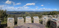
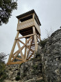
(9) Turn right to reach La Vigie.
(10) Take the path on the left, go downhill for a few metres and then rejoin the Vigie junction.
(9) Follow the previous route in the opposite direction to reach the junction at the barrier.
(8) At the barrier, take the service road leading uphill on the left. Follow a white concrete road running alongside the Loube buildings to reach the headland, where you’ll find another panoramic viewpoint on a rocky outcrop.
(11) Follow the same route back to the Vigie crossroads.
(9) Continue straight ahead for about thirty metres. Look out for a path on the left heading south-south-west. From this point onwards, the path is not marked on the map. Bear in mind that the service road will be on your left and that you need to rejoin it at a wide bend.
(12) Take another path which starts almost immediately at the bend in the service road. This one is shown on the IGN map. Follow it until you rejoin the road.
Important note: it is possible to take a shortcut by taking the service road from the barrier to Pas Gravet, but this will, of course, be far less interesting. This road is apparently only used by those working on the antennae. Vehicles are quite rare there.
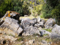
(13) Follow it down for a few metres to reach the first dolomite outcrops of Pas Gravet.
(14) Turn left onto the yellow-marked path. Follow it down through the dolomites to a junction further down.
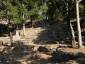
(15) Turn off onto the path on the right to reach the chimney and the Source des Orris.
(16) Follow the same route back to the previous junction.
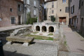
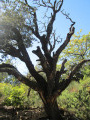
(15) Continue straight ahead, skirting the Source des Trois Fontaines, and walk almost level to reach the Jas d’Émilien, marked by a large oak tree.
(17) Take the path that descends opposite the oak tree. This path also runs almost level and joins the crossroads on the plateau you passed earlier.
(6) Turn right towards l’Amarron, also reaching the crossroads leading to this summit.
(5) Take the path on the left, leave the woods and, in the clearing that follows, reach the Amarron Dolmen; see the practical information.
(18) Continue along the path to reach the summit of l’Amarron.
Please note: after the altitude of 646 metres, the path leading up to the summit is not shown on the IGN map.
(3) Take the path on the left that you took earlier and return to the original junction.
(2) Turn right onto the long descent heading south; you’ll soon reach a four-way junction. Turn 90° to the left. Cross the track at a hairpin bend and continue along the stream bed. Further on, rejoin the track leading to the Domaine de la Garbelle.
(19) Head due north along the road to reach the starting car park in the clearing (S/E).


 Visorando Member
 Easy

 Moderate