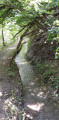
The Combarine Mine, starting from Puy-Saint-Pierre

Here’s a very short circular walk to explore the remains of the Briançon mines, particularly the Combarine mine in the commune of Puy-Saint-Pierre.

Details

25781259
Creation:
Last update:
Last review:
  • Walking
    Activity: Walking
  • ↔
    Distance: 2.12 mi
  • ◔
    Average duration: 1h 25 
  • ▲
    Difficulty: Easy

  • ⚐
    Back to start: Yes
  • ↗
    Ascent: + 541 ft
  • ↘
    Descent: - 541 ft

  • ▲
    Highest point: 5,328 ft
  • ▼
    Lowest point: 4,738 ft

Description of the walk

Park in the car park at the Church of Puy-Saint-Pierre.

(S/E) Turn left onto the D335 for just a few metres, then turn left immediately onto a track. Walk alongside the cemetery wall and begin a steep descent to reach the Bourelle crossroads.

(1) Turn right, then left, and continue slightly uphill. You’ll reach a Y-shaped junction of footpaths.

(2) Take the left-hand path, which isn’t shown on the IGN map but is clearly marked on OSM. Continue uphill to reach the Combarine Mine and its old buildings.

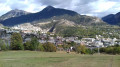
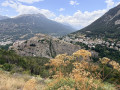
(3) Take care here: turn right to walk past the ruined buildings, then carry on to reach a junction. Turn left onto the steps made of wooden logs to reach a platform overlooking the valley. Enjoy the remarkable view of Briançon and the Durance valley from here. Head back down the steps and continue up a steeper climb to reach the information board about the mine. Carry on to join the D335 road.

(4) Turn right onto this road and follow it for a good hundred metres; it also forms part ofthe GR®50trail, marked in red and white. Turn left off the road and follow theGR® trail, cross through Puy Richard, continue along theGR® and you’ll easily find the car park at the church in Puy-Saint-Pierre (S/E).

Waypoints

  1. S/E : mi 0 - alt. 5,095 ft - Car park - Église Saint-Pierre (Puy-Saint-Pierre)
  2. 1 : mi 0.44 - alt. 4,738 ft - Bourelle crossroads
  3. 2 : mi 0.6 - alt. 4,839 ft - Fork
  4. 3 : mi 0.92 - alt. 4,865 ft - Combarine Mine
  5. 4 : mi 1.2 - alt. 5,226 ft - D335 and GR50
  6. S/E : mi 2.12 - alt. 5,095 ft - Car park - Église Saint-Pierre (Puy-Saint-Pierre)

Worth a visit

Always be cautious and plan ahead when you're outdoors. Visorando and the author of this route cannot be held responsible for any accidents occurring on this route.

The GR® and PR® markings are the intellectual property of the Fédération Française de Randonnée Pédestre.

Reviews and comments

3.3 / 5
Based on 5 reviews

Reliability of the description
3.4 / 5
Ease of following the route
2.6 / 5
Route interest
3.8 / 5
User 3676161

Overall rating : 5 / 5

Date of your route : Aug 03, 2026
Reliability of the description : ★★★★★ Very good
Ease of following the route : ★★★★★ Very good
Route interest : ★★★★★ Very good
Very busy route : No

Really nice and easy

Machine-translated

User 22290352

Overall rating : 2.5 / 5

Date of your route : Jul 08, 2025
Reliability of the description : ★★★★☆ Good
Ease of following the route : ★☆☆☆☆ Very disappointing
Route interest : Not used / Not applicable
Very busy route : No

Interesting description, but we quickly got lost. There were no signposts and the paths were poorly maintained. We never saw the mine! On the route, we passed very close to this famous mine.

Machine-translated

Blioud
Blioud

Overall rating : 3.3 / 5

Date of your route : Aug 05, 2024
Reliability of the description : ★★★☆☆ Average
Ease of following the route : ★★★☆☆ Average
Route interest : ★★★★☆ Good
Very busy route : No

A short, gentle walk to warm up, offering lovely views over the Briançon valley and the Melezin. In very hot weather, it’s best to start in the opposite direction to that described, setting off from the village and walking up to a bend in the road further up. At the wooden cross, turn left down a small, unmarked path. An information board about the mine is located a few dozen metres further down. The descent to the mine is exposed, whilst the climb back up to the village is through the forest. A section of the path is poorly marked. Make sure you follow your GPS carefully. This walk is not suitable for young children.

Machine-translated

nath88
nath88

Overall rating : 1.3 / 5

Date of your route : Aug 12, 2023
Reliability of the description : ★☆☆☆☆ Very disappointing
Ease of following the route : ★☆☆☆☆ Very disappointing
Route interest : ★★☆☆☆ Disappointing
Very busy route : No

An attempt at a hike along this route. Where to begin… The path is absolutely not maintained (tall grass, large stones in the middle of the path, a very, very steep path); I don’t think it’s suitable for children. I’m 1.90 metres tall and in some places the grass came up above my knees. If you’re afraid of snakes, I’d advise against this route as it’s the sort of place where they’re likely to be found. In the end, we had to turn back before reaching stage 3, as the grass and other foliage were reaching above my waist. Very disappointed with a walk that was advertised as easy and interesting. The first part of the walk does indeed offer a view of Briançon, but you leave the old town behind to look down at the Carrefour Market below… Really disappointing. The second part might have been more scenic, but it’s impossible to say.

Machine-translated

Astrid chap
Astrid chap

Overall rating : 3.7 / 5

Date of your route : Jun 14, 2023
Reliability of the description : ★★★★☆ Good
Ease of following the route : ★★★☆☆ Average
Route interest : ★★★★☆ Good
Very busy route : No

The path was difficult to walk on today due to the rain the day before and the very tall grass.
However, there were lovely views of Briançon, the town, its forts and the surrounding mountains.
There was a slight difficulty near the ruins as the path was not visible and the vegetation was very dense, so be sure to follow the GPS track closely.

Machine-translated

Other walks in the area

For more walks, use our search engine .

The GPS track and description are the property of this route's author. Please do not copy them without permission.