Braided torrents
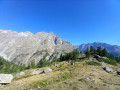
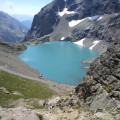
A constantly evolving environment, the braided streams were formed on the remains of an ancient glacial lake. They consist of an interlacing network of water channels that fluctuate with the tides in an area where the gradient suddenly becomes gentler. The material carried by the torrents down steep slopes is deposited to create small islands that erode and reform over time. These rare and fragile natural habitats are home to a distinctive flora. The braided torrents lend a unique character to the landscapes of the glacial valley floors. They are best viewed from the surrounding peaks or glacial barriers.
A glacial valley
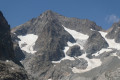
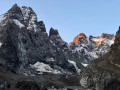
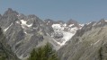
What makes this valley unique is that it is home to both a white glacier, where the accumulated ice remains at ground level, and a black glacier composed of ice covered with rocks. Their glacier tongues fluctuate in response to changing weather conditions, which plays a major role in shaping the landscape. A lithograph from 1854 depicts the two glaciers converging at the Pré de Madame Carle, ten years before the first ascent of the Barre des Ecrins. The Glacier Blanc lost more than 2 kilometres in length between 1885 and the 2000s.
Rock clover
A tiny clover dependent on constantly shifting alluvial deposits or moraines, the rock clover reproduces by seed every year, unlike other alpine plants, which are generally perennials. This strategy enables it to colonise environments that are constantly being reshaped. It is a rare species and is protected at national level.
Barre des Ecrins
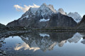
The Barre des Ecrins (4,102 metres above sea level, situated towards the Glacier Noir) was first climbed in 1864, via the north face, by Edouard Whymper, accompanied by Moore, Walker and his guides Almer and Michel. The south face, meanwhile, was first climbed by Henri Duhamel in 1880, with his guides Pierre Gaspard senior and junior, setting off from La Bérarde. The time came to seek out new routes, each more challenging than the last. In 1893, Auguste Reynier, with his guides Joseph Turc and Maximin Gaspard, opened the route that bears his name on the south-east face. The south pillar was first climbed in 1944 by Jeanne and Jean Franco.
The highest peak in the Ecrins
On the border between Isère and the Hautes-Alpes, little-known and formerly known as ‘Pointe des Arsines’, the Barre des Ecrins was given this name by mistake by cartographers. At the time, the Pelvoux was considered the highest point in the region and also in France, back when Savoy was an independent county. So when, in 1828, Captain Durand, a cartographer, made the first ascent of the Pelvoux, he was convinced that the title of highest peak should be awarded to the Barre des Ecrins (4,102 m).
The Glacier Blanc … on the move
The Glacier Blanc has been monitored for over a century. At the end of the 19th century, the Glacier Blanc joined the Glacier Noir at the Pré de Madame Carle. The path ran along the right bank, following the moraine, and passed beneath the Glacier Blanc refuge. During the 20th century, both glaciers retreated steadily. This glacial retreat was punctuated by advances, including a particularly spectacular one in the 1980s. Two key indicators of these impressive movements are the flow velocity measurements taken using beacons and the ladder installed in the early 1980s. The debate surrounding this structure has been reignited: was it necessary to build it, and should it be kept? The ladder, which had become both unnecessary and dangerous, was finally dismantled in 2008 as the old route had been cleared of ice and was therefore passable again. Part of it is preserved at the Maison de la Montagne in Ailefroide. Whilst we speak of eternal snows, the glacier continues to fluctuate in response to climatic variations …
Yellow-billed Chough
A master of flight and an acrobat of the peaks, the yellow-billed chough is also very adept at scavenging for the leftovers from walkers’ meals. It usually travels in flocks and brightens its passage with easily recognisable, high-pitched, flute-like calls. It is as much a companion to seasoned mountaineers as it is to casual day-trippers.
Alpine Accentor
The Alpine Accentor, more discreet than the Yellow-billed Chough and about the size of a sparrow, is another inhabitant of these heights. It is never far away. On its upperparts, a few black streaks mark its ash-grey plumage. Characteristic russet streaks mark its flanks. It scurries across the short grass of the alpine meadows and struts about on bare rock. It comes to peck at scraps around the mountain hut. When winter comes, it migrates down to the valleys. Its journey may even take it as far as the coastal cliffs. As the snow melts, along the snowfields, it is a formidable predator of small invertebrates numbed by the cold.
The cochlear-leaved bellflower
Campanula cochleariifolia. Campanulas have flowers shaped like charming little bells – ‘campanula’ is Latin for ‘bell’. The cochleariifolia is distinguished by its heart-shaped basal leaves, whilst the leaves on the stem are lanceolate. The pale blue of its flowers contrasts sharply with the grey of the fine high-altitude scree where it grows in large clusters.
The yellow saxifrage
Saxifraga aizoides The yellow saxifrage particularly favours damp habitats where water runs off. Its robust flowers are unusual in that they begin their life as male before becoming female, shedding their stamens in favour of a pistil ready to receive pollen from a younger neighbour. An effective system for encouraging fertilisation by foreign pollen!
Spiderweb houseleek
Sempervivum arachnoideumA species particularly well-adapted to the arid conditions of the high mountains, it forms small rosettes of thick leaves from which intertwining white hairs shoot skywards, looking strikingly like spider’s webs. However, these structures do not capture insects but rather dew; this water, essential for life, is then stored in the leaves. Amidst its numerous offshoots, the houseleek sometimes proudly displays a few bright pink, star-shaped flowers.
Moraine willowherb
Epilobium dodonaei subsp. fleischeri Smaller than its cousin, the spike-flowered willowherb, this elegant plant with pink flowers grows wherever alluvial deposits are found. Also possessing a great ability to spread, the moraine willowherb readily colonises the spaces left by melting glaciers. And in this unstable environment, it develops long stolons that enable it to re-emerge after being buried!
Life on the Glacier Blanc
Life thrives everywhere. Glaciers are no exception! Single-celled algae are able to grow on the surface of the snow, causing the snowfields to take on a reddish hue. The animal world is represented by the glacier flea (springtail), a primitive insect measuring 1 to 2 mm, which lives in small pools on the ice. It feeds on nutrient particles carried by the wind. It develops at temperatures between 0 and 4°C. As soon as the temperature reaches 12°C, it burrows deeper to meet the thermal requirements essential for its survival. Occasionally, other animals venture there at the risk of their lives.
Glacier monitoring
Every year, the Ecrins National Park carries out photographic surveys, mass assessments, glacier front monitoring and topographical surveys. Against a backdrop of rather worrying climate change, this is a vital programme for Europe’s high-mountain regions.
Tuckett Refuge
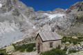
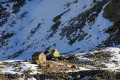
The refuge stands as a historic reminder of the pioneering era of mountaineering in Vallouise during the second half of the 19th century. At that time, it was situated at the foot of the glacier. It was built in 1886 to replace a rock shelter used by the first mountaineers. Small in size and built of stone and wood, it is a historic landmark. Its ruins now house an exhibition tracing its history.



 Country:

 City:
City:



 Visorando Member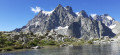
 Difficult
 Extremely difficult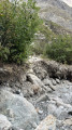
 Very difficult