


Refine your search for walks in Le Rateau d'Aussois
Le Rateau d'Aussois walks


 The Râteau d’Aussois from Plan d’Amont
 Visorando Member
 6.80 mi
 +3,763 ft
 -3,776 ft
 6h 25
6h 25
 Difficult
 Departure from Aussois (Savoie)
A beautiful, accessible rocky summit offering spectacular views from the top: Mont Blanc, the Écrins, Gran Paradiso, etc.
The path is excellent and allows you to cover the elevation gain efficiently. From the Col de la Masse to the summit, the route is a little more technical, passing through a sort of large scree slope.
Walks near Le Rateau d'Aussois
Map of Amont – Roc de la Pêche mountain hut
 9.99 mi
+3,852 ft
-4,390 ft
7h 55
Difficult
Departure from Aussois (Savoie)
9.99 mi
+3,852 ft
-4,390 ft
7h 55
Difficult
Departure from Aussois (Savoie)
The walk begins with a gentle, rural route to the Fond de l’Aussois mountain hut, followed by a steep climb to the Col de l’Aussois.
Refuge de l'Orgére - Refuge Peclet Polset
 5.43 mi
+2,986 ft
-1,171 ft
5h 05
Difficult
Departure from Villarodin-Bourget (Savoie)
5.43 mi
+2,986 ft
-1,171 ft
5h 05
Difficult
Departure from Villarodin-Bourget (Savoie)
The first stage takes you from the Refuge d’Orgére to the Refuge de Peclet Polset. Although short, this first stage features a significant elevation gain, helping you get into your stride for the rest of the trek. The views above the Maurienne Valley are already splendid. You’ll cross your first pass, the Col de Chaviére, at nearly 2,800 metres. Views of the Écrins and the Thabor, reminding us of the 2018 route.
From the Refuge de l'Orgère to the Refuge du Fond d'Aussois via the Grand Roc
 7.42 mi
+4,787 ft
-3,412 ft
7 hrs
7.42 mi
+4,787 ft
-3,412 ft
7 hrs
 Very difficult
Departure from Villarodin-Bourget (Savoie)
Very difficult
Departure from Villarodin-Bourget (Savoie)
Starting from the Refuge Porte de l'Orgère, the route passes through the Valon de l'Orgère to reach the Col de la Masse (2,952 m) with the option of climbing the Grand Roc (3,316 m), then follows the valleys to reach the Refuge du Fond d'Aussois.
Porte de l’Ogère Mountain Hut – Plan d’Amont
 6.27 mi
+3,412 ft
-2,913 ft
5h 50
Difficult
Departure from Villarodin-Bourget (Savoie)
6.27 mi
+3,412 ft
-2,913 ft
5h 50
Difficult
Departure from Villarodin-Bourget (Savoie)
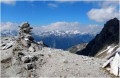
Walk in the Maurienne region from the Porte de l’Ogère mountain hut to Plan d’Amont via the Col de la Masse
From the Orgère Mountain Hut to the Granges in the Vallée Étroite
 16.10 mi
+4,564 ft
-5,131 ft
11h 25
Difficult
Departure from Villarodin-Bourget (Savoie)
16.10 mi
+4,564 ft
-5,131 ft
11h 25
Difficult
Departure from Villarodin-Bourget (Savoie)
This eleventh stage crosses the Mont Cenis massif and, in part, the Cerces massif. From the Refuge de l’Orgère, the GR®5 descends to Loutraz, crossing the River Arc via the bridge to the east of Modane. The route goes round the town hall, passes the church, follows the railway line eastwards, then westwards, and climbs the slope beneath the Fréjus Tunnel to pass under the motorway. It continues its ascent towards Notre-Dame du Charmaix. After the Valfréjus resort, it enters the Ruisseau du Charmaix valley and reaches the hamlet of Les Herbiers. Below the old Small Pass, it crosses the stream and, following the road, reaches the Lavoir Reservoir before tackling the steep climb towards La Losa, then, via the Combe de la Grande Montagne, reaches the Col de la Vallée Étroite. After a detour to the east, the descent heads due south, towards the Plaine Tavernette, then the valley of the same name. Finally, the GR®5 follows the Ruisseau de la Vallée Étroite to the Granges de la Vallée Étroite.
Refuge de la Fournache - Refuge de l'Orgére
 5.91 mi
+2,336 ft
-3,750 ft
4h 45
Difficult
Departure from Aussois (Savoie)
5.91 mi
+2,336 ft
-3,750 ft
4h 45
Difficult
Departure from Aussois (Savoie)
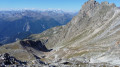
The final stage of this fabulous route from the Refuge de la Fournache to the Refuge de l'Orgére, via the Col de la Masse. The ascent of this pass is difficult due to the steep gradient. The end of the ascent and a good part of the descent are very technical. The view from the pass is absolutely exceptional; you will be able to see the Écrins and the Thabor massif.
 Chatalamia–Aussois traverse via the Col du Barbier
 6.01 mi
+3,658 ft
-2,700 ft
4 hrs
Very difficult
Departure from Villarodin-Bourget (Savoie)
6.01 mi
+3,658 ft
-2,700 ft
4 hrs
Very difficult
Departure from Villarodin-Bourget (Savoie)
From the Chatalamia rock, you’ll be able to see the female ibex and their kids; the chamois aren’t far away. After stopping to look at the cup-marked stone, you’ll continue the ascent through the forest, emerging onto the balcony path that leads to Le Barbier and then to the pass of the same name. During the descent to Le Plan d’Aval, you’ll be able to admire the resort of Aussois with its ski runs, but above all the magnificent panorama of the Dent Parrachée and Le Plan d’Aval.
From the Fond d'Aussois Refuge to the Saut Refuge via the Pointe de l'Observatoire
 9.33 mi
+4,724 ft
-5,443 ft
8 hrs
Very difficult
Departure from Aussois (Savoie)
9.33 mi
+4,724 ft
-5,443 ft
8 hrs
Very difficult
Departure from Aussois (Savoie)
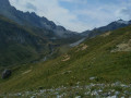
From the Refuge du Fond d'Aussois to the Refuge du Saut, the route passes via the Col d'Aussois (2,914 m) with the option to climb the Pointe de l'Observatoire (3,015 m) before descending into the valley via the Ritort farm, then the Col Rouge (2,730 m).
Aussois - Valfréjus
 12.42 mi
+3,225 ft
-2,923 ft
8h 30
Difficult
Departure from Aussois (Savoie)
12.42 mi
+3,225 ft
-2,923 ft
8h 30
Difficult
Departure from Aussois (Savoie)
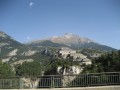
Étape de la Grande Traversée des Alpes d'Aussois (Vanoise) à Valfréjus (Maurienne).
Peclet-Polset Refuge - Merlets Lakes Refuge
 9.26 mi
+3,114 ft
-3,314 ft
7h 00
Difficult
Departure from Pralognan-la-Vanoise (Savoie)
9.26 mi
+3,114 ft
-3,314 ft
7h 00
Difficult
Departure from Pralognan-la-Vanoise (Savoie)
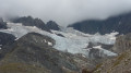
This second stage links the Peclet Polset Refuge to the Lacs Merlets Refuge via the Col du Soufre. You walk alongside the great Gebroulaz Glacier before reaching the Refuge du Saut. Next comes the ascent of the Col de Chanrouge and the arrival at the Lacs Merlets.
This stage takes you off the usual route through the Vanoise National Park. The landscapes are very wild. You’ll find plenty of edelweiss here.