


TrisranVDB

 Visorando Member
 Premium user
 Sign up:
Published route(s)
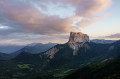
 Crête des Alleyrons
 2.79 mi
 +1,404 ft
 -1,404 ft
 2h 30
2h 30
 Moderate
 Departure from Gresse-en-Vercors (Isère)
An easy walk with a superb view on arrival of Mont Aiguille and the Grand Veymont.
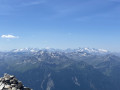
The Râteau d’Aussois from Plan d’Amont
 6.80 mi
+3,763 ft
-3,776 ft
6h 25
6.80 mi
+3,763 ft
-3,776 ft
6h 25
 Difficult
Departure from Aussois (Savoie)
Difficult
Departure from Aussois (Savoie)
A beautiful, accessible rocky summit offering spectacular views from the top: Mont Blanc, the Écrins, Gran Paradiso, etc.
The path is excellent and allows you to cover the elevation gain efficiently. From the Col de la Masse to the summit, the route is a little more technical, passing through a sort of large scree slope.
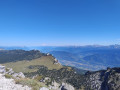
The Lances de Malissard from Les Essarts
 6.60 mi
+2,592 ft
-2,618 ft
5h 20
Difficult
Departure from Saint-Pierre-de-Chartreuse (Isère)
6.60 mi
+2,592 ft
-2,618 ft
5h 20
Difficult
Departure from Saint-Pierre-de-Chartreuse (Isère)
This route has the least elevation gain for climbing one of the four peaks over 2,000 m in the Chartreuse. Magnificent view of the back of the Dent de Crolles, the north of the Chartreuse and, on the other side, the majestic Mont Blanc.
Bec de l'Orient from Gève
4.93 mi
+1,020 ft
-1,010 ft
3h 10
Moderate
Departure from Autrans (Isère)
A fairly short and easy hike to see one of the most beautiful viewpoints in the Vercors.This is a non-winter route! It follows the route of a number of cross-country ski trails, which are not accessible to hikers. In winter, please follow the snowshoe markings, which are different.