Circular walk between Saint-Martin-lès-Melle and Saint-Romans-lès-Melle

A route alternating between footpaths and minor roads. It partly follows theGR®655(Way of St James). A pleasant walk thanks to its varied, sometimes undulating route, which nevertheless has a minimal elevation gain.

Details

n°219322
Creation:
Last update:
Last review:
  • Walking
    Activity: Walking
  • ↔
    Distance: 6.87 mi
  • ◔
    Average duration: 3h 25 
  • ▲
    Difficulty: Average

  • ⚐
    Back to start: Yes
  • ↗
    Ascent: + 259 ft
  • ↘
    Descent: - 266 ft

  • ▲
    Highest point: 427 ft
  • ▼
    Lowest point: 262 ft

Photos

Description of the walk

Car park at the village hall in Saint-Martin-lès-Melle.

(S/E) On leaving the car park, turn left onto the road towards Saint-Romans-lès-Melle, leave the village and ignore the first road on the right.

(1) Take the path that appears shortly afterwards on the right and continue to the next junction.

(2) At the junction of the farm tracks (altitude 110), turn left and follow this track, which passes under a power line.

(3) At the next junction with a road, take the road on the right and, shortly afterwards, go straight across the junction towards Pompérain.

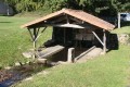
(4) In Pompérain, turn left onto a track towards Font-Maye (wash house), and continue along the track towards Saint-Romans-lès-Melle.

(5) The track leads out very close to the Romanesque church of Saint-Romans-lès-Melle. Follow the road uphill towards the village centre and immediately turn left onto Route du Logis (signposted). Walk past the farmhouse, which is part of the traditional local architecture.

(6) At the next junction, turn left onto the road towards Bel-Air, then, immediately after passing the first house on the right, take the path that winds its way between houses and gardens. At Le Pontreau, take the main road on the right towards Bel-Air. Leave the village. From Le Verdillon, the path follows theGR® 655 (Way of St James). Continue to the crossroads (altitude 103).

(7) Turn right towards Trappe. On leaving the hamlet, turn right onto the path towards Le Bassiou.

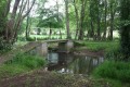
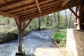
(8) Cross the Béronne via a raised bridge. At Le Bassiou, turn left onto the road, then ignore the first road on the right.

(9) At the lowest point, about a hundred metres further on, take the road on the right (near Prélebeau). Towards the top of the climb, turn onto the first path on the left, the Mouille-Pain path.

(10) At the bypass around Melle, cross the road and immediately afterwards take the path on the left leading uphill. At the top of the climb, turn right towards Saint-Hilaire.

(11) At the next junction, leave the track leading to Saint-Hilaire on your right and continue left towards the water pumping station. Go round it and take the track on the left which joins the road overlooking the bypass.

(12) Follow this on the right until you reach the junction with the road to Saint-Hilaire. Turn left, cross the ring road again and carry on straight ahead towards Le Prieuré. At the junction with the road coming from Melle, turn left and follow the road along the footpath running alongside it until you reach the car park at the Saint-Martin-lès-Melle village hall. Just before the town hall in Saint-Martin-lès-Melle, cross the ring road at the pedestrian crossing before returning to the car park which marks the start of this route (S/E).


Waypoints

  1. S/E : mi 0 - alt. 351 ft - Car park at the village hall
  2. 1 : mi 0.54 - alt. 381 ft - Path
  3. 2 : mi 0.96 - alt. 364 ft - Crossroads (elevation 110)
  4. 3 : mi 1.49 - alt. 361 ft - Junction with road
  5. 4 : mi 1.77 - alt. 322 ft - Pomperain
  6. 5 : mi 2.28 - alt. 282 ft - Church of Saint-Romans-lès-Melle
  7. 6 : mi 2.54 - alt. 266 ft - Crossroads after the farmhouse
  8. 7 : mi 3.43 - alt. 338 ft - Crossroads (elevation 113) towards Trappe
  9. 8 : mi 3.99 - alt. 269 ft - Elevated bridge - Béronne (rivière)
  10. 9 : mi 4.52 - alt. 292 ft - Turn right
  11. 10 : mi 5.38 - alt. 299 ft - Crossing the bypass
  12. 11 : mi 5.8 - alt. 420 ft - Continue to the left
  13. 12 : mi 6.25 - alt. 420 ft - Turn right onto the road
  14. S/E : mi 6.87 - alt. 351 ft - Car park at the village hall

Notes

Easy parking is available in the car park at the village hall in Saint-Martin-lès-Melle.
This route includes sections on roads due to the rainy season (early March). A route with more footpaths is possible with a few variations (recommended in dry weather).

This route takes you to the Font Maye washhouse and the Romanesque church at Saint-Romans-lès-Melle. It partly follows theGR®655.

Worth a visit

Saint-Romans-lès-Melle
See the 19th-century church at Saint-Romans-lès-Melle (notably the mascarons on the north-west portal)

Melle
You can visit three Romanesque churches dating from the 11th and 12th centuries:
- Saint-Hilaire (the most significant of the three churches, both for its architecture and its sculpture. It is listed as a UNESCO World Heritage Site as a stop on the Way of St James.)
- Saint-Pierre (Romanesque chancel)
- Saint-Savinien (the only one to have been built within the walls of the fortified town. Its chevet is surrounded by the town’s ancient walls. It served as a prison in the 19th and 20th centuries).
In Melle, there is also the Hôtel du Ménoc (former courthouse)

Always be cautious and plan ahead when you're outdoors. Visorando and the author of this route cannot be held responsible for any accidents occurring on this route.

The GR® and PR® markings are the intellectual property of the Fédération Française de Randonnée Pédestre.

Reviews and comments

4.3 / 5
Based on 2 reviews

Reliability of the description
4.5 / 5
Ease of following the route
4.5 / 5
Route interest
4 / 5
pgetrochon
pgetrochon

Thank you for your comment.
Enjoy your walks

Machine-translated

philippea79
philippea79

Overall rating : 4.7 / 5

Date of your route : Sep 10, 2019
Reliability of the description : ★★★★★ Very good
Ease of following the route : ★★★★★ Very good
Route interest : ★★★★☆ Good

A pleasant and easy walk

Machine-translated

POUPI79
POUPI79

Overall rating : 4 / 5

Date of your route : Dec 29, 2016
Reliability of the description : ★★★★☆ Good
Ease of following the route : ★★★★☆ Good
Route interest : ★★★★☆ Good

A lovely walk, despite having to walk along a lot of tarmac roads.

Machine-translated

Other walks in the area

For more walks, use our search engine .

The GPS track and description are the property of this route's author. Please do not copy them without permission.