Le Puy du Naouri via the southern trails

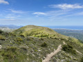
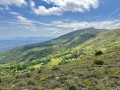
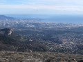
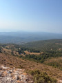
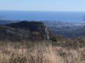
At the rounded summit of Puy de Naouri, you will never tire of looking at the landscape. A very beautiful walk offering magnificent views of the baous, the coastline, the Esterel, the Mercantour and sometimes even Corsica.

Details

67834556
Creation:
Last update:
Last review:
  • Walking
    Activity: Walking
  • ↔
    Distance: 3.66 mi
  • ◔
    Average duration: 2h 50 
  • ▲
    Difficulty: Moderate

  • ⚐
    Back to start: Yes
  • ↗
    Ascent: + 1,302 ft
  • ↘
    Descent: - 1,289 ft

  • ▲
    Highest point: 3,383 ft
  • ▼
    Lowest point: 2,172 ft

Photos

Description of the walk

The road is paved up to the starting point.
From the car park in Tourrettes-sur-Loup, take the Route de la Magdeleine, then turn left onto the Route des Costes. Continue straight on until you reach marker 172. At this point, turn right and follow the tarmac Route des Costes. At the junction marked by a flat stone with the inscription 'Touronet', turn left. The car park is located 100 m further on, near the water tower.

(S/E) Take the uphill path. After barely 50 metres, you will come to a V-shaped crossroads. Take the path on the left. You will soon reach another crossroads. Turn right here. Continue uphill along a few hairpin bends until you reach another crossroads marked by a cairn.

(1) Take the path on the left, walk along a cliff and you will reach a fenced-off area.

(2) Go around it on the right. Once you have gone around it, take the path on the far right in front of the large gate. Walk through the brambles for about 50 metres. Once on the plateau, head through the broom towards a large aviary, but be careful here: this is private property and access is prohibited. Go around it on the left to reach the track.

(3) Turn left, follow the track slightly uphill and you will reach a crossroads with several directions at marker 175a.

(4) Take the tarmac road on the right towards Le Puy Nouri. Walk alongside the Château du Caire, where you will find marker 176, which is not shown on the map. Continue towards Puy de Naouri. The road turns into a centuries-old paved slanting street, leading to a new marker that is shown on the map and also bears the number 176.

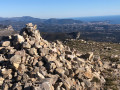
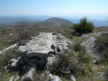
(5) Head towards Le Puy de Naouri on the right. Follow the path, pass marker 178 and continue east to reach the summit of Le Puy de Naouri and its metre-high cairn.

(6) Continue eastwards until you reach a second large cairn, then continue along the ridge downhill and walk alongside the woods until you reach the power line.

(7) Turn right at this crossroads and follow the path to reach the sheep park with its dry stone walls. Take the path on the right between two cairns. You will come to a drinking trough and a container used as a fire water reserve.

(8) Turn left at the water trough and you will come back to the initial crossroads you passed on the way there.

(1) Take the path on the left and follow the route in reverse to reach the water tower car park (S/E).


Waypoints

  1. S/E : mi 0 - alt. 2,178 ft - Water tower car park
  2. 1 : mi 0.21 - alt. 2,444 ft - Crossroads of the circular loop
  3. 2 : mi 0.34 - alt. 2,493 ft - Fenced area
  4. 3 : mi 0.63 - alt. 2,635 ft - Truck track
  5. 4 : mi 1.01 - alt. 2,687 ft - Marker 175a
  6. 5 : mi 1.58 - alt. 3,369 ft - Marker 176
  7. 6 : mi 2.31 - alt. 3,353 ft - Puy de Naouri
  8. 7 : mi 2.58 - alt. 2,904 ft - Power line
  9. 8 : mi 3.2 - alt. 2,674 ft - Watering hole
  10. S/E : mi 3.66 - alt. 2,172 ft - Water tower car park

Notes

Hiking boots and walking sticks are recommended.
Pruning shears are always useful, as vegetation quickly takes over.
This hike is possible all year round, but be careful in summer as the route is in the sun.
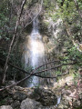
There is a water source at marker 176 near the Château de Caire.
Baou
You are in a pastoral area, so please behave appropriately to ensure everyone can coexist harmoniously. If you encounter herd protection dogs, keep your cool, calmly move away and avoid sudden movements.

Worth a visit

Between (1) and (2), enjoy the first views of the coastline.
Shortly after (4), you will see the Château du Caire, the former castle of the Lord of Tourrettes, which dates back to the 17th century. It belongs to the municipality of Tourrettes-Sur-Loup and is awaiting reallocation.
The village of Tourrettes-sur-Loup has a medieval character with its tall houses standing like ramparts above the Loup valley.

Reviews and comments

4.1 / 5
Based on 6 reviews

Reliability of the description
4.2 / 5
Ease of following the route
3.5 / 5
Route interest
4.7 / 5
bernard bb
bernard bb

Thank you for your feedback, Mario
Thanks for clearing the path between points 1 and 2
Best regards, B.

Machine-translated

Mario Simard
Mario Simard

Overall rating : 4.7 / 5

Date of your route : Apr 01, 2026
Reliability of the description : ★★★★★ Very good
Ease of following the route : ★★★★☆ Good
Route interest : ★★★★★ Very good
Very busy route : No

Some sections were indeed overgrown with brambles, but I cleared a good path between points 1 and 2 and the trail is now accessible. Someone had actually started the work before me… perhaps the shepherd and his sheep? To prevent the area from becoming overgrown again, it would be ideal if every hiker passing by could give the path a quick trim with their secateurs.

And the view from this section of the route is superb.

Machine-translated

bernard bb
bernard bb

Thank you for your review, User 20331201
The site is truly beautiful.
Best regards, B.

Machine-translated

User 20331201

Overall rating : 3.7 / 5

Date of your route : Jan 27, 2026
Reliability of the description : ★★★☆☆ Average
Ease of following the route : ★★★☆☆ Average
Route interest : ★★★★★ Very good
Very busy route : No

More difficult than expected, with entire sections that were quite challenging to traverse through brambles. There were sections where the route was impossible to find, requiring improvisation that was not always safe!
The site is absolutely beautiful.

Machine-translated

bernard bb
bernard bb

Thank you for this advice
As advised on the "bring pruning shears" sheet
Best regards, B.

Machine-translated

EmmaPoint
EmmaPoint

Overall rating : 4.3 / 5

Date of your route : Jan 03, 2026
Reliability of the description : ★★★★★ Very good
Ease of following the route : ★★★★☆ Good
Route interest : ★★★★☆ Good
Very busy route : No

Route completed on 2 January 2026. Section 1-2-3 is indeed not recommended. Vegetation has overgrown the path. Section 1-8-3 is definitely the best option.
In good weather, magnificent view of the Alps.

Machine-translated

bernard bb
bernard bb

Thank you, grc73, for this fair assessment.
When I get the chance, I'll go and clear the brambles
Best regards, rando, b.

Machine-translated

grc73
grc73

Overall rating : 4.3 / 5

Date of your route : May 25, 2025
Reliability of the description : ★★★★★ Very good
Ease of following the route : ★★★☆☆ Average
Route interest : ★★★★★ Very good
Very busy route : No

Very nice route, but I completely agree with the other comments: it's best to avoid zone 2-3 through the brambles, unless you have long, thick clothing or even a machete ... Otherwise, the trails are in good condition and offer superb views of the coastline and the Baous.
One last point: access to the starting point is via a very steep and narrow path, with only 2-3 parking spaces at the end and a very small turning area.

Machine-translated

bernard bb
bernard bb

Thank you, Ulya, for your review.

The description of this hike does not provide much information about the signposting.
The app can be used to avoid getting lost.

The summit, pure joy, that's it :-)

Machine-translated

Ulya
Ulya

Overall rating : 3.7 / 5

Date of your route : Jan 04, 2025
Reliability of the description : ★★★☆☆ Average
Ease of following the route : ★★★☆☆ Average
Route interest : ★★★★★ Very good
Very busy route : No

A beautiful hike for winter and mid-season.
Very little or no signage in some areas, so I recommend using your GPS to avoid taking the wrong path.
Avoid section 2 as you will get lost in the brambles. It is better to take 1/8/3 and then continue the hike.
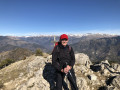
At the summit, pure bliss, with a magnificent view on this windy (cold) day.
Between sectors 6 and 7, the slope is very steep for weak knees!

Machine-translated

bernard bb
bernard bb

Thank you, bebeghislaine, for this review.
Best wishes, B.

Machine-translated

bebeghislaine
bebeghislaine

Overall rating : 4 / 5

Date of your route : Jan 05, 2025
Reliability of the description : ★★★★☆ Good
Ease of following the route : ★★★★☆ Good
Route interest : ★★★★☆ Good
Very busy route : No

A lovely little hike. I recommend going straight up to point 8 at point 1 to avoid the unpleasant brambles. At point 8, turn left onto a beautiful path that will take you more easily to point 3. Then follow the description in the guidebook. Enjoy your hike!

Machine-translated

Other walks in the area

For more walks, use our search engine .

The GPS track and description are the property of this route's author. Please do not copy them without permission.