The Mounard Route

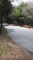
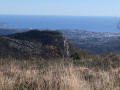
A short, fairly easy walk, consisting of a series of ascents and descents, through a forest situated between two valleys, a short distance from residential areas. You won’t find any remarkable views here, but it is a peaceful, family-friendly spot.

Details

95913425
Creation:
Last update:
Last review:
  • Walking
    Activity: Walking
  • ↔
    Distance: 2.92 mi
  • ◔
    Average duration: 1h 45 
  • ▲
    Difficulty: Easy

  • ⚐
    Back to start: Yes
  • ↗
    Ascent: + 505 ft
  • ↘
    Descent: - 509 ft

  • ▲
    Highest point: 1,014 ft
  • ▼
    Lowest point: 610 ft

Description of the walk

Park along the path where the road widens, at the junction of Route de Plan Buisson and the cul-de-sac of the same name.

(S/E) Take the tarmac Road du Plan Buisson; when you reach a junction, carry on straight ahead along the Piste du Mounard (signpost 154) until you reach a large clearing and signpost 155.

(1) Ignore the wide return path straight ahead and turn right onto the narrow path that runs alongside a property’s fence (towards Mounard Ouest). After about 700 m, a tree blocks the path.

(2) Go round this uprooted tree (information as of April 2026). You are now on a section of the GR® (marked in white and red). Continue to a junction marked with marker 158.

(3) When you cross the Piste du Mounard, take this wide DFCI track descending to the right. After about 400 m, the track winds down a few hairpin bends followed by a wide left-hand bend, then begins a right-hand bend. In this bend, look out for a small path on the left (use the route on the app if necessary). Please note: this path on the left is not signposted, but if you pay attention, you’ll find it easy to follow.

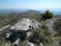
(4) Start a steep climb to the left, heading north, which winds through dense woodland until you come to a beautiful ruin at a crossroads.

(5) Turn right and follow a narrow path marked in yellow, which is very pleasant, until you reach a track suitable for vehicles.

(6) Take this track to the right for about a hundred metres until you come across a graffiti-covered water tank.

(7) Turn onto a small path on the left, running parallel to the track; this is a more pleasant route leading to the same spot, namely the clearing at marker 155 which you passed on the way out.

(1) Follow the path you took on the way there in the opposite direction back to the car park (S/E).

Waypoints

  1. S/E : mi 0 - alt. 981 ft - Route de Plan Buison
  2. 1 : mi 0.23 - alt. 919 ft - Waypoint 155
  3. 2 : mi 0.66 - alt. 781 ft - Fallen tree
  4. 3 : mi 0.95 - alt. 866 ft - Waypoint 158 - Miagne (rivière)
  5. 4 : mi 1.55 - alt. 610 ft - Path on the left - Loup (fleuve)
  6. 5 : mi 1.86 - alt. 869 ft - Ruins
  7. 6 : mi 2.56 - alt. 951 ft - Waypoint 156
  8. 7 : mi 2.6 - alt. 938 ft - Citerne
  9. S/E : mi 2.92 - alt. 981 ft - Route de Plan Buison

Notes

There is no water along the route.

The only section of the route that isn’t in the shade is the DFCI track at Le Mounard, which is about one kilometre long.

The total elevation gain is approximately 180 m according to my altimeter watch, which is slightly more than the figure automatically calculated by Visorando.

This short, undulating route can be completed in 1 hour by the fittest walkers and in 1 hour 30 minutes at a leisurely pace. It presents no difficulties, apart perhaps from the uphill section between (4) and (5), which is quite steep for those who are out of practice.

Worth a visit

If you’re not familiar with the Vence hinterland, do take the opportunity to visit Tourrettes-sur-Loup, a very pretty village clinging to the cliff face.

Always be cautious and plan ahead when you're outdoors. Visorando and the author of this route cannot be held responsible for any accidents occurring on this route.

The GR® and PR® markings are the intellectual property of the Fédération Française de Randonnée Pédestre.

Other walks in the area

For more walks, use our search engine .

The GPS track and description are the property of this route's author. Please do not copy them without permission.