Country:

 City:
City:


Park in the designated spaces along the D983 (Route du Sancy) and near the Restaurant La Table de l’Ours.
(S/E) Go round the restaurant on the right to find a path which you should follow to the left. Pass the start of the Chomets chairlift, then the ski lift of the same name, and return to the D983. Then turn right and walk carefully alongside it until you reach the first path on the right.
(1) Take this track, cross a small stream and walk for about 200 m. Turn right to begin a steep, winding ascent and reach the Durbis plateau.
(2) At the junction, take the path on the right to continue the climb. Join the GR®4 (marked in white and red) and follow it in the same direction to reach a junction on the north-eastern shoulder of the Roc de Cuzeau.
(3) Leave the GR®4 temporarily by taking the path along the hillside, which allows you to easily bypass the summit, and rejoin it at the Col de Cuzeau.
(4) Continue along the GR® to reach the Puy des Crébasses.
(5) Follow the path which crosses the western flank of the Puy de Cacadogne, passes by the Pic Intermédiaire and eventually joins one of the tracks leading to the summit of the Puy de Sancy.
(6) Turn left, pass through the Col de la Cabane and reach the foot of the final section of the ascent.
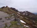
(7) Follow the stony, winding path leading to the Puy de Sancy: exceptional views.
(8) Descend via the steps, pass the picnic area and reach a junction at the Pas de l’Âne.
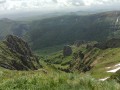
(9) Keep left, leaving the steps behind. Pass a beautiful viewpoint over the valley and continue across the southern slope of the Puy Redon to reach the Col de Courre.
(10) Carry on straight ahead towards the Tour Carrée, then follow the ridge to the right to reach the Puy de Cliergue: a paragliding take-off point.
(11) Stay on the path, which winds its way down in a series of hairpin bends before opening out onto a wide track; follow this to the right for about 300 metres.
(12) Leave the track and head towards Mont-Dore on the right. Descend steeply through the forest before joining the GR®4 variant.
(13) Turn right, cross the Ravin des Chèvres stream and reach a junction just before the Route de Pontauzy.
(14) Head to the right and walk alongside the Longes car park.
(15) Carry on straight ahead, pass under the Les Longes chairlift and cross the ski runs. Then cross the two footbridges to return to the car park, on the other side of the Route du Sancy (S/E).
 Visorando Member
 Moderate