Auvergne Volcanoes Park – Sancy Massif – Puy de Sancy – Chambon-sur-Lac

A walk starting from Puy de Sancy (located an hour’s drive south of Clermont-Ferrand) to the town of Chambon-sur-Lac.
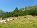
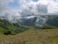
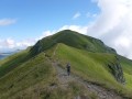
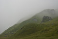
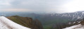
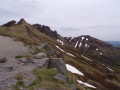
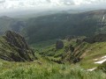
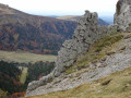
This walk offers views of the Chaudefour Valley National Nature Reserve from the ridge path of the Sancy massif, as well as the valley floor.
The walk ends at Lake Chambon, which is a lovely spot not only for a swim (weather permitting) but also to watch the sunset.

This walk is part of a multi-day hike: Walk of 2013-02-12T15:21:33+01:00

Details

11762
Creation:
Last update:
Last review:
  • Walking
    Activity: Walking
  • ↔
    Distance: 11.72 mi
  • ◔
    Average duration: 6h 15 
  • ▲
    Difficulty: Moderate

  • ⚐
    Back to start: No
  • ↗
    Ascent: + 971 ft
  • ↘
    Descent: - 4,039 ft

  • ▲
    Highest point: 5,951 ft
  • ▼
    Lowest point: 2,874 ft

Photos

Description of the walk

The route starts at the top station of the Puy de Sancy cable car.

(S) Head down alongside the Pas de l’Ane ski lift, then head up to the right to the Pan de la Grange, where you’ll join theGR®4.

(1) Take theGR®4to the left, following the ridge path (the Chaudefour valley lies below on your right).

(2) At the Puy des Crebasses, shortly after the Puy de Cacadogne, let theGR® head due north and veer to the right, staying on the ridge.

(3) At a fork, take the path on the right to descend into the valley.

Once in the valley, you’ll have a superb view of the Dent de la Rancune and the Crête de Coq.

(4) Shortly after joining a track, take the path branching off to the left which leads to Chambon des Neiges.

(5) From Chambon des Neiges, follow the markings; you’ll cross the D36 / D636 and rejoin the path by taking the track that heads left. You’ll walk along the tarmac of the D636 for a few metres. Continue to follow the markings, which will take you to Chambon sur Lac via Les Angles.

(6) You can walk round the lake on the left or the right (E).

Waypoints

  1. S : mi 0 - alt. 5,951 ft - Cable car from the - Puy de Sancy
  2. 1 : mi 0.79 - alt. 5,643 ft - Take the GR°°®°°4 on the left
  3. 2 : mi 1.84 - alt. 5,738 ft - To the right - Puy des Crebasses
  4. 3 : mi 2.85 - alt. 4,672 ft - Path leading downhill to the right
  5. 4 : mi 4.25 - alt. 3,990 ft - Near the - Couze Chambon (rivière) - Affluent de l'Allier
  6. 5 : mi 6.23 - alt. 3,816 ft - Follow the markings
  7. 6 : mi 10.72 - alt. 2,874 ft - Go round the lake on the right or left - Lac Chambon
  8. E : mi 11.72 - alt. 2,874 ft - Lac Chambon

Notes

Make sure you have a 1:25,000 map (at least the one provided on the website).

This route passes through multiple protected areas, which may be subject to special regulations:

Always be cautious and plan ahead when you're outdoors. Visorando and the author of this route cannot be held responsible for any accidents occurring on this route.

The GR® and PR® markings are the intellectual property of the Fédération Française de Randonnée Pédestre.

Reviews and comments

5 / 5
Based on 2 reviews

Reliability of the description
5 / 5
Ease of following the route
5 / 5
Route interest
5 / 5
gazok54
gazok54 ★

Thank you, jj.guedj@wanadoo.fr, for this comment, which is a real heart-warmer for our whole team.

Machine-translated

jj.guedj@wanadoo.fr
jj.guedj@wanadoo.fr

Overall rating : 5 / 5

Date of your route : Oct 22, 2015
Reliability of the description : ★★★★★ Very good
Ease of following the route : ★★★★★ Very good
Route interest : ★★★★★ Very good

It’s ideal for hikes – I can download it onto my tablet, so I don’t need maps anymore. Thanks, Visorando.

Machine-translated

najiar
najiar

Hello and thank you

Machine-translated

POULIN Gérard
POULIN Gérard ★
• Edited:

Hello Najiar,
This discussion isn’t relevant to this section; please head over to: https://www.visorando.com/forum-randonnee... – I think you’ll find what you’re looking for there. If not, post a message on that page with a few details (budget, knowledge of settings, whether you need a compass or altimeter, whether you’ll use it frequently or just occasionally, etc.). I’m sure you’ll find one or more experts to guide you.
Whether you use GPS or not, I wish you a wonderful horse ride in the Massif Central.

Machine-translated

najiar
najiar

Hello,
I’m thinking of getting a GPS for horse riding, perhaps in the Massif Central if I can find an easy trail – could you give me some advice?
Thanks in advance, and I hope you have some lovely rides this new year.
Najiar

Machine-translated

papouguy
papouguy

Reply to Ménouar24
I can confirm that I have a Garmin 62 S GPS myself, and the website is perfect for downloading GPX files of routes using the ‘export’ function. The GPX file is saved to the ‘Downloads’ folder on your computer. It may well be that your GPS isn’t compatible.

Machine-translated

gazok54
gazok54 ★

And thank you. It all looks much more harmonious now.

Machine-translated

menouar24
menouar24

Hello gazok54, thank you for pointing that out – I’d jotted it down in a hurry. I’ve now corrected it. Kind regards

Machine-translated

gazok54
gazok54 ★

Hello,
You say this route is brilliant, so it’s a shame to give this walk a poor rating just because you couldn’t download the PDF.
The download is fully compatible with Garmin GPS devices; I’ve got one myself.
Have a look through the forum; you’ll probably find the answer to your problem there.

Machine-translated

menouar24
menouar24
• Edited:

Overall rating : 5 / 5

Date of your route : Oct 30, 2014
Reliability of the description : ★★★★★ Very good
Ease of following the route : ★★★★★ Very good
Route interest : ★★★★★ Very good

The Sancy route is brilliant, but I can’t download it from your website, so I’m using Google Earth to plot my route. For my hikes, I use a Garmin GPS – the GPSMAP 60CSX – which might not be compatible with your website,I’ll try again to download a route from your hiking trails; perhaps you could make the download process a bit easier so it isn’t so complicated – thank you, best regards

Machine-translated

Mathilde M.
Mathilde M.

Hello,
I’m planning to do the 3-day route independently. Could you tell me if I can easily find places to pitch my tent without the risk of being disturbed, or perhaps are there any campsites or mountain huts where I can camp?
Thanks in advance.

Machine-translated

Other walks in the area

For more walks, use our search engine .

The GPS track and description are the property of this route's author. Please do not copy them without permission.