


 Country:

 City:
City:


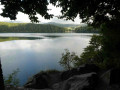
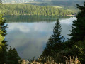
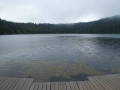

To reach the start point from Besse and Saint-Anastaise, follow the D149 and, at the top of the hill, head towards the Espace Nordique Sancy. Cross the site and continue along the small road to a small car park near the Chandèze Section Forest.
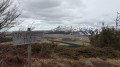
(S/E) Take the path leading down opposite the car park, walk along the left-hand side of Lac des Estivendoux (peat bog) and continue through the mountain pasture until you reach the tarmac road. Turn left and you’ll soon arrive at a viewpoint overlooking the lake, opposite a memorial stone.
(1) Carry on along the path that runs alongside the road on your right. Take the first hairpin bend to the left and continue to the next junction.
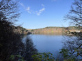
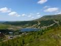
(2) Carry on to the left and follow the wide path to the next junction, taking in the magnificent views over Lac Pavin.
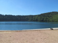
(3) Carry on straight ahead for a round trip to the beach and the restaurant at the entrance to the lake.
(4) Return to the previous fork in the path.
(3) Turn right, heading uphill through a lovely beech forest, until you reach a track.
(5) Follow it to the right and, at the end of the climb, continue along the wide path to the left until you reach a clearing.
(6) Climb the path on the left. Almost at the top, head a few metres to the right to reach the Puy de Montchal viewpoint.
(7) Turn back, ignore the path leading up and continue straight ahead on a gentle descent. You’ll reach a flat area with a four-way junction.
(8) Head right, descend into the crater and then, after climbing the slope on the opposite side, descend to the left until you reach the next fork.
(9) Take a hairpin bend to the right, ignore a wide path on the left and continue straight ahead. After two tight bends, first to the left then to the right, you’ll reach a track suitable for vehicles. Follow it to the left for about a hundred metres and you’ll come to a junction on the right.
(10) Follow the grassy track to the right, join a three-way junction and take the first turn left then right before reaching the tarmac.
(11) Continue downhill to the right until you reach a path on the left, at the left-hand bend in the road.
(12) Take the small path leading to the Creux de Soucy chasm (protected by a metal railing in August 2024) and walk round it.
(12) Back on the road, continue along it to the left for a few metres, then take the path on the left. Follow it straight on until you reach a T-junction.
(13) Turn left and, at the three-way junction that follows, turn right.
(14) As you emerge from the forest, cross a road and continue along the edge of the woodland until you reach the viewpoint overlooking Lake Pavin.
(1) Follow the same route back as on the way there to reach the car park at the Chandèze Section Forest (S/E).

 Finally, we returned to the starting point after crossing the same mountain pasture as on the way there. Well done and thank you for this route, which was greatly enjoyed!

 Visorando Member

 Difficult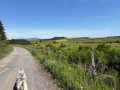
 Easy
Easy 
