Country:

 City:
City:


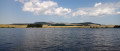
Start from the Lac de Bourdouze car park, along the D36.
Green markings (on one side only, in the opposite direction to the walk) + yellow directional signs with or without text
(S/E) From the car park, cross the D36 carefully and take a path that heads diagonally to the right. Walk gently downhill through fenced-off meadows. Ignore a path coming from the left and head back uphill.
(1) Cross the D36 again, taking care, and continue uphill along the path opposite. This will take you to the hamlet of Anglard.
(2) At the crossroads, take the first left and pass by the ‘Ferme de la Griffe’ sign. Return to the tarmac road and take a first turn left then right (there’s a fountain on the right). When the road bends to the right, carry on straight ahead along a track towards Saint-Anastaise, passing between two sheds. The track soon gives way to a grassy path: head towards a wood. Enter the wood and descend steeply.
(3) Carefully cross a road (the D127) and continue the descent along the path opposite. Cross a stream via a footbridge. Ignore a faint path on the right and turn left with the path.
(4) Shortly afterwards, turn right towards Saint-Anastaise and enter a dark woodland (be careful to spot this turn-off). Climb straight up a very steep and poorly marked path. Walk alongside a fence some distance to your right. Then turn right along the path and go through a gap in the fence (if this is closed, use a step-over on the right). Climb up a less steep, better-marked path.
(5) You’ll come out onto a track; follow it to the right. Leave the woodland and walk between fenced-off meadows, first slightly uphill and then on a gentle slope. You’ll come out onto a small road; follow it to the right past the Champs farm. Ignore the entrance to the farm on the left.
(6) Turn left immediately at a letterbox. Go round a cowshed on the left and continue along a track between fenced meadows.
(7) Go through a fence and make sure to close it properly behind you if it was closed. On the other side, turn right and head east-southeast. Cross a damp patch as best you can. The path then disappears: continue south-east and find a cattle track running parallel to the fence on the right. Keep to the right, reach this fence and follow it on your right-hand side.
(8) Cross a fence running perpendicular to the path (either step over it or crawl under it) and continue straight ahead. Cross another fence using a step-over and continue along a path with a fence on your left.
No signposting
(9) You’ll come out onto a small road; follow it to the right. At the junction, take the second left, the D624 towards Compains.
Green signposting (on one side only, in the opposite direction to your walk) + yellow directional signs with or without text
(10) Just after passing under a high-voltage power line, turn right onto a track towards Lac de Bourdouze (marker on the left). Pass under the high-voltage power line again and follow this track for some time between fenced-off meadows. Enter the forest and continue straight ahead.
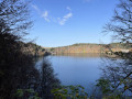
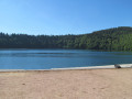
(11) At the first fork, turn left. At the next fork (information on the Besse maquis), turn left again and head downhill. At the bottom, turn right. Follow a path which first runs alongside a wetland area before winding through the forest. This will take you to the shore of Lac de Bourdouze.
(12) Turn right and walk along the lake on your left until you reach an information board.
(13) Then turn right and head up a track which quickly leads back to the car park where you started (S/E).

 Visorando Member

 Easy
Easy 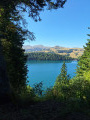
 Difficult