The Maupet headland

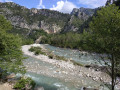
A lovely little spring walk, following a path with a well-preserved paved slanting street over a significant section. A long, flat stretch running alongside a terraced field overlooks the Latti Stream ravine. The final section is on the north-facing slope of a very pleasant wooded area, once you’ve rejoined the path.
The Visorando app is useful for about a hundred metres after the waypoint (9).

Details

n°72858248
Creation:
Last update:
Last review:
  • Walking
    Activity: Walking
  • ↔
    Distance: 4.70 mi
  • ◔
    Average duration: 3h 20 
  • ▲
    Difficulty: Moderate

  • ⚐
    Back to start: Yes
  • ↗
    Ascent: + 1,299 ft
  • ↘
    Descent: - 1,293 ft

  • ▲
    Highest point: 1,558 ft
  • ▼
    Lowest point: 915 ft

Photos

Description of the walk

Coming from Nice, park at the village exit, in the Parking de la Croix car park (Saint-Pancrace district).

(S/E) Head towards the village along Rue Pierre Niel.

(1) Take the steps on the right just after the bridge to reach the church square, made famous by the film “La Scoumoune”. Walk down Rue des Laves. Turn left, taking care, onto Route des Espauvettes until you reach a junction with a car park on your right (Chapelle Sainte-Anne).

(2) Continue along Route des Espauvettes to the left until you reach the bend in the road at the hamlet of Sainte-Anne.

Yellow markings

(3) Turn left onto the descending path and continue until you reach a road.

(4) First turn left then right; you’ll see marker no. 13. Follow the signs for Colle Belle along this paved slanting street through the woods.

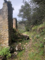
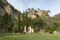
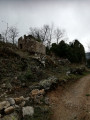
(5) At the crossroads of paths, where there is another marker No. 13, turn left towards Colle Belle. The path descends into the valley. Vegetation has reclaimed the sides of this paved slanting street, before crossing a concrete bridge.  Then, after a short slope, the path follows a terraced field, crossing several seasonal streams. You’ll come to a beautiful ruin.

(6) The path is dotted with bellflowers, borage and daisies (in spring), then enters a wooded area via a series of hairpin bends before running alongside a fence. It turns into a concrete track.

End of yellow markings

(7) After the bend in the road, turn left onto an ascending path. There is a wooden post (intended to support a sign, which is missing).

(8) Continue along a gently ascending, tree-lined track suitable for vehicles.

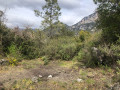
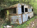
(9) Walk past the wreck of a 1960s caravan and a lorry water tank. At this point, the path veers to the left and disappears for about fifty metres into the forest, which is dotted with numerous wild boar tracks. Use the Visorando app to find your way back onto the clearly visible path. The path emerges into a small clearing, a ‘fire pit’.
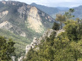
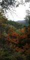
Head right along a path about ten metres long, with a surface of large pebbles, which leads to a promontory offering a fine view of Mont Lion, the summit of the Estallier and Mont Auvière.

(10) Turn back and follow the route in reverse until you reach the junction at the Sainte-Anne Chapel car park on Route des Espauvettes.

(3) Turn left and you’ll come out onto a car park; cross it.

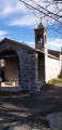
(11) Take the beautiful wooded path, with earthen steps and wooden risers, passing to the left of the Chapelle Saint-Anne and following a stream. There is a sign indicating “Village – Parking de la Croix”. At the top, crossthe Route de Nice with care to return to the car park (S/E). 

Waypoints

  1. S/E : mi 0 - alt. 1,483 ft - La Croix car park
  2. 1 : mi 0.2 - alt. 1,522 ft - Staircase
  3. 2 : mi 0.45 - alt. 1,325 ft - Car park. Joint A/R junction
  4. 3 : mi 0.57 - alt. 1,299 ft - Bend in the road
  5. 4 : mi 0.6 - alt. 1,270 ft - Marker 13
  6. 5 : mi 0.73 - alt. 1,145 ft - Trail junction, another marker 13
  7. 6 : mi 1.43 - alt. 984 ft - Ruins
  8. 7 : mi 1.92 - alt. 1,404 ft - Bend and start of the track
  9. 8 : mi 1.99 - alt. 1,427 ft - Crossroads between footpath and road
  10. 9 : mi 2.08 - alt. 1,430 ft - Wreck of a caravan from the 1960s
  11. 10 : mi 2.47 - alt. 1,529 ft - Clearing
  12. 11 : mi 4.55 - alt. 1,371 ft - Chapel of Sainte-Anne
  13. S/E : mi 4.7 - alt. 1,483 ft - La Croix car park

Notes

Hiking poles and walking shoes are recommended, but the terrain presents no particular difficulties.

Water point at the exit of the Croix car park, on the north side.

There are damp patches along the route where you can cool off.

Worth a visit

Gilette.Church of Notre-Dame-de-l’Assomption. The building was probably constructed around themid-17thcentury in the so-called ‘Jesuit’ Baroque style

Reviews and comments

4 / 5
Based on 2 reviews

Reliability of the description
4.5 / 5
Ease of following the route
3 / 5
Route interest
4.5 / 5
randonneurintrépide
randonneurintrépide

Overall rating : 5 / 5

Date of your route : Sep 19, 2025
Reliability of the description : ★★★★★ Very good
Ease of following the route : Not used / Not applicable
Route interest : ★★★★★ Very good
Very busy route : No

I was very pleased with this beautiful walk. Thank you, Bernard. Your hikes rarely disappoint me.
But I couldn't make it to the end; if there is no sign at point 7, it's because the wooded road is blocked by a landslide. The only solution would be to climb through the undergrowth. I don't feel comfortable taking my group there in these conditions. The normal path is a little further on, and there is a municipal by-law that closes it off

Machine-translated

bernard bb
bernard bb

Thanks, Wood – that finish in the woods wasn’t easy, was it?
A quiet spot
Hiking friends, b.

Machine-translated

Wood
Wood

Overall rating : 3.7 / 5

Date of your route : May 08, 2025
Reliability of the description : ★★★★☆ Good
Ease of following the route : ★★★☆☆ Average
Route interest : ★★★★☆ Good
Very busy route : No

A lovely walk that offers some unexpected delights. You reach the headland via a section of the path that’s not easy to spot. But once you get there, you’re treated to a superb view!

Machine-translated

Other walks in the area

For more walks, use our search engine .

The GPS track and description are the property of this route's author. Please do not copy them without permission.