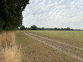
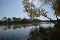
The Gallo-Roman bridge over the Sanguèze

A magnificent walk along the paths of La Regrippiére to discover its heritage.
Very well signposted: yellow markings.

Details

3416491
Creation:
Last update:
Last review:
  • Walking
    Activity: Walking
  • ↔
    Distance: 2.61 mi
  • ◔
    Average duration: 1h 20 
  • ▲
    Difficulty: Easy

  • ⚐
    Back to start: Yes
  • ↗
    Ascent: + 135 ft
  • ↘
    Descent: - 115 ft

  • ▲
    Highest point: 289 ft
  • ▼
    Lowest point: 180 ft

Photos

Description of the walk

Car park at the Fleurancellerie Chapel.

(S/E) Walk down the road towards the stream and follow it along a sunken path. Climb up to the plateau and follow the path straight on until you reach a fork, where you should take the left-hand path – this will be your route back.

(1) Carry on straight ahead, then turn left for 150 metres and then right until you reach the D308 road, which you cross. Take the path on your left running parallel to the road; when you reach a field, turn 90° to the right, following the edge of the field.

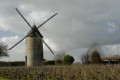
Turn right at the vineyard. Wind your way through the vines (markings on the ground on stones); at the end, turn left onto the path, then right at the end of the plot on the left, and left again at the junction.

(2) After 50 m, turn right between two rows of vines towards the woodland, follow the edge of the woodland and go down a flight of steps.

(3) Turn left onto a path that climbs straight ahead for about 300 m, then turn right, walking alongside a vineyard on your left until you reach a hedge. Take a small passage on the left into a descending sunken path, walk behind the houses and arrive at the bridge over the road.

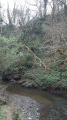
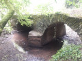
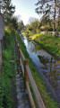
(4) Turn left before the bridge via a flight of steps (a tricky section) and walk alongside the River Sanguèze, past the Gallo-Roman bridge. Continue north-east.

(5) Turn left onto the uphill path to reach, straight ahead, the junction from the outward journey.

(3) Carry on straight towards the village along the tarmac road, turn left into Rue d’Anjou, then right after No. 42 between two buildings to rejoin the path from the outward journey.

(1) Turn left and follow the path back in the opposite direction as far as the chapel (S/E).

Waypoints

  1. S/E : mi 0 - alt. 259 ft - Car park at the Fleurancellerie Chapel
  2. 1 : mi 0.19 - alt. 279 ft - Junction of the Grand Boucle
  3. 2 : mi 0.78 - alt. 276 ft - Turn right between two rows of vines
  4. 3 : mi 0.93 - alt. 200 ft - Crossroads at the end of the short circular loop
  5. 4 : mi 1.41 - alt. 190 ft - Turn left before the bridge - Sanguèze (rivière) à finaliser
  6. 5 : mi 1.65 - alt. 190 ft - Turn left at the fork
  7. S/E : mi 2.61 - alt. 259 ft - Car park at the Fleurancellerie Chapel

Notes

Wear sturdy shoes and take water with you in hot weather.
There is a tricky section with steep steps, particularly in wet weather.

Worth a visit

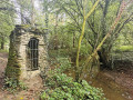
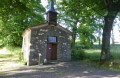
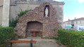
The Fleurancellerie Chapel was built in gratitude for the protection of a smuggler who narrowly escaped death at the hands of the gabelous (customs officers under the Ancien Régime who collected salt tax).
The Gallo-Roman bridge at La Ducherie, once crossed by a Roman road (1st century , Middle Ages), spans the Sanguèze. It is said that during the Hundred Years’ War, a terrible battle took place on the banks of a small river. Filled with blood, the river burst its banks. It has been known as ‘la Sanguèze’ ever since.
Make the most of the winegrowers’ cellars to sample their wines in moderation and visit their estates.
A 14 km route ‘in the footsteps of the gabelous’ starting and finishing at the same point.

Reviews and comments

4.7 / 5
Based on 2 reviews

Reliability of the description
5 / 5
Ease of following the route
4 / 5
Route interest
5 / 5
Pedro49
Pedro49

Overall rating : 5 / 5

Date of your route : Aug 03, 2025
Reliability of the description : ★★★★★ Very good
Ease of following the route : ★★★★★ Very good
Route interest : ★★★★★ Very good
Very busy route : Yes

Hello,
We did this tour on 3 August 2025.
In line with the previous review, the section after the Roman bridge is unexpected and very steep!
It is very well marked with new wooden signs, which also informed us that there is another route starting from the same place: "SUR LES PAS DES GABELOUS" (In the footsteps of the Gabelous), 14 km, marked in yellow.
I was unable to attach the PDF downloaded from the LA REGRIPPIERE town hall website.
All the best to everyone
PEDRO 49

Machine-translated

manuuher
manuuher

Overall rating : 4.3 / 5

Date of your route : Mar 30, 2025
Reliability of the description : ★★★★★ Very good
Ease of following the route : ★★★☆☆ Average
Route interest : ★★★★★ Very good
Very busy route : Yes

A truly unique walk through vineyards and damp woodland!
Please note: The route includes a very steep section between the waypoint (4) and (5), which may not be suitable for little ones or those who are less mobile. Forget about pushchairs! The section described as ‘tricky’ in the guide isn’t immediately after the waypoint (4) but just before the bridge, and it’s very steep in a place where you might not necessarily expect it. Fortunately, it’s well maintained with steps and handrails to hold on to. I took a photo.
Also, be careful at waypoint (4) – don’t take the route that goes uphill, but the one that goes down towards the stream. It’s easy to get it wrong.
In the vineyards too, it’s not always easy to avoid getting lost. Fortunately, the app helped me find my way.

Machine-translated

Other walks in the area

For more walks, use our search engine .

The GPS track and description are the property of this route's author. Please do not copy them without permission.