Les Hauts du Doré to Puiset Doré

An easy route, ideal for children. It winds its way past fruit orchards and vineyards, passing through a few clay-extraction areas.

Details

3240079
Creation:
Last update:
Last review:
  • Walking
    Activity: Walking
  • ↔
    Distance: 3.05 mi
  • ◔
    Average duration: 1h 25 
  • ▲
    Difficulty: Easy

  • ⚐
    Back to start: Yes
  • ↗
    Ascent: + 43 ft
  • ↘
    Descent: - 43 ft

  • ▲
    Highest point: 351 ft
  • ▼
    Lowest point: 308 ft

Photos

Description of the walk

The walk starts at a place called Le Plessis Bel Air, at the start sign.

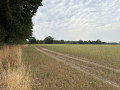
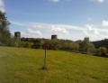
(S/E) Setting off in a clockwise direction, walk along the field beside the trees via the path that leads into the vineyards, onto a red path.

(1) At the wayside cross, turn right and walk along the road, surrounded by vineyards. Turn left after the small hamlet and, once past the last houses, the road becomes a track.

(2) At the wayside cross, turn left then immediately turn right, just past the soft-fruit greenhouses. At the end of the field, go round the row of trees and then turn right. At the dirt track, turn left.

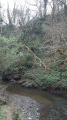
(3) Turn right just before the end of the track, continue through a more wooded section and cross a stream before reaching a small hamlet. At the end of the tarmac road, turn left and, 150 metres further on, turn right.

(4) At the four-way crossroads, carry on straight ahead. After the hamlet of Petit Buté, turn onto the dirt track on the left, which further on splits into a three-way junction. Take the track furthest to the right.
In the field, carry on straight ahead, then turn right at the end. After the small hamlet on the road, turn left to return to the starting point (S/E).


Waypoints

  1. S/E : mi 0 - alt. 351 ft - A place known as “Le Plessis Bel Air”
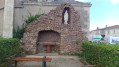
  2. 1 : mi 0.53 - alt. 325 ft - Calvary
  3. 2 : mi 1.07 - alt. 335 ft - Second wayside cross
  4. 3 : mi 1.44 - alt. 315 ft - Turn right at the fork
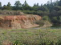
  5. 4 : mi 2.04 - alt. 338 ft - Clay extraction sites
  6. S/E : mi 3.05 - alt. 351 ft - A place known as “Le Plessis Bel-Air”

Notes

(4) At the junction of the four red paths, you can turn right for a short detour to the clay quarries.

23 per cent of the route is tarmac.

Worth a visit

  • 4 km away, discover the Maison du Potier in Le Fuilet, where clay has shaped local history: new exhibition layout and demonstrations, with numerous workshops on offer throughout the year.
  • 6 km away, a picnic area in the forest beside the Étang de la Foucaudière in Saint-Laurent-des-Autels, with (covered areas)
  • 8 km away is Natural’Parc in Saint-Laurent-des-Autels, a 13-hectare nature park combining respect for biodiversity, wildlife discovery and leisure activities.

Reviews and comments

3 / 5
Based on 2 reviews

Reliability of the description
3.5 / 5
Ease of following the route
3 / 5
Route interest
2.5 / 5
Ôsez Mauges
Ôsez Mauges

Hello, thank you for your feedback. For your information, the signposting is due to be reviewed shortly by the hiking federation. Maintenance will also be carried out by the municipality of Montrevault-sur-Evre.
Marie on behalf of the Ôsez Mauges team

Machine-translated

Pedro49
Pedro49

Overall rating : 3.3 / 5

Date of your route : Apr 28, 2025
Reliability of the description : ★★★★☆ Good
Ease of following the route : ★★★☆☆ Average
Route interest : ★★★☆☆ Average
Very busy route : No

The yellow markings are badly worn and have not been repainted. The sign at the starting point is difficult to see because of the brambles.
The path is clearly not maintained by the local council and is quite damp at the start.
A short, easy walk suitable for families.

Machine-translated

Mu44
Mu44

Overall rating : 2.7 / 5

Date of your route : Jan 30, 2023
Reliability of the description : ★★★☆☆ Average
Ease of following the route : ★★★☆☆ Average
Route interest : ★★☆☆☆ Disappointing
Very busy route : No

No parking space at the start
The first path isn’t signposted.
A large dog appeared after about 10–15 minutes’ walk. The height of the gate didn’t seem suitable for a dog of that size. Turned back…
What a shame

Machine-translated

Other walks in the area

For more walks, use our search engine .

The GPS track and description are the property of this route's author. Please do not copy them without permission.