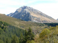
The Frèche plateau and its lake

A lovely walk in the Belledonne massif above Saint-Rémy-de-Maurienne through a wild and little-visited valley.
Lovely panoramic views that are well worth the detour, despite the steep climbs.

Details

n°2439751
Creation:
Last update:
Last review:
  • Walking
    Activity: Walking
  • ↔
    Distance: 4.23 mi
  • ◔
    Average duration: 4h 15 
  • ▲
    Difficulty: Moderate

  • ⚐
    Back to start: Yes
  • ↗
    Ascent: + 2,625 ft
  • ↘
    Descent: - 2,598 ft

  • ▲
    Highest point: 6,493 ft
  • ▼
    Lowest point: 3,862 ft

Photos

Description of the walk

Varrat car park

(S/E) Take the yellow-marked path near the car park to begin the steep climb through the forest. You’ll reach the first junction very quickly.

(1) Carry on by taking a wider path on the right which climbs through the forest.

(2) After another junction, take the yellow-marked path on the left towards the ruins of La Frèche.

(3) You will then gradually enter the valley, passing blueberry bushes and prickly blackthorn. The slope gradually levels out as you pass numerous streams, offering lovely views of the Grands Moulins and the Pic de Chatermes.

(4) Once you reach the Frèche plateau, turn right to quickly reach Lac de la Frèche.

(5) For the return journey, take the same route but follow an alternative path halfway along.

(2) Turn off onto the signposted path on the left to join the Noire Combe forest track.

(6) Follow this forest road to the right towards the starting point at Varrat (S/E).

Waypoints

  1. S/E : mi 0 - alt. 3,911 ft - Varrat car park
  2. 1 : mi 0.17 - alt. 4,213 ft - Signpost for the Col de la Frèche
  3. 2 : mi 0.41 - alt. 4,469 ft - Combe de la Frèche
  4. 3 : mi 1.08 - alt. 5,889 ft - The ruins of La Frèche
  5. 4 : mi 1.63 - alt. 6,447 ft - La Frèche Plateau
  6. 5 : mi 1.75 - alt. 6,490 ft - Lac de la Frèche
  7. 6 : mi 3.7 - alt. 4,055 ft - Noire Combe forest track
  8. S/E : mi 4.23 - alt. 3,937 ft - Varrat car park

Notes

Access – From the roundabout at the post office in Saint-Rémy-de-Maurienne, take the Frèche forest road which climbs towards the power station; this is a tarmac road for 9 km. Park at the Varrat car park (1,160 m) at the end of the tarmac road, marked by a junction on your left.

Additional information – At this point (4), it is possible to continue and climb the Col de la Frèche (2,183 m) to the west.

Reviews and comments

4.7 / 5
Based on 1 review

Reliability of the description
5 / 5
Ease of following the route
5 / 5
Route interest
4 / 5
Mandoline73
Mandoline73

Overall rating : 4.7 / 5

Date of your route : Aug 09, 2022
Reliability of the description : ★★★★★ Very good
Ease of following the route : ★★★★★ Very good
Route interest : ★★★★☆ Good
Very busy route : No

A hike I did in mid-August! The path is indeed steep, but it’s doable! It’s a really lovely route and the view from the plateau is stunning. The Étang de la Freche was completely dry on 9 August 2022, but I was able to cool my feet in the stream.
Make sure you follow the GPX track carefully to reach the lake; otherwise, it’s easy to get sidetracked by the path leading to the Col de la Freche. Incidentally, for early risers and the more determined, it’s possible to head to the Col de la Freche and then on to Les Grands Moulins (though I reckon that adds a good hour and a half each way). Trekking poles are recommended as it’s a steep climb and a very steep descent! A perfect trail for being on your own – I didn’t come across a single soul!!

Machine-translated

Other walks in the area

For more walks, use our search engine .

The GPS track and description are the property of this route's author. Please do not copy them without permission.