Col de la Frèche – Col d’Arpingon

This hike follows a beautiful section of the newGR® 738, inaugurated in 2018: the Haute Traversée de Belledonne.

Details

n°745659
Creation:
Last update:
Last review:
  • Walking
    Activity: Walking
  • ↔
    Distance: 6.86 mi
  • ◔
    Average duration: 5h 45 
  • ▲
    Difficulty: Moderate

  • ⚐
    Back to start: Yes
  • ↗
    Ascent: + 3,018 ft
  • ↘
    Descent: - 2,999 ft

  • ▲
    Highest point: 7,441 ft
  • ▼
    Lowest point: 5,558 ft

Description of the walk

Park in the large car park at the now-closed Val Pelouse ski resort.

(S/E) Head up the road that continues above the car park. Enter the mountain pasture and walk for 70 metres to reach a small crossroads.

(1) Head up to the right along the path, first through the mountain pasture and then into a more wooded area. The path winds several times before reaching a wide, flat area.

(2) Turn right and follow a long ridge path offering numerous views. You’ll reach the Col de La Perrière.

(3) From the pass, head down to the right along a stony path to a junction situated just above the Refuge de la Perrière.

(4) Turn left. Climb for a long while, ignoring the path to the left leading up to Les Grands Moulins (painted markings on the rocks).

(5) 50 metres further on, leave theGR® 738 and turn left onto a fairly steep path, which leads to the Col de la Frèche.

(6) From the pass, descend slightly to the other side of the slope and turn right (south) onto a faint track that runs along the ridge and gradually climbs back up to rejoin the GR®.

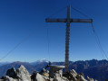
(7) Continue southwards and, after a series of ascents and descents, reach the Col d’Arpingon.

(8) For the return journey, follow the route in reverse until you reach the junction just above the Refuge de la Perrière, bypassing the Col de la Frèche.

(4) Follow the path on the left which heads west before quickly turning north, after a short stretch still in the open. Then enter the forest and follow the path until it emerges into the nearby mountain pasture, above the crossroads where the walk began.
Then walk downhill along the edge of the woodland, rejoining first the footpath, then the road, and finally the car park (S/E).

Waypoints

  1. S/E : mi 0 - alt. 5,558 ft - Val Pelouse car park
  2. 1 : mi 0.2 - alt. 5,636 ft - Small crossroads
  3. 2 : mi 0.66 - alt. 6,122 ft - Flat stretch
  4. 3 : mi 1.69 - alt. 6,486 ft - Col de la Perrière
  5. 4 : mi 2.01 - alt. 6,102 ft - Chalet de la Pérrière
  6. 5 : mi 2.99 - alt. 6,998 ft - Path on the left
  7. 6 : mi 3.07 - alt. 7,133 ft - Col de la Frèche (2183m)
  8. 7 : mi 3.3 - alt. 7,320 ft - Back on the GR
  9. 8 : mi 3.71 - alt. 7,441 ft - Col d'Arpingon (2276m)
  10. S/E : mi 6.86 - alt. 5,558 ft - Val Pelouse car park

Notes

La Perrière refuge: unstaffed, water source nearby.

Worth a visit

Note: on the way there, you can head directly to the Refuge de la Perrière without taking the ridge path.

Always be cautious and plan ahead when you're outdoors. Visorando and the author of this route cannot be held responsible for any accidents occurring on this route.

The GR® and PR® markings are the intellectual property of the Fédération Française de Randonnée Pédestre.

Reviews and comments

4.2 / 5
Based on 2 reviews

Reliability of the description
4.5 / 5
Ease of following the route
3.5 / 5
Route interest
4.5 / 5
meco
meco

Overall rating : 3.7 / 5

Date of your route : Sep 23, 2021
Reliability of the description : ★★★★☆ Good
Ease of following the route : ★★★☆☆ Average
Route interest : ★★★★☆ Good
Very busy route : Yes

A hike done in no particular order. First the Col d’Arpingon, then the Col des Bèches via the ridges (really lovely, provided you don’t suffer from vertigo – it saves you from having to go back down only to climb a very steep slope again), and finally the Col de la Perrière.
Going this way, the return route along the ridges wasn’t clear, or at least not obvious.
A very beautiful hike.

Machine-translated

Elise Antunes
Elise Antunes

Overall rating : 4.7 / 5

Date of your route : Aug 04, 2019
Reliability of the description : ★★★★★ Very good
Ease of following the route : ★★★★☆ Good
Route interest : ★★★★★ Very good

Breathtaking scenery!!

The second part of the climb is quite steep (as a Sunday hiker, I’d have classed it as ‘difficult’) and the numerous rocky outcrops make it even more challenging.

But the view is well worth the effort and makes the sweat worthwhile

Thank you to nature for this splendid spectacle, and thank you to Bernard for this great tip.

Machine-translated

Other walks in the area

For more walks, use our search engine .

The GPS track and description are the property of this route's author. Please do not copy them without permission.