Country:

 City:


(S/E) Setting off from the Saint-Jean-de-Sixt tourist office, go round the tennis courts to the right and follow the path overlooking the river, before heading down to the right towards the footbridge that takes you across it. On the other bank, take the path on the left which heads boldly up the slope.
After five minutes of a good climb through the woods, you’ll reach a meadow; walk along its edge until you come to a chalet that must have been very beautiful before it became a rubbish dump. Immediately after passing it, you’ll reach the Route des Lombardes.
(1) Turn left and follow the road down until you reach a stream. Pass the housing estate just beyond the stream and turn right to head up the Impasse de l’Ars to the last chalet. A narrow path continues from there, tackling the hillside and winding its way up in two or three hairpin bends.
(2) When you reach a forest track (elevation 1082), turn left and follow it to the end. At the far end of the clearing formed at its terminus, continue along the path that branches off to the left, heading south along the hillside.
After a rather impressive but well-secured section above the wooded ravine, you’ll reach another track that leads out above the first houses of La Clusaz.
(3) When you reach the Route des Rifroids, head down to the left, past the chalets. Turn right at the first junction, then left a few metres further on to reach the ice rink. The cable car departure point is very close by, but make sure you take the right line, as there are two.
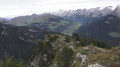
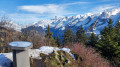
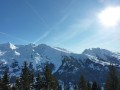
(4) You must choose the Beauregard line. You’ll reach the plateau in a few minutes, with no effort required other than admiring the view that opens out onto the Confins valley and the Aravis range.
(5) Although it will cost you just over eight euros, this aerial detour eliminates the main difficulty of this route, namely the 600-metre climb between the Clusaz valley and the plateau.
On leaving the cable car station, head down the track that branches off to the left. After a few hairpin bends, you’ll reach the first mountain farm (selling cheese) and continue downhill until you reach the Nant des Prises, one of the main streams draining water from the plateau.
(6) One hundred and fifty metres after crossing the stream (elevation 1,511), turn right onto the track that climbs through woodland and pastures. It leads up to the Aupt du Mont, one of the alpine chalets dotted across the plateau.
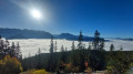
(7) As the view opens out over the valley leading to Thônes, continue along the path that follows the edge of the plateau. Ignore the tracks branching off to the right or left (elevation 1577) and carry on towards the Poutassets chalets, which you pass below before reaching the Vargne chalet.
(8) Once past this chalet, leave the wide, stony tracks behind for much more picturesque paths, though you’ll have to share most of them with mountain bikers.
Cross the fence and head into the woods, following the clearly visible track. It leads without any particular difficulty to the top of the Corbassières farm.
Continue along the ridge opposite for about 700 metres before beginning the descent just before the Parmis chalet. The path takes on the appearance of a sunken track before winding between the trees on either side of the steeply sloping ridge.
(9) You emerge from the woods onto a grassy clearing, in the centre of which stands the Parmis chalet. Follow the edge of the pastures, and continue to the left once you have passed the chalet, until the path enters the forest again, just above a rocky ledge.
(10) At the first junction, above Les Écotagnes, turn right and follow the path to the next junction.
(11) From this point onwards, the path is severely disrupted by mountain bikes, whose braking scrapes away the surface of the ground, sometimes over a considerable width. This makes it difficult to spot the correct path and to find firm footing. From the last signpost, head left, down the slope, until you pass near a chalet. The path veers to the right and, as the ground levels out, returns to a more regular profile. But soon, as the slope steepens, you’ll encounter the same difficulties as in the previous section. Follow the trail as best you can, descending the steep slope through the woods. You’ll eventually reach a cross-path, where you turn right.
Throughout this descent, and from the last signpost, keep the ridge line – on which the path is supposed to run, according to the map – in sight to your right. As you walk along the cross-country path, you’ll eventually return to this ridge, which you’ll now follow all the way to Les Lombardes.
(12) As the slope levels out, you emerge from the forest just above the houses at Les Lombardes. The path veers to the left to go round them, completing the descent along the ridge. Once you have passed the last houses, turn right to head back towards the road that serves them. You reach it at a hairpin bend. Turn left to continue the descent until you reach the waste collection point seen on the way up. Turn left, heading in the opposite direction to the path you took on the way up, and follow it down to the river. Once you’ve crossed the footbridge, all that remains is to climb up the opposite slope, then turn left when you reach the first chalets in Saint-Jean. The tennis courts are immediately on the right and the starting point is just behind them (S/E).

 Visorando Member

 Difficult