Vé Vinau

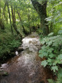
This route will allow you to discover the hamlet of Vinols from different angles. It crosses the Cotayet twice and winds its way through woods of Garoles and Fayards.

Details

4327283
Creation:
Last update:
Last review:
  • Walking
    Activity: Walking
  • ↔
    Distance: 3.09 mi
  • ◔
    Average duration: 2h 00 
  • ▲
    Difficulty: Easy

  • ⚐
    Back to start: Yes
  • ↗
    Ascent: + 630 ft
  • ↘
    Descent: - 640 ft

  • ▲
    Highest point: 2,133 ft
  • ▼
    Lowest point: 1,663 ft

Description of the walk

Park at the side of the Leat des Espagnols near the junction with the D113.

(S/E) Take the second small road on the right (Allée du Puy Chavant), which turns into a dirt track.

(1) Walk down to Le Cotayet and cross it. Follow the path which climbs immediately to the right up to Granger.

(2) Take the tarmac road on the right. Pass through La Perrière.

(3) At the crossroads, head down the dirt track to the right until you reach the tarmac road.

(4) Cross it and take the path leading uphill opposite, through the woods of Garolles. Cut across a path and climb up to Le Romanet.
At the 648-metre mark, continue to the right along the road and turn off onto the track on the right.

(5) After passing Malleval, turn right to join the PR®4, which leads downhill. Head down to the right and continue to Le Cotayet. Cross the river and take the path that cuts diagonally across the flat ground to the right. Follow it to Vinols to reach the car park (S/E).

Waypoints

  1. S/E : mi 0 - alt. 1,745 ft - Vinols
  2. 1 : mi 0.25 - alt. 1,663 ft - Le Cotayet or - Moingt (rivière)
  3. 2 : mi 0.57 - alt. 1,923 ft - Granger
  4. 3 : mi 0.76 - alt. 1,900 ft - La Perrière
  5. 4 : mi 1.06 - alt. 1,709 ft - Route de Celle
  6. 5 : mi 1.84 - alt. 2,103 ft - Malleval
  7. S/E : mi 3.09 - alt. 1,745 ft - Vinols

Notes

Always be cautious and plan ahead when you're outdoors. Visorando and the author of this route cannot be held responsible for any accidents occurring on this route.

The GR® and PR® markings are the intellectual property of the Fédération Française de Randonnée Pédestre.

Reviews and comments

5 / 5
Based on 2 reviews

Reliability of the description
5 / 5
Ease of following the route
5 / 5
Route interest
5 / 5
User 28749416

Overall rating : 5 / 5

Date of your route : May 25, 2026
Reliability of the description : ★★★★★ Very good
Ease of following the route : ★★★★★ Very good
Route interest : ★★★★★ Very good
Very busy route : No

Pleasant routes, with a few steep hills.

Machine-translated

EC
EC

Overall rating : 5 / 5

Date of your route : Apr 19, 2021
Reliability of the description : ★★★★★ Very good
Ease of following the route : ★★★★★ Very good
Route interest : ★★★★★ Very good
Very busy route : No

A very pleasant route.
A few steep climbs and descents, but not very long.
A short route that leaves time to take it easy.
A few lovely views and a route through wind-sheltered valleys.

Machine-translated

Other walks in the area

For more walks, use our search engine .

The GPS track and description are the property of this route's author. Please do not copy them without permission.