The Stiff Lighthouse and Lann Per ar Lan circular walk starting from Lampaul

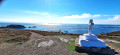
A easy route. The first section winds its way through a few hamlets, offering the chance to discover some old buildings. It leads to the Stiff Lighthouse, from the top of which you can enjoy a magnificent 360° panorama.
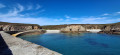
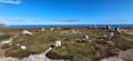
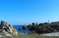
As you reach the coast at Lann Pen ar Lan, you can visit a 4,000-year-old stone circle. You can then enjoy the small beach at Porz ar Lan for a refreshing dip!
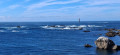
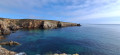
The coastline stretches south-west, offering views of Molène to the east and the Fromveur current, which churns the waters near the Kéréon Lighthouse. This stretch of coastline contrasts with the rest of the island; whilst less indented, it also offers some lovely views.

Details

n°89106411
Creation:
Last update:
Last review:
–
  • Walking
    Activity: Walking
  • ↔
    Distance: 9.97 mi
  • ◔
    Average duration: 4h 55 
  • ▲
    Difficulty: Moderate

  • ⚐
    Back to start: Yes
  • ↗
    Ascent: + 371 ft
  • ↘
    Descent: - 371 ft

  • ▲
    Highest point: 203 ft
  • ▼
    Lowest point: 16 ft
  • ⚐ Country: France
  • ⚐ City: Ouessant (29242)
  • ⚑
    Start/End: N 48.457346° / W 5.096436°
  • ❏
    IGN map(s): Ref. 0317OT
  • Hour-by-hour weather

Photos

Description of the walk

Start from the church square.

(S/E) With your back to the church, take the steps on the right. At the top, turn right onto the uphill road until you reach the junction by the youth hostel. Turn right. After passing a wash house on the right-hand side, you’ll come to a junction at a place called Pennorz.

(1) Take the first right towards Kernigou. You’ll come out onto the D81; follow it to the left.

(2) After about a hundred metres, turn left. Pass by the foot of a water tower and immediately turn onto a path on the right. Ignore a turn-off on the left; you’ll come out onto another path and follow it to the right.

(3) Join the D81 again at a place called Kernonnen and follow it to the left, going round Fort Saint-Michel (barely visible) on the right. At a junction at a place called Frugoullou, keep right on the D81.

(4) After about 250 m, turn left onto a track. At the end, first turn left then right and pass through the hamlet of Guéral.

(5) At the junction, take the second road on the right, which heads towards the Stiff Lighthouse, visible in the distance. Carry on straight ahead to reach the foot of the lighthouse.

(6) Head right (south) and pass the signal box on your left. Stay on the path, pass a picnic area and then a wash house, and join the D81.

(7) Cross the road and continue straight ahead up the road.

(8) After about 200 m, turn left onto the coastal path. Follow the coast to the Ledenez rock.

(9) Take the path uphill to reach the site of a cromlech with a very small menhir.

(10) Retrace your steps.

(9) Return to the coastal path and follow it to the right. You’ll reach a white stone cross, the Croix de Saint-Paul. Out at sea, you can make out the Kéréon Lighthouse.

(11) Continue along the coastal path until you reach a junction with the D181 at Porz ar Lan.

(12) Join the D181 at Porz Darland.

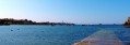
(12) Walk to the end of the jetty and back.

(12) Turn left after two containers to join the path that climbs uphill. After about 150 metres, turn sharply left and head towards the coast. Follow the coastal path for a long stretch. This will take you to the small cove at Porzh Gwenn.

(13) Leave the coastal path and turn right (north-west) to climb up to the hamlet of Porzh Gwenn.

(14) Follow the road to the left for about 75 metres and, at a Fork in the road, turn right to reach a junction straight away.

(15) Then turn left. After about 50 metres, first turn right then left. Ignore a path branching off to the left and continue westwards.

(16) Join a road and follow it to the right along the beach. After about 150 m, take a path on the left along the coast. Go downhill and join the road to the harbour after three stone steps.

(17) Follow the road to the right. At the T-junction, turn left twice. Pass the post office on your left and you’ll soon reach the church (S/E).

Waypoints

  1. S/E : mi 0 - alt. 49 ft - Église Saint-Paul-Aurélien (Lampaul)
  2. 1 : mi 0.37 - alt. 85 ft - Crossroads – Pennorz
  3. 2 : mi 0.6 - alt. 69 ft - Junction
  4. 3 : mi 1.22 - alt. 125 ft - D81 road
  5. 4 : mi 1.79 - alt. 125 ft - Start of the path
  6. 5 : mi 2.17 - alt. 174 ft - Crossroads
  7. 6 : mi 2.69 - alt. 203 ft - Phare du Stiff
  8. 7 : mi 3.17 - alt. 95 ft - Crossing the D81
  9. 8 : mi 3.3 - alt. 138 ft - Start of the footpath
  10. 9 : mi 4.82 - alt. 82 ft - Opposite Ledenez Rock
  11. 10 : mi 4.96 - alt. 105 ft - Cromlech de Lann Pen ar Lan
  12. 11 : mi 5.47 - alt. 102 ft - Stone cross
  13. 12 : mi 6.07 - alt. 23 ft - Junction – Porz ar Lan
  14. 13 : mi 8.84 - alt. 59 ft - Porzh Gwenn Cove
  15. 14 : mi 8.94 - alt. 85 ft - Porzh Gwenn
  16. 15 : mi 9.02 - alt. 75 ft - Junction
  17. 16 : mi 9.44 - alt. 23 ft - Road – Corz Beach
  18. 17 : mi 9.83 - alt. 16 ft - Road to the harbour
  19. S/E : mi 9.97 - alt. 49 ft - Église Saint-Paul-Aurélien (Lampaul)

Notes

Take care when walking alongside or crossing roads.

Do not walk too close to the edges of the cliffs – there is a risk of rockfalls.

Do not disturb wild animals.

Worth a visit

Stiff Lighthouse
Located near the jetty, the Stiff Lighthouse – the first lighthouse built on the island – is one of the oldest lighthouses in France. Renovated since 2013, it offers a visit full of discoveries through its museum displays.

The Lann Pen ar Lan Cromlech
This megalithic monument consists of several standing stones arranged in a circular pattern. This cromlech is thought to date from the late Neolithic period or the early Bronze Age, several millennia before our era.

Saint Paul’s Cross
Also known as Kroaz ar C’halvar. It stands at the top of a three-tiered calvary. It is the oldest cross on the island, having been erected in 1704.

Porz ar Lan
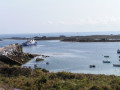
A massive jetty protecting two lovely little beaches.

Fort Saint-Michel
Not open to the public; it is a military site.

Other walks in the area

For more walks, use our search engine .

The GPS track and description are the property of this route's author. Please do not copy them without permission.