
Circular walk on Ouessant via Poull Bridik, Creac’h and Pointe de Pern

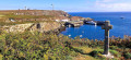
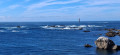
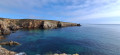
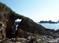
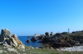
A superb walk starting from Lampaul, following the coastal path along the north-west of the island. The rocks are very jagged all along the west coast. They form statues of stone giants that give free rein to the imagination. The Pointe de Pern offers a spectacular sight, especially when the swell is strong.

Details

n°89165103
Creation:
Last update:
Last review:
–
  • Walking
    Activity: Walking
  • ↔
    Distance: 6.01 mi
  • ◔
    Average duration: 2h 50 
  • ▲
    Difficulty: Moderate

  • ⚐
    Back to start: Yes
  • ↗
    Ascent: + 102 ft
  • ↘
    Descent: - 98 ft

  • ▲
    Highest point: 108 ft
  • ▼
    Lowest point: 13 ft
  • ⚐ Country: France
  • ⚐ City: Ouessant (29242)
  • ⚑
    Start/End: N 48.457346° / W 5.096436°
  • ❏
    IGN map(s): Ref. 0317OT
  • Hour-by-hour weather

Photos

Description of the walk

(S/E) With your back to the church porch, take the street opposite. At the junction, carry on straight ahead and follow the road to the lighthouse (D81). The road goes uphill. Pass the wayside cross and continue to the next junction. Then take the second road on the right, towards the eco-museum; it forms a right angle with the D81. A wayside cross, known as the Croix de Kerc’héré, is situated on the left.

(1) Carry on to the right, pass the Poulfeas mill, then the eco-museum, and turn left for about a hundred metres until you reach the crossroads.

(2) Turn right and head towards a hamlet. As you leave the hamlet, in the bend, take the path on the right and continue to the coast until you reach an old wash house.

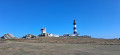
(3) Head west and follow the coastline to Créac’h Lighthouse.

(4) Continue along the path by the coast to reach Pointe de Pern and the “Villa des Tempête”. This is the nickname given to an old building fitted with a siren trumpet used as a foghorn. In the distance stands the Nividic Lighthouse.

(5) Carry on along the path to reach the old fort at Trébéchou and the ‘Ancre de l’Atlas’ below.

(6) Carry on along the path by the coast , taking in the views of the Jument Lighthouse and Lampaul Bay. The path leads up to the heights above the little harbour of Bougézen , with the ruins of a small mill visible in the distance.

(7) Stay on the path heading towards Lampaul. Pass the hamlet of Parluc’hen on your left and continue along the coast.

(8) Carry on along the path towards Lampaul, keeping the church in sight. Keep heading straight ahead. You’ll reach the church square (S/E).

Waypoints

  1. S/E : mi 0 - alt. 49 ft - Church Square - Église Saint-Paul-Aurélien (Lampaul)
  2. 1 : mi 0.3 - alt. 105 ft - Calvary, Kerc’héré Cross
  3. 2 : mi 0.86 - alt. 79 ft - Crossroads after the eco-museum
  4. 3 : mi 1.13 - alt. 36 ft - Washing place
  5. 4 : mi 2.06 - alt. 75 ft - Phare du Créac'h
  6. 5 : mi 3.45 - alt. 36 ft - Former maritime signalling structure - Pointe de Pern
  7. 6 : mi 4.19 - alt. 59 ft - Trébéchou Fort
  8. 7 : mi 4.53 - alt. 59 ft - Locqueltas, a small harbour and guardhouse
  9. 8 : mi 5.49 - alt. 62 ft - Parluc’hen, house
  10. S/E : mi 6.02 - alt. 49 ft - Church Square - Église Saint-Paul-Aurélien (Lampaul)

Notes

Keep well clear of the cliff edges.

Do not disturb wild animals or free-roaming sheep and goats.

Take care when walking alongside or crossing roads: even if there is little traffic, the roads are narrow.

Worth a visit

Créac’h Lighthouse (4)
Not open to visitors. 54 metres high with a range of 60 km. It is characterised by its black and white stripes. Behind the lighthouse stands the sheer rock face on which, in 1900, an underwater bell was installed on a square platform. It was used until 1919.

The Lighthouse and Beacon Museum (4)
Closed until 2027 for renovation work.

The horse-driven foghorn (5)
Installed in 1866, this site housed a foghorn powered by four horses, which turned a carousel that compressed the air needed to operate the foghorn. Also known as the ‘Villa des Tempêtes’.

Pebbles, north of (5)
Just north of Pointe de Pern, you can see two bands of pebbles dating from between 1 and 3.6 million years ago. These pebbles, a protected heritage site, bear witness to a time when the sea level was higher.

The Villa des Sirènes (9)
This is a former maritime sound signal installation dating from 1885. It is a siren trumpet.

Other walks in the area

For more walks, use our search engine .

The GPS track and description are the property of this route's author. Please do not copy them without permission.